Alright damn it, lets do this....

joshuajbelanger

Jr. Member
Joined
Apr 19, 2010
Messages
90
Reaction score
11
Golden Thread
0
Location
Tampa, Fl
Detector(s) used
Tesoro Cibola, Tesoro Compadre
Alright damn it, let's do this....

I've stumbled upon a typewritten book at my local library, it was not available for circulation(no checking out), but, being technologically savy as I am, I took pictures of every page, then converted the pictures into text documents, and sent them to my printer. So, I have hundreds of fort sites from around florida, some lost, some forgotten, some famous, some protected...I'm currently using google earth to locate these fort ruins from my phone on slow days at work. So...let's do it, eh?

Let me know if you are interested.

-J
 

Re: Alright damn it, let's do this....

Hey J,

Don't want to be negative, but I researched many of those forts. This guy did a great job, but the coords are taken by pointing to 1800's era maps. Some are plus or minus 50 miles.

I compared the information against some fort sites that I had visited and found his coords to sometimes not even be in the same county.

P1090671.webp

Jack
 

Re: Alright damn it, let's do this....

Oh jack, you had to go and start breaking my dream? I really thought I was on to something with that booklet. I understand it wouldn't be completely accurate, considering the age of the maps, but I expected it to at least point me in the right direction. 50 miles is a stretch even for google earth...but I'm sick of beach detecting, so hopefully with a little diligence the book might still be some what rewarding...maybe we can compare notes at a later time.

-j
 

Last edited by a moderator:
Re: Alright damn it, let's do this....

Wish you luck...........Something to point out, the pages displayed speak of small rivers as land marks, rivers move over the centuries.....They are finding riverboats that sank in the Missouri river in fields many miles from the Missouri river........
 

Re: Alright damn it, let's do this....

joshuajbelanger said:
so hopefully with a little diligence the book might still be some what rewarding...maybe we can compare notes at a later time.

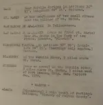
Hey, I actually typed that entire book into my notes. I figured, at worst, it might help to confirm or deny other information found from different sources. Take this one for an example from the page above:

Fort Stansbury
1. (1839 - 1843), on the Wakulla River nine miles above St. Marks, probably near Bethel.

2. Lat. 30o15', Long. 84o12' - On the Wakulla River nine miles above St. Marks and three miles west of Burns Station.

They both give different landmarks, so it might help to find it one day . . .

Jack
 

Re: Alright damn it, let's do this....

Your absolutely right, I was actually gonna type most of the book as well, once I discovered it couldn't be rented, luckily my better half showed me a much easier way. I understand it's not completely accurate, but I think the chase is the funnest part. It's obvious someone took the time to locate and study all those old maps, probably as a graduate thesis I'm guessing. Regardless it points me in the right direction, and I'm up for a little adventure. When these things do finally payoff, they Payoff big, ya know?

-j
 

Re: Alright damn it, let's do this....

Josh, You have the right attitude! Keep up the research. The least that can happen is you will sharpen your research skills. The best that can happen is you will put together little pieces of info that have never "figured" before and.... POOF! You will have something! Keep it up! Tnx. TTC
 

i would be interested in going.
 

There is a "Labins GLO" site that contains the original survey plats of the State of Florida. The down side is that you access a map by the range and township. The up side is that they show calvary forts, indian villages, and early homesteads. They are circa 1846 and are fairly accurate...
 

you can buy the book from KellyCo, its worth it. I used it to figure out what forts were "unknown" and then researched a few of those and discovered a couple. Made contact with he property owners and found out they are already aware their property contains the fort location and not interested in giving permission...........well that's all I will say about that.

That book would be even better if the person that made it gave an electronic copy with it, and then the coordinates could be converted to a google earth KMZ file.....that would be nice.
 

I'm a few years late, but I've actually been working on the same thing. I believe I've pinned down the exact locations of 3 forgotten forts Just north of Ocala thru a combination of old maps, my knowledge of local waterways, and Gmaps. If you're still up for it, let me know.
 

Top Member Reactions

Users who are viewing this thread

Back
Top Bottom