fmrUSMC_0844
Bronze Member
- Joined
- Sep 4, 2008
- Messages
- 1,567
- Reaction score
- 1,104
- Golden Thread
- 0
- Location
- Mormonville, AKA Salt Lake City, UT
- Detector(s) used
- Whites MXT Pro, Whites TDI, Keene A52, Calsluice, Gold Hog Piglet
- Primary Interest:
- Metal Detecting
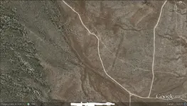
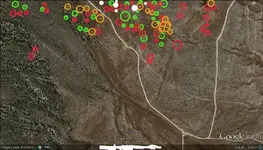
- #1
Thread Owner
I have been doing a lot of research this winter on a place. I think I may have narrowed down the area but Im not sure. I am having a problem with figuring out the coordinates. I am hoping this is close to where it is. Thanks in advance!