two bear
Jr. Member
- Joined
- Dec 14, 2013
- Messages
- 65
- Reaction score
- 31
- Golden Thread
- 0
- Location
- Smoky Mtns of east Tn
- Detector(s) used
- Whites metal detectors
- Primary Interest:
- All Treasure Hunting
- #1
Thread Owner
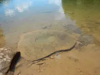
Two years ago I was kayak camping on Fontana lake with a friend who's family came out of Chambers Creek. We camped and hiked up the creek to see some of the most beautiful old homesites still left that I have ever seen. He had a 1800s map that showed where the homesites were located and the names of the families that lived there. It was awesome to see the sites and know the names of those who lived there. The map also stated that there was a Cherokee petroglyph on Welch's branch that is underwater in the summer but visible when the water level is down. So we decided to paddle there and check it out. After a while we realized that the map named the area Welch's creek but it was not on the park service's map. We found two men in a bass boat fishing and asked them if they ever heard of Welch's creek. "Been fishin these here waters all our lives and never heered of that thar crick" they stated. So we looked at the old map and the branch was beside another one that came into the lake near one another and looked like a set of horns. We paddled to the branch using the old map and crawled out of our boats. After a 10 second walk on the bank, there it was. A hand pointed in a certain direction along with two lines that crossed and lines that went thru the other existing lines. My friend got a great picture but I was experiencing dead batteries so I didn't. Anyone ever seen this petroglyph? We later found info that it was a directional map showing the villages on the river. I hope to go there this spring and obtain a picture of my own.


