CLUE CONCERN: TRAIL TO SAN CARLOS #13

393stroker

Hero Member
🥇 Charter Member
Joined
Jun 27, 2012
Messages
540
Reaction score
896
Golden Thread
0
Location
HOUSTON
Detector(s) used
Garrett pro-something
Primary Interest:
All Treasure Hunting
This clue didn`t make any sense to me until recently. I`m just speculating, if the trail to San Carlos, that is east of Globe is now Hwy 88, and you go to where the road turns towards the south, and the 4 Peaks line up as 1. There is a deep canyon. In that canyon is Boulder Cave. Could this be the hidden camp/rock house? To the south is a high point/needle. On the other side of the hill is the mountain that you would need to climb to see Weavers to the south. CLUE 13.webp
 

That,s a good spot because there 4 peaks would appear as 1 mountain,with 4 peaks, instead of 1 mountain,with 1 peak,(4 lined up as 1).
Plus its close to a main trail.
Now,did he mean 88,or did he mean the military trail,or soldier trail.
Look at the military map.
There is a trail(soldier I believe),that goes around Weavers,then turns south.After it starts out eastward.
He said towards San Carlos,which to me only means East,not a trail that goes all the way.
But it could be he meant the road or trail that goes all the way to San Carlos.
I was looking through the preview of the Holmes Manuscript,part 2.
Reading what was said at the death bed.
 

What I was thinking was that way back when, that what is now Hwy.88 was the military trail. And where it turns south and you can see 4 Peaks lined up as one, there is a canyon that is too steep to climb down. It sort of fits the description of the canyon just east of Tortilla Flats where Boulder Cave is. And up high on the mountain ridge to the south could be where the LDM is. Lets go and do some recon up there.
 

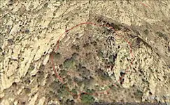
circle.webpNotice the circular formation of the rocks.@33*30.09.84,111*20.38.32. When the mountain was being formed long ago, it could have been a volcanic vent that pushed some heavy metal to the surface.
 

Read These 2 books real fast.
The second one is just directions.

LDm Location

LDM story

Now again,just someone else opinion maybe.
But I look at all versions or theorys.
I just made a post in the thread The dutchman lies,check out my last post.
 

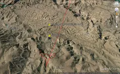
I think I can drive to the bridge abutment, and hike it in the rest of the way, 3 miles to the top.Bridge abutment.webp
 

I will go take a look at GE and see where you are going.
 

Chuck:
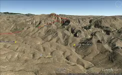
You can drive to the old abutment in your Raptor. You have the west face of Tortilla Mountain circled in red, so if that's where your headed, it's a long haul to the top. There is an old trail which follows the ridgelines, which I have added to your view. I've climbed up to it by the black/yellow route, but there is probably an easier way to get up there.

Regards:SH

View attachment trail.bmp
 

Last edited:
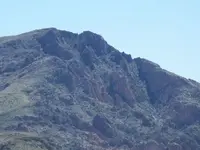
Here's a view of Tortilla from that trail, part of which can be seen at center-left.

tortilla.webp
 

You can follow the trail from the bridge abutment over the first ridge into Tortilla Creek. Where the trail turns west, and leads you towards Peters Canyon you need to leave the trail and head east through the shadowy overhanging cliffs to the base of Tortilla Mt. I can only imagine the pain and the beautiful sights that await me. You can find the trail on the SAR site. Thanks for sharing the photo, it looks steeper than the last one I did in Pinto Creek.
 

Top Member Reactions

Users who are viewing this thread

Back
Top Bottom