You are using an out of date browser. It may not display this or other websites correctly.
You should upgrade or use an alternative browser.
You should upgrade or use an alternative browser.
Cool Old photos superimposed at Present Locations
- Thread starter bergie
- Start date
richm
Sr. Member
- Joined
- Apr 30, 2009
- Messages
- 484
- Reaction score
- 10
- Golden Thread
- 0
- Location
- Madison, CT
- Detector(s) used
- White's mxt Pro / Sun Ray DX / Ultimate Gray Ghost's / Lesche
- Primary Interest:
- All Treasure Hunting
That is so awesome! I think I'm going to try to do that with some old pictures of our town!
Minrelica
Bronze Member
There's a few people that have been doing this recently. Just the other day my girlfriend emailed me this link from Flickr. I like the idea but I'm not into the photoshopping.
http://www.flickr.com/groups/lookingintothepast/
EDIT: I guess both links lead to one another....
http://www.flickr.com/groups/lookingintothepast/
EDIT: I guess both links lead to one another....
NHBandit
Silver Member
- Joined
- Feb 21, 2010
- Messages
- 3,473
- Reaction score
- 3,285
- Golden Thread
- 0
- Location
- Formerly NH now East Tennessee
- Detector(s) used
- Garrett GtaX1250
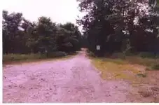
I always look for old postcards of local places when at the flea markets & antique shops to use as a tool in my metal detecting. Here is a postcard from Hill NH taken in the 1930s or early 40s compared to a picture taken recently. The entire town was moved uphill in 1941 when a dam was built on the river to control flooding. 3 churches, gas station, stores, factories, school, train station and repair shop, as well as several homes all either moved a mile or so away or destroyed. The unfortunate part of the story is that the site is maintained by the Army Corps of Engineers and depending on which ranger you run into metal detecting may or may not be allowed. My point though is don't overlook old postcards as a treasure hunting tool. First pic is the "before" pic. 2nd pic is what the same spot looks like today... The good news is that you would assume the coins would date to 1941 & before and the town was founded in the mid 1700s. The bad news is that local kids have been partying there since the invention of beer and the last time I was there all I found was clad and memorial cents & ALOT of beer cans
Attachments
NHBandit
Silver Member
- Joined
- Feb 21, 2010
- Messages
- 3,473
- Reaction score
- 3,285
- Golden Thread
- 0
- Location
- Formerly NH now East Tennessee
- Detector(s) used
- Garrett GtaX1250
Here is a copy of a map showing the locations where the buildings used to be. Picture a small rural town center with all the businesses & schools that make up small town USA suddenly gone. It's one of my favorite places to go even when I leave the detector at home & take the dog instead. Amazing that all of this is gone now and even most of the cellar homes have been filled in. A few remain but alot of them are just open fields that look like nothing was ever there. It's a place where you have to be VERY careful though. A couple years ago while swinging my detector and just enjoying the quiet I stepped into an open well and damn near broke my leg. There are several scattered around the property and what I've read is that it's a total of 30,000 acres.
Attachments
Frankn
Gold Member
I have been doing something like this for quite a while, only with a twist. I take pictures of historical structeres and convert them back to their orginal appeaeance in my computer. it takes a lot of research and time. I work with Photoshop Elements and Painter 9.5 plus some ad on programs. Now a days you can do anything you want with a photo.
Similar threads
- Replies
- 7
- Views
- 531
- Replies
- 0
- Views
- 685
Users who are viewing this thread
Total: 1 (members: 0, guests: 1)
Latest Discussions
-
Metal Detectors 4 Veterans Teams Up with Valor Metal Detecting
- Latest: Terry Soloman
-
-
-
Confederate Gold from the Civil War was Found in a Shocking Place
- Latest: achanceforgold


