DesertRat
Jr. Member
- Joined
- Jun 12, 2006
- Messages
- 37
- Reaction score
- 4
- Golden Thread
- 0
- Detector(s) used
- Tesero Lobo Super Traq
- #1
Thread Owner
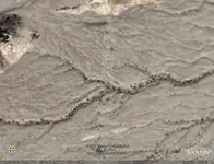
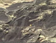
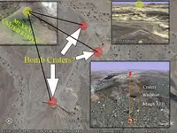
These desert tracks lead from a small elevated dune at the foot of the eastern edge of the Fish Creek Mountains north to south, over washes, and small hills. Sometimes they disappear and then reappear. Out of curiosity I followed them using Google Earth. They look like modern tracks used by some government vehicles. Funny thing is where they lead to and where they stop. Using the measuring tool on Google, the tracks run straight for almost six miles before abruptly turning a perfect ninety degrees and stopping at an incongruous location. Measured distance 6.66 miles. I know its just a number. What I would like to find out is who made the tracks and why. The end locations seem to indicate something of value was hidden and dug up. Those of you who have Google the coordinates are: 32 deg. 56' 07.11"N 115 deg. 59' 03.47" W. Any ideas out there?


