sdcfia
Silver Member
- #1
Thread Owner
Detailed route to Adams' gold
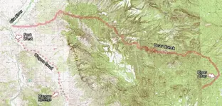
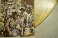
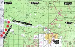
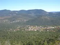
Many searchers claim to have located the Lost Adams Diggings during recent decades. As far as I can determine, one key element missing from these solutions is the most important one - nobody has proven either gold existed at their target site or that there was a reasonable potential for a substantial deposit of gold nearby. I have spent a fair amount of time since the late 1970s pondering the LAD, and have explored a few of the favored search zones where much attention has been focused on the legend. My current working model indicates a strong probability that the Adams placer field was in Bear Creek, several miles downstream from the village of Pinos Altos NM.
Landmarks that have been reported to fit this legend are present in numerous locations in eastern Arizona and western New Mexico, generating reports through the years that the LAD has been found in many diverse places. Much of the confusion with the Adams legend results from the fact that more than two dozen versions of the story are extant - many of them similar, some of them quite at odds with the others. The ample choices available of described routes, vaguely identified landmarks and descriptions of the terrain followed by the Adams party leave the reader in the uncomfortable position of having to choose which version to believe. For whatever reason, researchers generally tend to favor certain tellings at the exclusion of the rest.
My analysis of the LAD begins with a two-stage filter. First, where is a likely area where the possibility of both rich placer gold and nearby lode gold exists? The deposits would have to have been obvious, considering that the Adams party reportedly recovered a substantial amount of gold in a relatively short time, and the Apache were apparently well aware of the diggings. Second, can an acceptable number of LAD landmarks and terrain descriptions fit with the expedition's route that presumably began at the "Pima Villages” - the central Arizona region just south of today's Phoenix - and terminated at the gold deposits? Using this filter, I suspect that the Adams party discovered the placer deposit in Bear Creek or one of its tributaries.
Some key talking points will follow. I believe that by referring to reasonably detailed maps (USGS topo, Forest Service and historical), the LAD route will be easy for the reader to follow. The analysis is a simple and obvious solution to a long-lived enigma - and it leads to gold. The concept of Occam’s razor suggests that the simplest option is often the best solution to a complex problem. Judge for yourself.
Route to the Diggings
The Adams party likely followed established trails along the Gila River from the Pima Villages easterly into New Mexico. The river has several difficult sections, probably necessitating detours. The group’s Native guide would have known the easiest route and it makes sense that the trip would have taken about two weeks for a large group on horseback.
At Mangas Creek, the party likely left the Gila River and travelled east, upstream to Mangas Springs, the well-known Apache rancheria - a farming area under the control of Mangas Coloradas’ band. This was the “pumpkin patch" described in some of the LAD versions and earlier by the Walker Party when they visited in 1861.
Near Mangas Springs, the Adams party would have crossed the "wagon road" from Las Cruces that led northwest to Fort West, further upstream on the Gila River, about two miles south of Cliff NM. The Fort was in service January 1863 to January 1864. This would seem to date the LAD events to the summer of 1863.
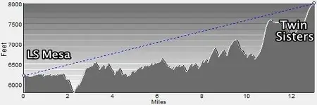
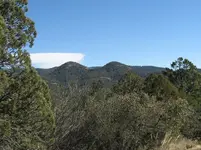
Traveling east from here, the guide led the horsemen up a narrow winding canyon - likely Blacksmith Canyon - to the top of LS Mesa. This is about a 1,200 foot climb. From this position, Bear Mountain - a large local landmark - rises above them two miles to the south. About twelve miles easterly, “dos piloncillos” (Twin Sisters Peaks) are visible on the horizon.
The party would have now turned north, following the mesa top until they dropped off easterly about 500 feet into Walnut Canyon, which they followed north until it emptied into Bear Canyon, at a point just east of Dorsey Ranch. Here, the party has arrived at the western terminus of a ten-mile stretch of placer deposits that produced gold off and on from the Spanish era until the late twentieth century.
Next: Details about the gold fields; circumstances leading to the Apache attack.

Amazon Forum Fav 👍
Last edited:


 However I would like to hear your reasons for thinking he is, thanks in advance.
 Please do continue;
