coingairl300
Jr. Member
- Joined
- Mar 17, 2008
- Messages
- 98
- Reaction score
- 0
- Golden Thread
- 0
- Location
- Warren county NJ
- Detector(s) used
- Whites MXT
- Primary Interest:
- All Treasure Hunting
- #1
Thread Owner
Hi
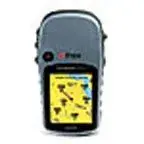
Im looking to buy a GPS for treasure hunting,I am looking to spend no more than$ 200.00 for one.
Any advise would be of help to me? thanks
Priscilla
Im looking to buy a GPS for treasure hunting,I am looking to spend no more than$ 200.00 for one.
Any advise would be of help to me? thanks
Priscilla