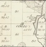
Not much to be found, at least to my naked eye. Entire surroundings are solid Maple with a few pine mixed in, which supports the notation sugar camp. I cross referenced the old survey map with current topo and came to the spot indicated, but other than a few hot iron rocks nothing popped at least on the detector. I looked for any indication of teepee rings, but I zeroed out there also. The ground cover is minimal as far as small plants, but there is at least 3-4 inches of leaf litter. I kicked moss off of every protruding rock I could find looking for any fire marks, but didn't see anything. As far as looking for flint chips and such there is no way with the existing leaf litter. I did read Marc's infrared camera post but that's a little out of my price range at the moment. Any other advice on how to locate the exact area where the camp would have been? I know we didn't even cover half of the hill as my buddy had to get back to the wife and kids.
Continued thanks everyone for your advice.
Irishmick.