hauntedwesternny
Greenie
- Joined
- May 10, 2007
- Messages
- 15
- Reaction score
- 1
- Golden Thread
- 0
- Location
- Niagara Falls, NY
- Detector(s) used
- Minelab Explorer II
- #1
Thread Owner
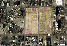
I had a brainstorm today and thought I would share it with all my fellow NY THers. When I am doing research in Niagara County( this is where I live) two of most important tools are Google Earth and a 1908 Century Atlas of Niagara County NY. The County atlas is a Goldmine, It shows every building, church, park, school ETC... What I did is I scanned a page from this atlas and broke it down to 1 block areas. I then overlayed them onto the coresponding plot in google earth. I can accuratley see what was there and what is there now.
We all love maps and most of us that love the reseach have tons of old maps. If a bunch of us startng doing this we could exchange KML files. All of us are experts on our own cities, towns, villages, counties etc. With many of us doing this we could build a KML database to exchange. Let me know if this is a brainstorm or a brainfart.
Check out the Image .