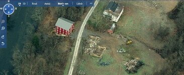
That might be a foundation, or it MIGHT be ground storage for loose cattle feed. Some bigger cattle farms use something like that. They dump it in there and use a front end loader to scoop it out.
That might be a foundation, or it MIGHT be ground storage for loose cattle feed. Some bigger cattle farms use something like that. They dump it in there and use a front end loader to scoop it out.
It looks like and old foundation of a house. The white building looks like an old Bunk House.
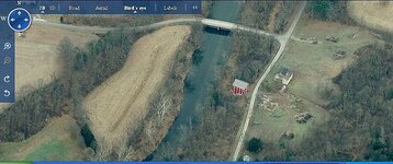
The red one could even be an old mill.
Looks like a good place to hunt.
Kevin
hmmm owner of Mill property does not live there
so either empty or has live in's
same with School Property, I May know the owner, or 1875 school.
I know the name, but not the address he lives at according to tax records.
havn't seen him since 80's
just need to find out if he's the same one
well, I'll say that one's not the school
School maybe moved up the road & turned into cabin
Hey try this site just type in your zip code and see it pulls up maps for your area it does for a lot of places I hunt as well as old topo maps all the way back to 1800's NETR Online • Historic Aerials