You are using an out of date browser. It may not display this or other websites correctly.
You should upgrade or use an alternative browser.
You should upgrade or use an alternative browser.
Looking for help please
- Thread starter Mark60
- Start date
Red_desert
Gold Member
- Joined
- Feb 21, 2008
- Messages
- 7,157
- Reaction score
- 3,794
- Golden Thread
- 0
- Location
- Midwest USA
- Detector(s) used
- Garrett Ace 250/GTA 1,000; Fisher Gold Bug-2; Gemini-3; Unique Design L-Rods
- Primary Interest:
- All Treasure Hunting
aarthrj3811
Gold Member
- Joined
- Apr 1, 2004
- Messages
- 9,256
- Reaction score
- 1,176
- Golden Thread
- 0
- Location
- Northern Nevada
- Detector(s) used
- Dowsing Rods and a Ranger Tell Examiner
nothing
Mark60
Full Member
- #28
Thread Owner
I have a theory. After researching old maps I found that a lot of the section markers from old maps were wrong. I think that in some areas the KGC were the surveyors. That let them locate a lot of the Spanish gold. When I find Spanish markers mixed with KGC markers I do not believe them.
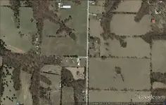
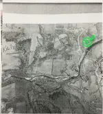
aarthrj3811, I have done some preliminary searching on the east side of the area, havent come up anything yet but theres still plenty to check, i am posting an enlarged view of the area you marked, if possible you might narrow the area a little bit more thank you for your time, m60

Last edited:
aarthrj3811
Gold Member
- Joined
- Apr 1, 2004
- Messages
- 9,256
- Reaction score
- 1,176
- Golden Thread
- 0
- Location
- Northern Nevada
- Detector(s) used
- Dowsing Rods and a Ranger Tell Examiner
nothing
weekender
Sr. Member
- Joined
- Feb 28, 2009
- Messages
- 497
- Reaction score
- 1,163
- Golden Thread
- 0
- Location
- Arkansas-River Valley-Ft. Smith
- Detector(s) used
- Prism V
- Primary Interest:
- All Treasure Hunting
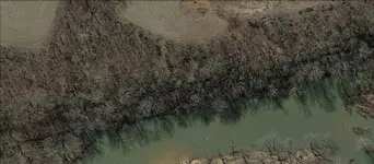
Hello to everyone talking with another member he suggested I post a map here for y'all to take a look at and possibly help me to narrow down my area. I didn't realize this was possible I thought dousing had to be performed on site so this great. I sure hope someone can help if more pics are needed I can post them here or you check my thread "unusual rock carving" thanks again to everyone. View attachment 1351078View attachment 1351080View attachment 1351081
Mark60,
In your picture with the initials on the bluff, It looks like a triangle carved into the right hand side
of the picture. do you have any other pictures from different angles?
-Weekender
Similar threads
Users who are viewing this thread
Total: 1 (members: 0, guests: 1)
Latest Discussions
-
-
-
Garrett Vortex VX9 potential major flaw(s) with latest version software
- Latest: tnsharpshooter
-
-


