Gypsy Heart
Gold Member
- #1
Thread Owner
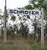
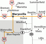
Schroyer. A trading community between Marysville and Blue Rapids, named for the Shroyer family. A "c" was added by mistake on the sign for the depot, and the railroad refused to change it. About 7/10 mile north of Alcove Spring on the East River Road, Southwest Quadrant.
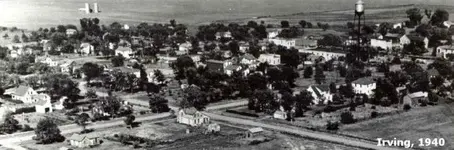
Three towns in Marshall County were levelled about 1960 to make way for the reservoir of the Tuttle Creek Dam, located 40 miles to the south. The townsites have rarely been under water since the dam was built.
Irving. Founded 1859. Best known because it was struck by two tornados in one day, in 1879. Leave a message in the mailbox near the marker if you like. Zenith and 12th Roads, Southwest Quadrant.
Bigelow. Founded 1881, noted for its stone quarries. Marker at Zenith and 17th Roads, Southeast Quadrant.
Barrett. Founded 1858. Site of the first sawmill in the area. Marker at 19th Terrace and Wildcat Road, Southeast Quadrant.
Southwest quadrant shaded