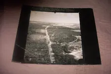
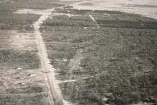
Pretty sure it is not Brunswick. The road doesn't match with Google maps on either end of the runway. Even if the road was not used after the crash, it would take 100 years to cover up a road like that. Also, the trees in Bramblefind's post are much larger and thicker than the ones in the original post.
I also looked at Pensacola, Wildwood NJ, and a few other east coast Naval Air Stations and didn't find a match.
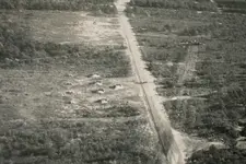
I believe I can see a 3 digit number on the runway, but can't read it. The last digit might be an 8 or a 0 but I can't be sure.
If the aircraft was in distress it could have attempted a landing on any runway possible, so it might not be a NAS.


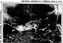

 but the plane in the crash I referenced is P2V Neptune and I think that has a single tail?
