Goldstar1
Full Member
- Joined
- May 22, 2010
- Messages
- 222
- Reaction score
- 295
- Golden Thread
- 0
- Detector(s) used
- Goldbug Pro ,
Equinox 800
- Primary Interest:
- All Treasure Hunting
- #21
Thread Owner
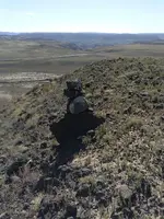
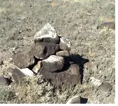
 Heres this little guy, it is part of the first cluster of stuff , yep just about 2.5 miles from the placer area in the background, I will try to map and measure the others in this set and put something together . The next cluster is about the same distance from the markers I posted . I interpret this as a guarded camp , but could be way off ,Im certainly interested in other opinions on this.....


