teacher457
Jr. Member
- #1
Thread Owner
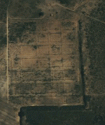
Found this plot while searching Google Earth for MDing sites and was wondering what it could be. It's located about 9 miles North East of Post and no one around here seems to know what it is, including the land owner.
Thanks,
Carol
Thanks,
Carol