What's new

Petroglyphs

rginn

Gold Member
Joined
Oct 16, 2007
Messages
9,219
Reaction score
13,567
Golden Thread
0
Location
Summit County, CO
Detector(s) used
White's DFX, White's Classic 1 Coinmaster, Nokta Pointer
Primary Interest:
All Treasure Hunting
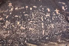
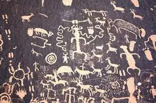
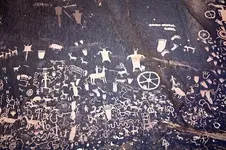
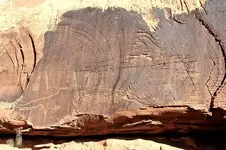
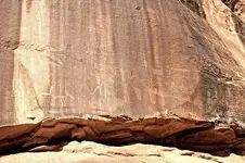
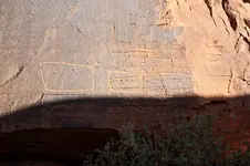
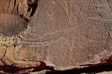
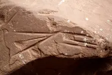
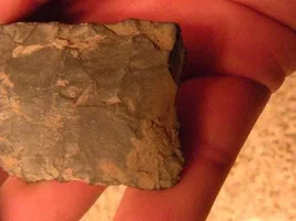
So I went down to SE Utah since it's warmer and I needed to go someplace since I was on vacation. I walked a lot and took pics of a lot of sites. At only one site did I find lithic materials in close association with the pictographs. I found curvilinear style, Fremont, historic Ute, possible Anasazi, and Earl's declaration of love forever for Betty. Most of the sites BLM knows about, but some they don't. This is a lot of pics, but I took about a hundred, so I cut it down.
 

Attachments
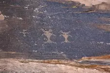
  • petro1.webp
    petro1.webp
    45.3 KB · Views: 355
  • petro2.webp
    petro2.webp
    75.4 KB · Views: 347
  • petro3.webp
    petro3.webp
    76.1 KB · Views: 360
  • petro4.webp
    petro4.webp
    77.1 KB · Views: 366
  • petro5.webp
    petro5.webp
    65.8 KB · Views: 333
  • petro6.webp
    petro6.webp
    60.6 KB · Views: 342
  • petro7.webp
    petro7.webp
    50.9 KB · Views: 341
Upvote 0

thats cool that their still there and none of them grave digging "for knowledge" fellows aint molested them. although it looks like someone tried to by that one pic. thanks for posting.
 
Thank you for sharing that, I have blown it up to look at it. Amazing art work. What a thrill to see in person. Thanks a lot for sharing the great photographs Rginn.
HH
TnMountains
 
I considered this petroglyph a map. There's about 85 or so dots between the man and coyote figure. I took these as steps and walked east. There was some rocks that were piled up. When I backtracked and went west, I wound up in front of a rock overhang that showed signs of human occupation. In the lower left hand corner of the pic, the top line approximates the course of the stream, which of course will change over the years. The bottom line is pretty much the same course the canyon rim takes. The rectangle or square at the left, which is hard to make out in the pic, corresponds with a box canyon, then the line pretty much follows the course of the canyon rim. I could be wrong and engagin in fanciful thinkin. I didn't find any Spanish gold or anything.
 

Attachments

  • sevenmilemap.webp
    sevenmilemap.webp
    143.5 KB · Views: 319
RGINN,
Great photos! Good views of some excellent petroglyphs.
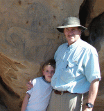
As I think I'd mentioned to you before, my son and I visited some areas of the OK panhandle and later, just over the border into Colorado, that had some interesting glyphs, nothing of that scope however. I've attached a single photo with image just behind us.
Again, great shots.
PS
Why aren't you vacationing down here in the mother land? We've got a few sites to see!
Doc
 

Attachments

  • DSC09802(2).GIF
    DSC09802(2).GIF
    204.9 KB · Views: 340
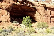
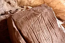
That's a great horse pic, docmann. I've seen that in Ms. Farley's book, I'm pretty sure. It's a much different style than you usually encounter. The best thing about Utah is somebody with the government has taken the time to go all around and put up these little metal signs about a foot off the ground warning about messing with the site. Sometimes the sign is harder for me to spot than the rock art, but if I can find the sign I know I'm on to something. I made it to Oklahoma twice this last summer, but we always try to make it over to Moab at least once. It's like Texas without my Texan cousins. Here's pics of a rock shelter and tool sharpening marks. Or tally marks. Or Ogam writing, take your pick.
 

Attachments

  • rs1.webp
    rs1.webp
    122 KB · Views: 266
  • rs2.webp
    rs2.webp
    94.3 KB · Views: 362
  • rs3.webp
    rs3.webp
    75.9 KB · Views: 250

Users who are viewing this thread

Back
Top Bottom