Back when I was in network installation, one of the jobs I picked up was for the company that makes many of the cameras used in the satellites for the National Recon Office/Agency. Some of the images they had on their walls were fantastic. One of their engineers told me that they were taken from low orbit and I thought they were very cool. (Hey!!!! I can see my house from up here!!) Then he told me that the shots were not even the best they could do but anything better was classified and they couldn't have examples of their equipments' abilities up on the walls like that. Told me they almost had it down to the point that they could read a newspaper over your shoulder while you sat in the park. That was late 80s or so. GoogleEarth and the rest are nice, but they'll never have access to that kind of gear.
Read up on optics and the "
circle of confusion". Physics simply don't allow reading a newspaper from low orbit much less from ordinary imaging satellites. That "almost" in the 80's still exists today no matter what you see on television.
It's true that there is much better satellite imagery available than what we are allowed to use. Even that is limited by the laws of physics.
Google works on the 3 meter standard (10 foot resolution) where they can get it, including the entire continental US. In some parts of the US One foot resolution is used. All of the imagery in that range is made from airplane photos. 1 foot resolution does not mean that you can see a one foot object it means that one pixel is represented per foot of surface viewed. It takes approximately a 32 x 32 pixel area to create a recognizable image (1024 pixels or 1024 square feet). So at best an object needs to be 32 foot square on the ground to be recognizable with one foot resolution.
I know a bunch of readers are probably thinking "BS - I can see better than that in the images already on this thread". To illustrate this concept I've clipped a 1 foot resolution 29 x 29 pixel square representing 841 square feet on the ground here:

Can you tell me what object is shown? Being below the 32 x 32 pixel limit it's unlikely that anyone can get information about that area without some other visual clues.
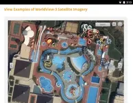
This is the best resolution google (and Land Matters) display. 1 foot resolution. At 3 meter resolution 32 pixels represent just short of 10,000 square feet - about the same area as a small residential house lot.
At Land Matters we use a custom worked satellite image until the map view gets down to about 300 square miles then we switch to the same streamed aerial photos everyone else uses. The government provides these images for free to google, bing and Land Matters.
The differences you see between the different maps is more about map projections than where the images come from. At Land Matters we provide equal area mapping. This means that a measurement in any direction is equally accurate. One mile North, East or Southwest is the same visual measurable distance. Accuracy in representation is our goal. Google, bing and the other map systems provide non standard mercator projections that can not be accurately measured. Depending on where you are on a google map a mile North /South may only be 70% as far in measurement (and visually) as an East/West "mile". Different maps for different purposes using the same aerial views.
Aerial mapping is slowly getting better. More of the United States gets 1 foot resolution aerial photos added each year. Satellite photos available (at a price) get a little better resolution every few years - there is a lot of competition in the satellite business but those better quality satellite photos are not free and they only cover very limited areas. Prices range around $40 per square kilometer with minimum purchases about $2000 for private one time use. The best color satellite resolution you can buy is about 4 1/2 foot resolution and that's only in select areas. Not near as high resolution as the 1 foot resolution provided for free from the government.
In our mapping business we have several sources for private very high resolution aerial photos but the cost is something only large companies with big mapping budgets can afford. For now the best quality imagery you will see is still that 1 foot resolution aerial (airplane) photography found on all the major mapping systems - including Land Matters.
Heavy Pans