What's new

Spanish Gold and The Lost Dutchman

Continue please,
Hat Rock.webp
 
I place the "Hat Rock" south of where it is shown on the map. Google Earth does not show its true shape; it is flattened and broadened by GE. It should be easily visible from Triple Arch Trailhead along Highway 88. Maybe a Tnet member can provide a photo taken from that viewpoint.

View attachment 2270067

View attachment 2270068
View attachment 2270069
View attachment 2270070
Yes this is the " hat rock " shown by Rosencrans in his book. IMHO, this is not the real " La Sombrera " rock. The real one was described in Erwin Ruth clue for the LDM, which says: " The mine is on a knob about 50 feet high ...". So, if the rock in the book would be the real one, then the mine would be somewhere close by.
Acctually , the " hat rock " ( always IMO ) is located elsewhere, in a place which is hidden by the surroundind landmarks, but can be seen from the Military Trail, from a specific location.
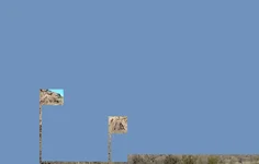
I have a real picture of that knob and I will post it here, and as you can see, in the background of the " hat rock " is a bigger mountain. In the left up rectangle is the rampant horse landmark, and in the lower square is the " La Sombrera ".
 

Attachments

  • La Sombrera.webp
    La Sombrera.webp
    10.3 KB · Views: 19
Yes this is the " hat rock " shown by Rosencrans in his book. IMHO, this is not the real " La Sombrera " rock. The real one was described in Erwin Ruth clue for the LDM, which says: " The mine is on a knob about 50 feet high ...". So, if the rock in the book would be the real one, then the mine would be somewhere close by.
Acctually , the " hat rock " ( always IMO ) is located elsewhere, in a place which is hidden by the surroundind landmarks, but can be seen from the Military Trail, from a specific location.
I have a real picture of that knob and I will post it here, and as you can see, in the background of the " hat rock " is a bigger mountain. In the left up rectangle is the rampant horse landmark, and in the lower square is the " La Sombrera ".
Markmar

And what do you mean when you say "Military Trail"? Remember, there isn't a specific trail called the Military Trail. The Military used many of the old trails in and around the Supes.
-SpartanOC
 
"Spanish Gold and The Lost Dutchman" by Ludwig G. Rosecrans (1949, 64 pages) offers the author's theory on why the Lost Dutchman mine has not been found and where he thinks it could be located. It is an interesting read for those who enjoy alternative theories and viewpoints. It should be noted that the author was not a successful prospector, nor was he native-born to the southwestern United States. His mining "claim" was just a ploy to provide some justification for his squatting on public domain land. He did a little superficial digging to keep his "claim" active. Apparently, he did no gainful work, subsisting only on money doled out from the family coffers.

I'll call the pages that follow here "Part One." The "meatier" parts of the matter will follow in installments.

"Ludwig “Doc” Rosecrans was born in 1914 and he was the only son in his family. His father became a successful physician but Ludwig chose a very different career path. He came to the Superstition Mountain area to search for gold shortly after World War II. He was in his early thirties. He lived in a ramshackle shack built on his mining claim just off of the Apache Trail.
Doc was somewhat of a philosopher who had his own ideas about the soul and various other related topics. Although in 1949 he published a book, “Spanish Gold and the Lost Dutchman”, he also “intended” to publish a book on these other interests." -- Gary and Carol Cundiff

View attachment 2250482
View attachment 2250483
View attachment 2250484
View attachment 2250485
View attachment 2250486
View attachment 2250487
View attachment 2250488
Howdy Skyhawk,
Ludwig g. Rosecrans was just one of many who failed in their search for the LDM, and ended up writing about it. He got many things wrong, following his ideas will just lead you in his same fruitless path. He claimed that Weaver's Needle was unnamed at the time of the Peraltas. They had names for most mountains there, whether Kino had named them, or anyone else. Pauline Weaver didn't "discover" that salient pinnacle, many before him knew about it.
If you read THE SALAZAR SURVEY BY MR. CLAY WORST, you will find that what we know as Weavers Needle, was known as El Sombrero by the Peraltas. The survey map that Cristobal Peralta brought with him from Spain, referenced to the salient pinnacle, as El Sombrero. A notation indicated that the pinnacle was located 14 kilometers South of the Rio Salado. It was the first thing I verified, and it is exactly 14 kilometers, but Ludwig didn't know about this, can't blame him though. He also stated, THE LOST PERALTA DIGGINGS ARE NOT AROUND THE NEEDLE, he got that wrong also.
Hate to see a good man follow false info.

Homar
 
Markmar

And what do you mean when you say "Military Trail"? Remember, there isn't a specific trail called the Military Trail. The Military used many of the old trails in and around the Supes.
-SpartanOC
To me is a common trail. According to Waltz, the same trail was the Military trail. If a trail is close to the LDM and could be seen from the mine, then that trail should be the ex Military Trail.
 

Users who are viewing this thread

Latest Discussions

Back
Top Bottom