Re: Tea Kettle, & Lookout rock...
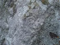
Hey truthseeker, thanks for the info! Yes this carving still has me puzzled. I'm thinking now that two of the X's are M's instead of X's.... Ive posted a picture of this carving, in this pic you will see the "J S" , turkey tracks, on the left is what I'm thinking is some of Swifts crew, and the top right is the map of the ridge line. You have to look very hard to see this but its there! Ive drew a rough map of what stands out in the negative of this picture, ill take a picture and post it later. Two of these X's or M's match the places I've found, like the mine opening, and the rockhouse/cave. It points these places out almost perfect!!! The other x or m I'm currently looking for. I must mention the mine opening I've found does have a chestnut burr rock above it. This map also could be Indian, letting other Indians know of where to maybe find something that was important in the area. There was alot of Indian activity around this area....to be honest there is no telling what might be hiding in the area.
These carvings are exposed to weathering, the map of the ridge could have been there before the initial carvings. Like i said before the place where this carving is located is in a very rough remote place, on privet land. The land owner does not allow people to trespass, you have to ask before you enter. The hike to this place is around 3 mile from where i start. -KI-
 post erased
 post erased


 Gg, THOSE "signs" COULD be KNIGHT TEMPLARS, PIRATES, FREEMASONS, or KGC. AND! The "TEA KETTLE" COULDbe a "BRIT connection"... DUNNO.


 Had problem with "puter", earlier... try THIS...

