The Peralta Stone Maps, Real Maps to Lost Gold Mines or Cruel Hoax?

Do you think the Peralta stone maps are genuine, or fake?


  • Total voters
    121
I gave you everything I have, go to google earth and do it for yourself, then look over the area from different views.

skumpa
 

skumpa said:
I gave you everything I have, go to google earth and do it for yourself, then look over the area from different views.

skumpa


I think the Pro version is required to input coordinates.

I can tell you how to take a screen shot of it, if you are having trouble with that.
 

try this one. Remember you have to go to GE to look at the two sites e and w to see why I chose the two man made locations.
 

Attachments

  • dutch (2).kmz
    1.9 KB · Views: 108
Skumpa,

I went through this exercise years ago, along with Kraig Roberts. Brown's Peak is the biggest of the four peaks, at a little over 7,600 feet. In that respect, they don't ever look like one peak from anywhere in the Superstitions......as far as I can tell. IMHO, for that to happen on a line from Weaver's Needle, you would need to be much closer to the Four Peaks.

I could, of course, be wrong. :dontknow:

Good luck,

Joe Ribaudo
 

Joe: You are more knowledgable about this than I. But if you stand on Bluff Spring MT. one can see all four makers and the 4 peaks (as far away as they are) apeer to be one. Ah, what the heck, people probably have been all over this site from the begging. But it was fun, looking at the clues. I just wish I could go out there some day and see that beautiful country.
 

I think the best you can do from Bluff Springs, is seeing 1 and 1/2 -3/4 of a second one. I don't believe you can line it up any better than that
from Bluff Springs Mountain.

I have looked from Bluff Springs Mountain, and, it did not line them up into one. I'd be interested in seeing any pics where they
did all like up as one, as you say.

Thanks,

Beth
 

Beth: I said it apeared as one from the top of the bluff. I have never been there. I did it from google earth. so don't take it as I said. don't take it so litteral. Even on GE you cannot see all the detail, as u would by being there. Really which part of the needle would u go off of, or what part of the 4 peaks would u go off of. the marks e and w are they percise? I don't know, I NEVER was there. I am just being general. cheeeessss!!!!
 

skumpa---

Thanks for posting the screen shot. Coordinates no longer show up on my GE. I guess I did something to turn that off, and I can't find anything that will turn that feature back on. I may have blocked it in my firewall (?) I don't normally use that info, so I didn't notice whenever it happened.

Your guess is as good as anyone's.
 

Skumpa,

Actually, what you said was "But if you stand on Bluff Spring MT. one can see all four makers and the 4 peaks (as far away as they are) apeer to be one."

Which, to me, does not sound like a "Google Earth" statement, but, rather, a physical one. You will never be able to "see" it on GE

I, however, am telling you from actually standing up there, the very best you could see is Four Peaks becoming 1-1/2 to 1/-3/4, not aligned as one.

Beth
 

you're right Beth, but who knows what he was thinking, it maybe was a general statement by him, I don't think he had GE back then. lol
 

I'm sure he didn't have Google Earth. :BangHead: :dontknow:

However, if I was explaining something, and I was talking about Four Peaks, if I said they lined up as one, I would say - they lined up. (or, they ALMOST lined up).


That is a funny statement on your part - don't take it like you said? :dontknow: :icon_scratch: :help:

Beth
 

Ok, since your such a stickler for right ons, let me ask your OPINION on this, " to enter my mine you must go through a hole!" and the difference between " to enter my mine you must go into a hole!" and you are right, that nowwhere on earth does the 4 peaks line up as one on GE, and if the don't line up there they probably don't line up in real life either, they just apear to look as one n to s, more than they look e to w. r we still friends?
 

Hi,

My OPINION is that neither statement is accurate. First - it depends on who's book or transcript or article, you have read. What started out as a handful of clues back when I first got interested in the Lost Dutchman, it has turned to hundreds of clues.

However, taking the AVERAGE of when someone spoke of a "hole", the most common statement(s) were "on the way to my mine, you can see a peak with a hole in it" - or another one is "you have to climb through a hole to get to my mine". And, there are several other versions of the "hole". However, I believe that Joe Deering mentioned climbing through a hole.

Now, without getting into big long explanations, "clues" are only as good as their sources, and, obviously, there have been many, many variations on Walt's clues. (and not just the one about the hole).

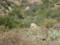
In my opinion - and make no mistake, I look, and have looked - at many a place on Google Earth, but, you cannot "see" what you are looking for. For instance, here is a picture I took 2 years ago - and, knowing EXACTLY where it is - by exact GPS coordinates - you cannot find it on GE.

Beth
 

Attachments

  • A real rock face.jpg
    A real rock face.jpg
    148.5 KB · Views: 593
  • A real rock face.jpg
    A real rock face.jpg
    148.5 KB · Views: 522
Skumpa and everyone, - please don't take a question as a personal attack. It is not attacking to ask to see a photo, and I got the same impression about what was posted meaning that there was such a spot on Bluff Springs mountain at which Four Peaks would line up as one, which I have never found that spot. If there is a photo (from anyone) that shows the peaks lining up I would like to see it too.

Something to consider when comparing the stone maps with what you see from Google Earth, if you find a lot of matching details that implies that the stone maps were created by use of some kind of aerial overview (as proposed by our mutual amigo Hal Croves) and this would tend to point to a modern origin. Just a factor to consider.

On Deering's clues, they may well be pertaining to a different mine from that of Waltz. Personally I am fairly convinced that this is the case. What he told his friend John Chuning led Chuning to a spot on the northern side of the range quite close to the Salt river, or maybe Chuning had given up on following the clues and was simply prospecting when he found the mine that he, Ely and Bark then worked? A key difference for Deering's mine is that he stated there were pieces of ore laying around the entrance, and secondarily that it was not covered. Does that sound like what Waltz allegedly told Julia, Reiney or Dick Holmes? :dontknow:

Good luck and good hunting, I hope you find the treasures that you seek.
Oroblanco

:coffee2: :coffee2: :coffee2:
 

oro, I thoght beth cleared that up in earlier posts. I think your right they never ever line up, anywhere, one of the four always stick out somewhere. but maybe the line is very close to the w side of the bluff if not on top, over the edge and down. if he closed up the funnel tunnel, where no one could find it. then a small cave entrance over the side. i have tried a different locations to line it up to be on top of the bluff, but the line disappears into the mountain, so it is difficult. I hope it was some help to u. Then again I could be completely wrong.
 

Top Member Reactions

Users who are viewing this thread

Back
Top