Your scale 1/125000 topo has a maximum precision of about 200 feet. That means the very best located feature on the original topo will be within 200 feet of it's actual location. The actuality is that very few map features will be anywhere near that accurate. More like a 1/4 mile on the original topo for general accuracy of features.
That's for the original topo which is probably in a long ago Polyconic projection. Once you combine it with Google in a made up non standard projection (900973) based on a much more modern WGS 84 geographic model you end up with a mutt. Projections matter a lot and although georeferencing a few corners can get you closer you really need to reproject the maps to match projections. Google products can not reproject or even change projections so your tools are incapable of making any more than a stretched and warped copy of the topo. Stretched and warped are not terms that are compatible with accurate mapping.
IF you have the GE "terrain" and 3D features turned off you might reasonable expect accuracy within 3,000 feet for some features on your topo but not all. If you have the terrain and 3D features on you can throw
any locational accuracy out the door.
More modern topos are created by stereographic pairs of aerial photos as ChampFergusonTN correctly pointed out. That method is MUCH more accurate than the earlier hand drawn topos like your 1909.
Stereoplotters are still in use today and they are still the most accurate terrain mapping method. Modern topos have a scale of 1/24000 which is much more accurate than your 1/125000 topo. Generally features on modern topos are within 40 feet of their ground location about 60% of the time. The same rules apply when you put those 1/24000 topos on google earth - accuracy goes way down.
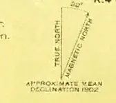
The declination is probably 3
.2 degrees. I'm not sure 32 degrees declination is even possible. The middle of the pacific ocean is only 20 degrees declination. I'm not sure why the declination would matter unless you are triangulating with a magnetic compass. The topo, google and a GPS unit already have declination figured in. Magnetic drift will have virtually no effect compared with the scale of map and the native google earth inaccuracy you are encountering.
You can see a chart of the different resolutions used for topos
on this page. There is also a link there to a map that will allow you to download any topo or shoreline survey, modern or historic, ever made in the U.S. You might just find there is a much higher resolution topo of your area of interest from the same period that will have the information you need.


