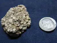
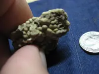
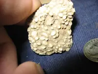
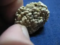
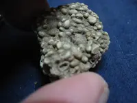
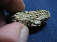
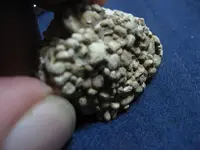
this was found in south central cooper county, Mo.. I have seen a couple of these but this is all I brought home. appreciate the help. I hope these pictures will help, about the best I can come up with. I tried to bust a piece off with my fingers and in half also but seems that it is very hard and tight. wes
It is a conglomerate. Conglomerates are clastic sedimentary rocks with grain size>2mm. Commonly, the matrix is sand(1/16mm-2mm) and silt(1/256mm-1/16mm) sized particles. They represent a high energy depositional environment and form in streams and channels.
It is a conglomerate. Conglomerates are clastic sedimentary rocks with grain size>2mm. Commonly, the matrix is sand(1/16mm-2mm) and silt(1/256mm-1/16mm) sized particles. They represent a high energy depositional environment and form in streams and channels.
Some more information that you might, or might not, find interesting:
It appears that your specimen is from a "lens"(but not really, your's is erosional) of Pennsylvanian rocks that are exposed in your area. At the time, the formation of the super continent of Pangea was nearing its completion. During the formation of Pangea, South America(Gondwana, et al) was colliding with the southern margins of North America(Laurentia), and during the phase of orogenic episodes that created the Ouachita Mnts, there was a large mountain chain formed along the southern margin of Laurentia(really, it is a continuation of the appalachian orogenies).
As such, mountain streams poured into the sea that was located on the back side of the front range... kind of like what is going on along the west coast of Japan, today.
Cool rock; definitely a keeper! I keep all new rock types, if only as a reference.