Azquester
Bronze Member
- Dec 15, 2006
- 1,736
- 2,596
- Primary Interest:
- All Treasure Hunting
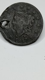
Looks like El Tio.
View attachment 1194326
Assuming the lines are treasure symbols .
Horns, Ears, or Mountains above the Heart?


 My point was that it's not a Jesuit map, but you assume there is an original?