LDM why you cant get it ! MAP #10

OP
OP
JackH

JackH

Full Member
Feb 26, 2011
211
19
Central Pennsylvania, ex SoCal
Detector(s) used
White's DFX
Jack

I believe how was more easy for the Peraltas to transfer their gold via Gila Trail to San Diego

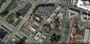
View attachment 747204

Marius

You could be very Right Marius,

But these are my reasons maybe not:

1) Gila Trail: (Southern Emigrant Trail - Wikipedia, the free encyclopedia)
In October 1846, General Stephen Watts Kearny and his dragoons with their scout Kit Carson found the route.

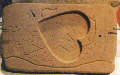
2) The last reference before the Legend of the Massacre (Peralta) is 1847 on the interior of the Peralta Heartstone. We can assume that Peralta visited the Great Mine (LDM) at least twice before the Massacre. My assumption because there was a Galleon waiting for him, and possibly others. This Galleon was on a time schedule. Galleons were the most expensive item to produce in the day. They had to keep moving like todays sea going freighter to pay for the cost of building and bring profit. That schedule was kept by Peralta because he knew how much time it would take to fulfull his obligation to the King of Spain and deliver.

3) Old Spanish Trail (trade route) - Wikipedia, the free encyclopedia
A route linking New Mexico to California, combining information from many explorers, was opened in 1829-30 when Santa Fe merchant Antonio Armijo led a trade party of 60 men and 100 mules to California. Using a short cut discovered by Rafael Rivera the previous year, the Armijo party was able to stitch together a route that connected the routes of the Rivera and Domínguez-Escalante Expeditions and the Jedediah Smith explorations with the approaches to San Gabriel Mission through the Mojave along the Mojave River. After this date, the route began to be used by traders for usually a single annual round trip.

The trading party usually left New Mexico in early November to take advantage of winter rains to cross the deserts on the trail and would arrive in California in early February.
The return party would usually leave California for New Mexico in early April to get over the trail before the water holes dried up and the melting snow raised the rivers too high. The return party often consisted of several hundred to a few thousand horses and mules

4) Low-scale emigration from New Mexico to California used parts of the trail in the late 1830s when the trapping trade began to die. The trail was also used for illicit purposes, namely to raid the California ranchos for horses and for an extensive Indian slave trade. These horse raids were made by Mexicans, ex-trappers and Indian tribes who together stole hundreds to thousands of horses in one raid.

Essentially, Peralta would use an Established Route as replacement work animals would most likely be available. I'm sure he had spare animals to begin his trip.

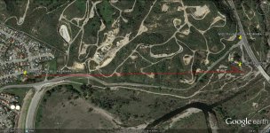
5) It appears by the information provided, the real hardships began on the Old Spanish Trail somewhere here for the trip to the San Gabriel Mission and coast:
Entering the Great Basin in Utah via Salina Canyon, the trail turned southwest following the Sevier River, Santa Clara River and Virgin River before ascending the Mormon Plateau and hitting the Muddy River in present-day Nevada. From there, it was a 55 miles (89 km) waterless trip crossing southern Nevada to the springs at Las Vegas, Nevada. From Las Vegas, the trail went across the Mojave desert from Mountain, Resting, Salt and Bitter springs (which were sometimes dry), each about a day's travel apart across the Mojave Desert until it reached the only intermittently dependable Mojave River. The river was followed to a point near Cajon Pass over the San Bernardino Mountains.
 

Attachments

  • HEARTSTONE INTERIOR.gif
    HEARTSTONE INTERIOR.gif
    71 KB · Views: 155
OP
OP
JackH

JackH

Full Member
Feb 26, 2011
211
19
Central Pennsylvania, ex SoCal
Detector(s) used
White's DFX
Hi Jack

How long time ago , you believe , had started the exploitation of LDM ?
I believe more before Coronado .

Marius

Marius, I do not know how many generations of Peralta's Mined in the Superstitions.
Somehow 200 years comes to mind, that the Family worked for the King of Spain.

Jack
 

OP
OP
JackH

JackH

Full Member
Feb 26, 2011
211
19
Central Pennsylvania, ex SoCal
Detector(s) used
White's DFX
Hi jack are you looking for peralta? The san gabriel mission was washed away in a flashflood.there is a sign with a plaque a block away from the end of the street going south on san gabriel blvd.the franciscans built a new large mission and some of the indians are buried in the walls of the mission.
Miramar I left you a response on pictures you took on the regular site. Where do you live and what treasure are you looking for.?

Tom, it looks like we crossed the same paths.

But the answer is Not that easy. Here is part of the email that I sent on to the Montebello Historical Society.

Quote:
Dear Montebello Historical Society,
(etc.)

Your Statement:
Our Mission:
Preserving the past for generations to come.


No doubt you have visited the 1st (site) Mission San Gabriel corner of
Lincoln Ave & San Gabriel Blvd on the outskirts of Montebello.

My purpose is to direct you to the Actual site which is just below
the site where the marker is placed:
La Mision vieja ? (click on site window to see the copyrighted photographs)
(A plaque erected by Walter P. Temple and commemorating the founding of the mission on the 150th anniversary in 1921.)
(Feb 27, 2013)
[I have a Real Problem with this dedication photograph. It is clearly (not July 31, 1921). The photograph is a clean-up
party sometime in the 1940-50's ? Notice the broom, hoe, old concrete base. And the guy with the stylish hat up front,
what is he doing ? Applying black paint to the base ?] End of remark.


I believe the Marker was placed by convenience, as it could not
be seen on the actual site because it is much lower than the road.

The Mission Vieja was devistated in (1776) and moved to the present
site in San Gabriel (namesake) as you well know.

If you choose to investigate this site, you may find and old adobe
wall where the long red line which stands apart from the others.

I investigated this area below the (site) when I was @ 10 yrs old, and
found many interesting anomalies (1958).

Don't you think it should be identified and preserved ?

Just thought you would like to know...

============================================================


What Tom has pointed out is where the Marker (Landmark) is located. In this photo (3) the Landmark is
landlocked on a small parcel of ground. Pin placement Earth image.

What has happened since the dedication in 1921 was a new road cut off the complete parcel of land
containing the illusive site footprint. One should notice the original road just below the red lines, that
curves upward toward the Landmark.

photo (2) shows San Gabriel Blvd which leads to where the new Mission is 5 miles or so down the road.
Somewhere near the San Gabriel Mountains on the right side of the picture.

The winding looping roads above the site is working Oil Wells. The Rich history of this area speaks of
Fortunes made for the descendants of the original and early land owners. Some became Bankers and
refused to close their doors during an economic crisis, which ended in their fortunes lost. Some
regained their fortunes when Oil was discovered here @ 1900.


The Montebello Historical Society sent me the photo of the Adobe building as (it's) sight.

My Exuberance of this whole picture of Peralta delivering Gold to the Coast, so overwhelmed me in
this discovery in Montebello, that personal controls were lost.

The Society knows very well where the footprint should lie.
 

Attachments

  • adobe est 1869, pic1920, des 1937.jpg
    adobe est 1869, pic1920, des 1937.jpg
    166 KB · Views: 133
  • Mision La Vieja.jpg
    Mision La Vieja.jpg
    290.9 KB · Views: 152
  • 1st San Gabriel Mission.jpg
    1st San Gabriel Mission.jpg
    40 KB · Views: 147
Last edited:
OP
OP
JackH

JackH

Full Member
Feb 26, 2011
211
19
Central Pennsylvania, ex SoCal
Detector(s) used
White's DFX
A peak into the next segment after "Mision La Vieja".

A view of some of the key people who owned the valuable
land surrounding the unwanted barren basin that was to
become Los Angeles, California and the Mexican Governor
who was an important part of that History......

Who We Are | Homestead Museum
 

OP
OP
JackH

JackH

Full Member
Feb 26, 2011
211
19
Central Pennsylvania, ex SoCal
Detector(s) used
White's DFX
MISION LA VIEJA foot prints...........

(Part of my reply to Montebello Historical Society)

Thank you for the Quick reply and (
Manuel Zuniga and was his store) photo) your 2nd response.

I think we will both agree that the site is most likely that of La Mision Vieja.

The old road below the Zuinga Store was the first road and the new Lincoln Ave came much later.
That would then include the suspected area.

Mission San Gabriel Arcángel - Wikipedia, the free encyclopediaMission San Gabriel was founded on September 8, 1771 by fathers Pedro Cambon and Angel Somera. The planned site for the Mission was along the banks of the Río de los Temblores (the River of the Earthquakes-the Santa Ana River). The priests chose an alternate site on a fertile plain located directly alongside the Rio Hondo in the Whittier Narrows


1) I would also think this road at the point of La Mision Vieja was an intersection selected by the Fathers Cambon and Somera. One traversing
across the Rio Hondo, the other towards what is now Montebello on what is the earlier Lincoln Ave. used by the Indigenous Peoples of the area
for centuries.
(Remark 02.28.2013) You can't make people come to a Mission, you must take the Mission to the People (Indigenous Peoples). Secondly, by the information available,
there were more populous Tribes nearer the Mountains that became the San Gabriels.


2) San Gabriel Blvd I would think is the path that the Gabrielino Indians traveled to and from Mount Wilson for La Mision Vieja building supplies.
Sierra Madre, California - Wikipedia, the free encyclopedia The first Mount Wilson trail was carved by the Gabrielino Indians which was used by them when they carried timber down from the mountains for the construction of the San Gabriel Mission in 1771.[SUP][9][/SUP]


Kittanning Path - Wikipedia, the free encyclopedia (this site reference only gives a 1721 date)
Example: In central Pennsylvania the Kittanning Path/Trail was used by the Indigenous Peoples of New York, Ohio, Maryland, Virginia, W. Virginia,
Indiana as well as those of Pennsylvania. They had been using these trails for as much as 1000-1500 years before the White man set foot on this
continent. Today many of those Paths/Trails are under main roads throughout the Mid-Atlantic states.


3) If I am correct, the suspected site was already an established crossroads, that would give reason to be an ideal location for the Zuinga Store
or anyone before him up until the time of La Mision Vieja.

http://en.wikipedia.org/wiki/Rio_Hondo_(California The Rio Hondo (Spanish translation: "Deep River") is a tributary of the Los Angeles River in Los Angeles County, California, approximately 16.4 miles (26.4 km) long.[SUP][2][/SUP] As a named river, it begins in Irwindale and flows southwest to its confluence in South Gate, passing through several cities (though not the city of Los Angeles). Above Irwindale its main stem is known as Santa Anita Creek, which extends another 10 miles (16 km) northwards into the San Gabriel Mountains where the source, or headwaters, of the river are found.

Santa Ana River - Wikipedia, the free encyclopedia Relatively little water actually flows in the river or most of its tributaries


[SUP]Rancho Santa Anita - Wikipedia, the free encyclopedia [/SUP]Rancho Santa Anita was a 13,319-acre (53.90 km[SUP]2[/SUP]) land grant in present day Los Angeles County, California given to Perfecto Hugo Reid. The land grant was formally recognized by Governor Pio Pico in 1845.[SUP][1][/SUP] The land grant covered all or portions of the present day cities of Arcadia, Monrovia, Sierra Madre, Pasadena and San Marino.[SUP][2][/SUP][SUP][3][/SUP] A small portion of the rancho has been preserved as the Los Angeles County Arboretum and Botanic Garden.[SUP][4]
[/SUP]

History
[SUP]Reid was a [/SUP][SUP]Scot[/SUP][SUP] who became a Mexican citizen, thus being eligible to own Mexican land. To comply with Mexican law for the land grant, he built an adobe house and lived here with his wife, Victoria.[/SUP][SUP][5][/SUP][SUP] In 1847, Reid sold Rancho Santa Anita to his [/SUP][SUP]Rancho Azusa[/SUP][SUP] neighbor, Henry Dalton.[/SUP]
[SUP]With the [/SUP][SUP]cession[/SUP][SUP] of California to the United States following the [/SUP][SUP]Mexican-American War[/SUP][SUP], the 1848 [/SUP][SUP]Treaty of Guadalupe Hidalgo[/SUP][SUP] provided that the land grants would be honored. As required by the Land Act of 1851, a claim was filed with the [/SUP][SUP]Public Land Commission[/SUP][SUP] in 1852,[/SUP][SUP][6][/SUP][SUP] and the grant was [/SUP][SUP]patented[/SUP][SUP] to Henry Dalton in 1866.[/SUP][SUP][7][/SUP]
[SUP]Joseph Andrew Rowe[/SUP][SUP] lived in the rancho for several years after purchasing it in 1854.[/SUP][SUP][8][/SUP][SUP] In 1858, Albert Dibblee (1816-1895) and William Corbett bought the rancho and who held it until 1864. The land then passed to the Wolfskills who sold it in 1872 to Los Angeles merchant [/SUP][SUP]Harris Newmark[/SUP][SUP]. In 1875, Newmark sold Rancho Santa Anita to [/SUP][SUP]Elias Jackson ("Lucky") Baldwin[/SUP][SUP].[/SUP][SUP][4][9][/SUP]
Harris Newmark - Wikipedia, the free encyclopedia In May 1899, Newmark subdivided the tract owned by himself and his nephew, after contracting with William Mulholland to design and construct a suitable water system for the new settlement.[SUP][8][/SUP] Accounts differ on the actual size of Newmark and Cohn's parcel, but it was somewhere around 1,200 to 1,500 acres (6.1 km[SUP]2[/SUP]).[SUP][7][/SUP][SUP][9][/SUP] A piece of this tract adjacent to the tracks of the San Pedro, Los Angeles & Salt Lake Railroad was developed into a town site called Newmark. The remaining land was subdivided into 5-acre (20,000 m[SUP]2[/SUP]) lots suitable for small-scale agriculture. The entire settlement, including the Newmark town site, was given the name Montebello.[SUP][8][/SUP] When the town incorporated in 1920, Montebello replaced Newmark as the new city's name.[SUP][1][/SUP][SUP][7][/SUP][SUP][10]

[/SUP]
Please excuse the change of typeset, as I have no control over (Wikipedia) on how it was introduced to them, where their control is unified.


Lastly Tim, this trip started in the Superstition Mountains of Arizona near Phoenix. It is all about the hunt for the Lost Dutchman Mine and an explanation of where and how Spanish General Peralta delivered his Gold to his higher authority. It is believed by many that Peralta minted coins where he found the Gold. There is only one good reason he would do that. It was closer to the west coast than to the Gulf of Mexico. I believe he delivered his Gold to a Spanish Galleon waiting for him and his pack-train off the coast of California most likely where the Rio Hondo spilled into the sea. That Spanish Galleon sailed directly to Asia, as currency was delivered for exchange on the voyage.

It is believed that as many as 100 animals have been recorded in a Mexican pack-train. Each animal could carry 200 lbs. By todays calculations, it would not be difficult to come up with as much as a half billion dollars in gold on one pack-train passing through Montebello annually. Most likely somewhere around $250,000,000 and that figure.
One must realize that Gold was valuable but only $20 ? ounce then. Average wage $1 $ @ day.
History of Los Angeles - Wikipedia, the free encyclopedia

(The year Mission Vieja was built 1771) 3. It would provide a base for increasing trade with Asia.
Quote: The Spanish expedition of Alta California

Los Angeles had its beginnings between 1765 and 1771 in the plans of a royal bureaucrat visiting New Spain, General José de Gálvez. He was in charge of implementing Bourbon administrative reforms. His reorganization included plans for the further exploration of Alta California and the settlement of a whole line of missions and presidios ("military forts"). The military forts were not self-sustaining, and the missions would supply them with goods and food.
Galvez petitioned the king to approve these plans with these arguments: 1. It would provide new revenues for the Vice Royalty governing New Spain. 2. It would protect the Spanish Empire in North America, especially from the encroaching Russians. (3. It would provide a base for increasing trade with Asia.) The plans also had the support of the Franciscans who wanted to open new missions in Alta California.

I went to Montebello High School with a girl who said her grandfather grew up at Sanchez Adobe.


Thank You for your time Tim. Please don't hesitate to ask me any questions.

Jack H.......
===================================----------------------------
Remark,

Lastly, I had offered a $100 donation to the Historical Society on a bet that the 1921 photograph was not taken in 1921.


Last edited:
OP
OP
JackH

JackH

Full Member
Feb 26, 2011
211
19
Central Pennsylvania, ex SoCal
Detector(s) used
White's DFX
MISION LA VIEJA foot prints...........

The original construction was as the Indigenous Peoples of the area provided for them
like their own dwellings made of small tree parts (hut) elongated (?), one can only imagine.

The Historical Society does not have the time to debate my claim that the Spanish
Fathers of the day would have insisted on a comparable structure as built like the two
Spanish Missions before them: (Spanish missions in California - Wikipedia, the free encyclopedia)
In chronological order


Mission San Antonio de Padua was started just a few months before San Gabriel.


Herein lies the problem.

The old mission La Vieja was started 1771 on a flood plane on the Rio Hondo River site
near where Lincoln Ave and San Gabriel Blvd intersect, Montebello, California.

The Army Corps of Engineers 1957 construct the Whittier Narrows Dam: Whittier Narrows Dam - Wikipedia, the free encyclopedia

The area that contains the water in time of need would encompass the original site
further destroying (?) any foot prints. Or most majorly buried under the Breast of
the Dam.

But in my favor: La Misión Vieja: First LA European Settlement: Misión Vieja and the 1900 Federal Census
Archaeological investigation, however, as pointed out in early posts on this blog, have not been able, with certainty, to establish this site, primarily because of the total disturbance of the area from flooding, ranching and farming, oil and gas development and the like. It is thought, though, that a site just to the west of the Rio Hondo, the old course of the San Gabriel River prior to 1867, and north of San Gabriel Boulevard, which is roughly along the old road between the old and new mission sites, is the likeliest spot.

Quote:
There are several questionable aspects to this statement, one being that the natives would settle on bare hills rather than in the fertile lowlands closer to water, game and usable plant material. Another is the inference that the Kizh/Gabrieleño were as helpful in work and dutiful in the Spaniards' religious ceremonies as Eastman described. Her statement, however, that the original 1771 mission structures "were built of materials as flimsy as those from which were formed the huts of neighboring Isantcangna," is notable for two reasons. First, the demeaning use of "flimsy" (as opposed to, say, "flexible"?) and the suggestion that the Spanish were willing to copy native building materials for their new facility.

Johnson also mischaracterized the later settlement of Old Mission, writing that "years later a little Mexican village of adobe buildings grew up nearby and took the name 'Old Mission,' but this was destroyed in the floods of 1867 and now lies in the rubble behind the new flood-control dam." This last statement about the 1867 floods is simply untrue: the Temple adobe of 1851, built just a few hundred yards from the river and which was flooded in 1862, survived into the 20th-century and two years after the 1867 deluge, Rafael Basye built an adobe house adjacent to the Rio Hondo. Moreover, the Old Mission community existed for decades beyond that flood.

(photo)
Lucinda Temple Zuñiga (1860-1928) standing in front of the store and saloon owned by her husband Manuel M. Zuñiga (1854-1928) at the Basye Adobe. Rafael Basye and Jesús Andrade built the adobe and started the business and then Zuñiga assumed ownership after Basye's death. Lucinda's brother, Walter P. Temple (1869-1938) bought the adobe in 1912 and moved his family into it. Copy provided by Carlos Hartnell, a Zuñiga descendant, to the Workman and Temple Family Homestead Museum

Remark:
Two years later Walter's son finds oil on the property, you can see the Derrick behind the Adobe in the other photo.

What is significant, the Families were Millionaires until a stock market crash in 1875 that took most
everything. Remember Jimmy Stewart in "It's a Wonderful Life, and kept the doors open during the crash ?
That's what happened to the Family Fortune, only their Bank ran out of Funds and had to borrow from "Potter."

(Rancho La Merced - Wikipedia, the free encyclopedia)
History

Governor Micheltorena granted Rancho La Merced to Casilda Soto de Lobo in 1844. Casilda Soto de Lobo was the widow of a soldier assigned to the San Gabriel Mission. In 1850, William Workman purchased Rancho La Merced from Casilda Soto. In 1851, Workman gave his son-in-law, Francisco P. Temple and former ranch foreman, [Juan Matias Sanchez],[SUP][5][/SUP] each an undivided half interest in Rancho La Merced.
With the cession of California to the United States following the Mexican-American War, the 1848 Treaty of Guadalupe Hidalgo provided that the land grants would be honored. As required by the Land Act of 1851, a claim for Rancho La Merced was filed with the Public Land Commission in 1853,[SUP][6][/SUP] and the grant was patented to Temple and Sanchez in 1872.[SUP][7][/SUP]
In 1876 the Temple and Workman Bank failed, and Temple and Sanchez, who had mortgaged the property to Elias J. "Lucky" Baldwin, lost their land when Baldwin foreclosed.[SUP][8][/SUP] Distraught and broke, William Workman shot himself in 1876. Temple suffered a stroke that left him partially paralyzed, and died penniless in 1880. Juan Matias Sanchez died in poverty in 1885. The rancho was acquired by Alessandro Repetto, an Italian sheep rancher. Businessman Harris Newmark, along with four others, bought the ranch from Repetto in 1886.
(photo)
Juan Matias Sanchez Adobe lies across the road from the site of the Temple Adobe.
( Welcome)


Based on Gold value @ $20 oz (?) 1875 and todays value $1580 3/4 of a Billion. Or we can use the table below.

Current data is only available till 2011. In 2011, the relative worth of $1.00 from 1875 is:
$21.10using the Consumer Price Index
$19.50using the GDP deflator
$136.00using the unskilled wage
$232.00using the Production Worker Compensation
$270.00using the nominal GDP per capita
$1,850.00using the relative share of GDP
 

Attachments

  • 1102-86 Lucinda Temple de Zuniga at Basye Adobe c_1890s.jpg
    1102-86 Lucinda Temple de Zuniga at Basye Adobe c_1890s.jpg
    88.8 KB · Views: 190
  • adobe est 1869, pic1920, des 1937.jpg
    adobe est 1869, pic1920, des 1937.jpg
    166 KB · Views: 185
  • Juan Matias Sanchez].jpg
    Juan Matias Sanchez].jpg
    19.1 KB · Views: 326
  • ADOBE'S.jpg
    ADOBE'S.jpg
    294 KB · Views: 218
Last edited:
OP
OP
JackH

JackH

Full Member
Feb 26, 2011
211
19
Central Pennsylvania, ex SoCal
Detector(s) used
White's DFX
Francisco P. Temple - Wikipedia, the free encyclopedia

Francisco P. Temple (February 13, 1822 – April 27, 1880) served on the first Los Angeles County Board of Supervisors in 1852.
[edit] Biography

Francisco Pliny Fisk (F.P.F) Temple was born in Reading, Massachusetts was the youngest of a family of ten children. He started for Alta California a Mexican territory, by the way of Cape Horn, arriving at Los Angeles in the summer of 1841. There his brother, Jonathan Temple, who had established himself as a pioneer merchant in 1827, was then the leading merchant of the Pueblo de Los Angeles. As his half-brother Jonathan's junior by 26 years, he was born after Jonathan went to sea and moved to California. When F.P.F. Temple arrived in Los Angeles, he had never met his brother. Between 1841 and 1849 he was a Clerk in Jonathan Temple's Store in Los Angeles. Pliny had been nicknamed "Templito," or "Little Temple" as by the natives because of his short height of five feet, four inches (163 cm). Phiny Fisk Temple had been baptized in the Catholic faith at the San Gabriel Mission shortly prior to accepting the Christian name of Francisco P.F. Temple.
In 1845, Temple married Antonia Margarita Workman (July 26, 1830–January 24, 1892) the daughter of William Workman and his Taos Native American wife Maria Nicolasa Urioste de Valencia. They had 12 children. In 1851, Workman gave Temple an undivided half share in Rancho La Merced located 12 miles (19 km) east of Los Angeles where he made his home. He planted a vineyard of 30,000 vines, 30 acres (120,000 m²) of fruit trees, and a garden. Temple became involved with real estate, and with breeding and selling cattle.[SUP][1][/SUP]
In 1850 he was elected to be the Los Angeles city treasurer, and in 1852 he served on the first Los Angeles County Board of Supervisors.[SUP][2][/SUP]
In 1868 Temple with his father-in-law William Workman and Isaias W. Hellman formed the banking house of Hellman, Temple & Co. Three years later Hellman dropped out of the business, but the partnership between Temple and Workman continued as the Temple & Workman Bank in a downtown Los Angeles area known as the Temple Block. In 1875, when nearly every bank in the state closed its doors for a time, Temple & Workman Bank went bankrupt due to mismanagement. Both men lost everything. Temple never recovered from the financial disaster, and Workman committed suicide a year later.[SUP][3][/SUP]
On April 27, 1880, Temple died and is buried in the Workman and Temple family El Campo Santo Cemetery.[SUP][4][/SUP] He was 58, and was survived by his wife, Antonia, and seven children: Thomas, William, John, Lucinda, Maggie, Walter P. Temple and Charles.
[The following from the Temple City Historical Society:]In 1903, Walter Temple married Laurenza Gonsalez, a member of an early Spanish-California family, who, it has been said, was related to half the residents of San Gabriel. Some years later, Temple purchased 400 acres of land four miles east of San Gabriel which had been part of Lucky Baldwin's vast Rancho Santa Anita.

Quote from previous post:
Lucinda Temple Zuñiga (1860-1928) standing in front of the store and saloon owned by her husband Manuel M. Zuñiga (1854-1928) at the Basye Adobe. Rafael Basye and Jesús Andrade built the adobe and started the business and then Zuñiga assumed ownership after Basye's death. Lucinda's brother, Walter P. Temple (1869-1938) bought the adobe in 1912 and moved his family into it. Copy provided by Carlos Hartnell, a Zuñiga descendant, to the Workman and Temple Family Homestead Museum
. Remark: ​Two years later Walter's son finds oil on the property, you can see the Derrick behind the Adobe in the other photo.

If you have gotten to this point, I offer this outstanding site that covers
the chronological time line of the Workman, Temple and Sanchez Families.
A good short read: (
http://lamercedmontebello.com/about/timeline.htm)
 

Last edited:
OP
OP
JackH

JackH

Full Member
Feb 26, 2011
211
19
Central Pennsylvania, ex SoCal
Detector(s) used
White's DFX
Walter P Workman Philanthropist: (http://homesteadmuseum.wordpress.com/2010/07/16/kauffman-memorial/)

Quote:
Joseph’s brother, Milton, was a partner in the store, but also worked in oil and real estate and was business manager for Walter P. Temple. In fact, Milton was instrumental in obtaining the mineral rights to former Temple family land that Walter purchased from the estate of the famed flamboyant millionaire Elias J. “Lucky” Baldwin. It is believed that Kauffman, with his oil industry background, thought there were deposits in the area.Sure enough, oil was discovered on the property and the Temple family launched into great wealth in 1917. This was also the year the United States entered World War I and Joseph Kauffman, at twenty-two years of age, enlisted in the armed services.
 

Attachments

  • 0161 dedicatiomission%20monumen.jpg
    0161 dedicatiomission%20monumen.jpg
    21.5 KB · Views: 582
Last edited:
OP
OP
JackH

JackH

Full Member
Feb 26, 2011
211
19
Central Pennsylvania, ex SoCal
Detector(s) used
White's DFX
(Pío Pico - Wikipedia, the free encyclopedia)

Pío de Jesús Pico
(May 5, 1801 – September 11, 1894) was the last Governor of Alta California (now the State of California) under Mexican rule.
Bold text==Origins== Pico was a third-generation Californio. He was born at the Mission San Gabriel Arcángel to José María Pico and his wife María Eustaquia Gutiérrez, with the aid of midwife Eulalia Pérez de Guillén Mariné. His paternal grandmother, María Jacinta de la Bastida, was listed in the 1790 census as mulata, meaning mixed race with some African ancestry. His paternal grandfather, Santiago de la Cruz Pico, was described as a Mestizo (Native American-Spanish) in the same census. He was one of the soldiers who accompanied Juan Bautista de Anza on the expedition that left Tubac, Arizona for California in 1775 to explore the region and colonize it.[SUP][1][/SUP] Pio Pico was thus of Spanish, African and Native American ancestry.

His success and failures into poverty.
Pio Pico as he see's himself, a look back.
A look into how he fits in with the Workman's.

(Water and Power Associates)
Historical Notes
By the 1850s Pico was one of the richest men in Alta California. In 1850 he purchased the 8,894-acre Rancho Paso de Bartolo, which included half of present day Whittier. Two years later, he built a home on the ranch and lived there until 1892. It is preserved today as Pio Pico State Historic Park. Pico also owned the former Mission San Fernando Rey de España, Rancho Santa Margarita y Las Flores (now part of Camp Pendleton), and several other ranchos for a total of over one half-million acres.*^
Pio Pico died, penniless, in 1894. In 1907 his friend Harriet Russell Strong saved the adobe from demolition and began to restore it. In 1914, she gave the compound to the State of California, to be maintained for the education and enjoyment of the people. The State has restored the adobe three times: in 1946, 1968 and 2000.*^#

photo:
(1936)* - A view of the courtyard/patio area and well of the Pico Mansion Adobe, Pío Pico's favorite home, maintained by the State. Originally containing 36 rooms, 17 remained in 1936 by which time the adobe was restored to some extent but not furnished. Location: Pio Pico State Historic Park, 6003 Pioneer Blvd, Whittier.

(http://en.wikipedia.org/wiki/Pio_Pico_State_Historic_Park)
 

Attachments

  • Gov. Don Pio Pico 1801-1894.jpg
    Gov. Don Pio Pico 1801-1894.jpg
    16.9 KB · Views: 125
  • El_Ranchito Pio Pico Mansion.jpg
    El_Ranchito Pio Pico Mansion.jpg
    191.3 KB · Views: 157
  • pio_pico_mansion 1936  Adobe.jpg
    pio_pico_mansion 1936 Adobe.jpg
    126.2 KB · Views: 514
  • San_Gabriel_Mission_late_1800s.jpg
    San_Gabriel_Mission_late_1800s.jpg
    82.2 KB · Views: 199
Last edited:
OP
OP
JackH

JackH

Full Member
Feb 26, 2011
211
19
Central Pennsylvania, ex SoCal
Detector(s) used
White's DFX
(Pio Pico State Historic Park - Wikipedia, the free encyclopedia)

History

Pío Pico, a successful businessman who was the last Mexican Governor of Alta California, ordered construction of a luxury hotel in the growing town. The architect was Ezra F. Kysor, who also designed the Cathedral of Saint Vibiana, and it was constructed between 1869 and 1870.[SUP][1][/SUP] The resulting Italianate three story, 33-room hotel, dubbed Pico House (or Casa de Pico) was the most extravagant and lavish hotel in Southern California, and its opening was cause for much celebration. It had a total of nearly eighty rooms, large windows, a small interior court, and a grand staircase. In the days of the hotel's primacy the courtyard featured a fountain[SUP][5][/SUP] and an aviary of exotic birds.[SUP][6][/SUP] The structure forms three sides of a trapezoid of which the open end immediately abuts the adjacent Merced Theatre, thus forming the courtyard. The back of the hotel faces Sanchez Street,[SUP][7][/SUP] where the large carriage entrance can still be seen.
Its time in the spotlight did not last very long. By 1876 the Southern Pacific Railroad had linked the city with the rest of the country and more residents and businessman began pouring in. Pio Pico himself started having financial troubles, and lost the hotel to the San Francisco Savings and Loan Company.
In 1882, the hotel was so crowded with guests that Manager Dunham secured thirty rooms on the opposite side of the street, "and still the cry is more room."[SUP][8][/SUP]
The business center of the city began to move south and, by 1900, the building began to decline. After decades as a shabby lodging house, it finally passed into the hands of the State of California in 1953, and it now belongs to the El Pueblo de Los Angeles State Historic Monument. Parts of this building were renovated in 1981 and 1992. The ground floor is occasionally used for exhibits and other events.

photo (5)
(1869)** - The Plaza and 'Old Plaza Church (Mission Nuestra Senora Reina de Los Angeles). The square main brick reservoir in the middle of the Plaza at the right was the terminus of the town's historic lifeline: The Zanja Madre (Click HERE to read more on the Zanja Madre). The building in the top right background was the Lugo House: first home to St. Vincent's College (now Loyola Marymount University). Click HERE to see more Early Views of the Los Angeles Plaza. Location: 535 N Main St near Macy St, Los Angeles.

(photo)
(ca. 1869)^^ - Photograph of the L.A. Plaza and the entrance to Wine Street looking north from the Pico House, ca.1869. The Avila Adobe is visible on Wine Street (renamed Olvera Street in 1877). Click HERE to see more in Early Views of the L.A. Plaza.

(Olvera Street - Wikipedia, the free encyclopedia)
 

Attachments

  • a look from Pio_Pico_House_ca1869.jpg
    a look from Pio_Pico_House_ca1869.jpg
    138.5 KB · Views: 133
  • Pico_House_1875.jpg
    Pico_House_1875.jpg
    94.3 KB · Views: 118
  • Pico1869.jpg
    Pico1869.jpg
    183.6 KB · Views: 121
  • Pico House 1920.bmp
    1.1 MB · Views: 119
  • 550px-LosAngeles-Plaza-1869.jpg
    550px-LosAngeles-Plaza-1869.jpg
    32.7 KB · Views: 113
OP
OP
JackH

JackH

Full Member
Feb 26, 2011
211
19
Central Pennsylvania, ex SoCal
Detector(s) used
White's DFX
Mexico, California, Arizona (1900) by William Henry Bishop (Pico in his own words)

(Mexico. California and Arizona (Open Library))

Written in 1883 by William Henry Bishop regarded as the best book of recent
times as it went into press. This copy is the new and revised edition 1888.
These few pages describes "Sonora" which is the Plaza, center of the Old
Los Angeles. It describes that Plaza and Church shown in the earlier images,
and Wine St which is preserved (today) as "Olvera Street" the oldest street
in Los Angeles. It also describes what has developed into "Chinatown" which
begins next to Olvera Street.

In the pages beyond "Sonora" and "Pico" the travels (some by foot) describe
the dry barren terrain that once was the "Great Basin" and immediate areas
between the Old Missions started @ 1769. Considering that Los Angeles
County has an estimated 3 1/2 million inhabitants today, this is quite an
accomplishment. From a near worthless "Great Basin", and Rancho's of
immense proportions that needed to be worked/ranched to remain profitable,
has emerged Los Angeles County and its neighboring counties.

[due to circumstances beyond My control these pages fall in a line of their own.]

If inclined, starts with pg 426 (place cursor over image) for page #.
 

Attachments

  • 430.jpg
    430.jpg
    99.2 KB · Views: 140
  • 429.jpg
    429.jpg
    101.9 KB · Views: 139
  • 428.jpg
    428.jpg
    87.5 KB · Views: 136
  • 427.jpg
    427.jpg
    98.7 KB · Views: 135
  • 426.jpg
    426.jpg
    103.8 KB · Views: 120
Last edited:

markmar

Silver Member
Oct 17, 2012
4,119
6,260
Primary Interest:
All Treasure Hunting
Hi Jack

I believe how the Indians , with the new lifestyle ( cazino , wealth , etc. ) they have lose their native identity .The new lifestyle is not appropriate to their habits and traditions ( maybe the Thunder God to punish them ) .This is danger to lose their Reservations ?

Marius
 

Last edited:
OP
OP
JackH

JackH

Full Member
Feb 26, 2011
211
19
Central Pennsylvania, ex SoCal
Detector(s) used
White's DFX
Hi jack

I believe how the Indians , with the new lifestyle ( cazino , wealth , etc. ) they have lose their native identity .The new lifestyle is not appropriate to their habits and traditions ( maybe the Thunder God to punish them ) .This is danger to lose their Reservations ?

Marius

Hello Marius,

Our Native Friends have had Secrets for thousands of years. But it may only take a little more
than 235 years for Our Leaders to destroy what America was supposed to Stand for, Freedom
and Justice for All, for an example.
 

OP
OP
JackH

JackH

Full Member
Feb 26, 2011
211
19
Central Pennsylvania, ex SoCal
Detector(s) used
White's DFX
JACKH .. i mean they shipped it way of the salton sea / ships were seen in there and the one found of a lost spanish ship of pearls.

H-2 CHARLIE,

I read your article, and have found many things wrong with it. But thanks for throwing it out there.

I have read the earliest accounts of looking for a sailing passage through the Gulf of California (Straits of Anian), your story does not relate in fact.

Blonde hair and blue eyes by the Mayo's could be from Russian influence before Alta California was established with Missions.

One has only to watch Antiques Road Show and listen to those with more knowledge who brought the item, than the Experts, as far as the cannon ball story.
I found a cannon ball @ 4" a few years ago in excavated dirt. It looks like a shot put (Shot put - Wikipedia, the free encyclopedia). It could be either or both.

Newspapers like to sell "Copy," a good story will.

I take liberties in my analysis of my suspicions in my Search (LDM). But I Provide Copy/Paste facts/sources to back up my theories. There is not much in that story.

Saguaro cactus would make a good ships mast at night.

Pearls are delicate, gold/silver, precious stones are not. Cannot see the investment by the Spanish for looking for such as the story indicates.

Quote:
And in 1915, a Yuma Indian arrived in one town paying for his merchandise with pearls. After being questioned, he claimed to have spent the night in a strangely shaped wooden house that was partially covered by sand. The people he spoke to offered him several hundreds of dollars plus a place to sleep for the night if he would take them back there in the morning. He agreed, collected his pay, agreed to be lodged for the night, and was no where to be seen come morning, having completely vanished.

This sounds like the locals got a little to close to something, and the Natives put the "Bait & Switch to them.

I have a little more work yet to do with this Thread, this unfortunately is not one of them.


Thanks for asking my thoughts on your Subject.

Jack
 

Last edited:

peralta

Sr. Member
Sep 28, 2011
389
45
oahu hawaii
Detector(s) used
Whites 2-box
Primary Interest:
All Treasure Hunting
(Mexico. California and Arizona (Open Library))

Written in 1883 by William Henry Bishop regarded as the best book of recent
times as it went into press. This copy is the new and revised edition 1888.
These few pages describes "Sonora" which is the Plaza, center of the Old
Los Angeles. It describes that Plaza and Church shown in the earlier images,
and Wine St which is preserved (today) as "Olvera Street" the oldest street
in Los Angeles. It also describes what has developed into "Chinatown" which
begins next to Olvera Street.

In the pages beyond "Sonora" and "Pico" the travels (some by foot) describe
the dry barren terrain that once was the "Great Basin" and immediate areas
between the Old Missions started @ 1769. Considering that Los Angeles
County has an estimated 3 1/2 million inhabitants today, this is quite an
accomplishment. From a near worthless "Great Basin", and Rancho's of
immense proportions that needed to be worked/ranched to remain profitable,
has emerged Los Angeles County and its neighboring counties.

[due to circumstances beyond My control these pages fall in a line of their own.]

If inclined, starts with pg 426 (place cursor over image) for page #.

Hi jack, my ancestors were the first settlers with the padre.there is a plak on the plaza stage with the different rosas familys.
 

markmar

Silver Member
Oct 17, 2012
4,119
6,260
Primary Interest:
All Treasure Hunting
Hi Jack

The picture with a Bull which you posted , I gave a better look and I saw many suspicious things . Around the Bull hill are many roads , and on east of the hill are two parallel roads , which in my opinion are to facilitate movement in both directions . Bellow the Bull's belly , two roads ( like triangle ) joined under a big tree . In this junction may be a mine entrance .

Maybe in the past , there was a gold or silver source . Maybe the bull icon on the coin was not coincidence .

Marius
 

Last edited:
OP
OP
JackH

JackH

Full Member
Feb 26, 2011
211
19
Central Pennsylvania, ex SoCal
Detector(s) used
White's DFX
Hi jack, my ancestors were the first settlers with the padre.there is a plak on the plaza stage with the different rosas familys.

Hello Tom,

I am embarrassed to admit that of the few times I had visited Olvera St, I don't believe I ever walked into the Plaza.
After looking at the Old pictures before the paved streets there, I have missed a lot of Important History embedded
into the Center of the Old Town.

There is a subterranean Mexican restaurant going up the incline on Olvera St. that opens up on Alameda. It had a 1 1/2
hr reservation list at noon of that day. We looked at other eating opportunities along the Street and decided that it had
the best to offer. By the time we got back around 1pm, the waiting list was now 4 hours. A couple years later a local
Champion Mexican boxer did a beer commercial inside the Restaurant, late 60's or early 70's. After seeing that plate of
Wonderful food setting in front of him, did I realize how much we missed. But I still have my red velour, gold sequined
Marichi styled sombrero !

Looked up my high school class directory, there was a Christina (Chris) Rosa back in the day. Forgot how good lookin'
she was.

Jack
 

Attachments

  • PICO HOUSE-CITY HALL-CHURCH.jpg
    PICO HOUSE-CITY HALL-CHURCH.jpg
    175.3 KB · Views: 152
  • PLAZA today.jpg
    PLAZA today.jpg
    435.5 KB · Views: 143

Top Member Reactions

Users who are viewing this thread

Top