Old Hand Dug Holes Found And What Took Me There

OP
OP
D

dsty

Bronze Member
Dec 2, 2007
1,300
736
Randal County
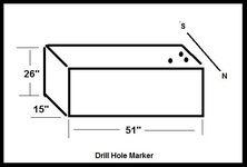
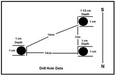
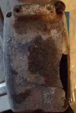
Hello Lost Horse, If it is possible and if you find yourself back where the Triangle with the 4 drill holes, I kinda had an idea that it was one corner of a windrose, My request is could / would, you use a fabric measure tape and work it as you would a drill hole. How high, how far across and the circumference and it may be X 2, if it is I think it may be something that would answer questions for a lot of folks, also its keeping me up nights wondering how you get around, Jeep - Motor Bike - ( I really don't think you travel on a mule ) Too much territory to walk, lots of folks have balloon's Do you have a pair of white and pink tennis shoes and are they snake proof. Have a safe day, your friend dsty
 

Lost Horse

Sr. Member
Nov 3, 2008
345
672
Hi
I hope this is the data you were re-guesting.

Drill Hole Data.jpg Drill Data Data 002.jpg

Lost Horse
 

Last edited:
OP
OP
D

dsty

Bronze Member
Dec 2, 2007
1,300
736
Randal County
Thank You LH, This the very first measurement of any marker in the field that I have ever had. I don't get out in the field any more, Tinman has invited me his place in Eastern Oklahoma on a hunt with motorized vehicles, perhaps several teenage boys from school to do the heavy lifting, I'm expecting to have lots of fun, I can not get it out my mind what they used as distance marker's, Drill holes as close as 95 feet apart, everything it seems they were honest in those things you could see, The country where you live is more than likely flooded with all types of different symbols, trails markers, square league markers.I 've just about convinced myself that a Head is the start, a head and body is a trail that goes both directions, I have seen waist high markers 4 inches across with a the shape of a hog that can be seen from one side only and the only thought that I can come up with is it belongs on that side of a line of a league square and those that have one of the degrees N S E W magnetic is associated with a league square, No 45's and such will help eliminate some of the confusion. Got to get, I'm gonna sharpen all of my pencils and get to work Thanks LH
 

OP
OP
D

dsty

Bronze Member
Dec 2, 2007
1,300
736
Randal County
Hello LH, I done some thinking about your triangle, Boulder and measurements, I believe that the flat top is to measure from to the ground which 26 inches = 66 MM divide by 2 = 33 inches If we take a soldiers step ( to the left -- to the left --- to the left marching you skip a step with your right foot which could make a solders left foot strike the ground at 66 inches, Then we could take your 14 CM X 66 = 92400 inches divide by 12 = 7700 feet divide by 5280 = 1.4583 miles and the pointed end looks man made to me. I believe it to be the map of a windrose and that its possible to find it, the red color drill hole may be the cache or mine
 

Last edited:
OP
OP
D

dsty

Bronze Member
Dec 2, 2007
1,300
736
Randal County
Sorry LH, I was referring to 15 inch ( 38 MM ) wide instead of 14 MM which is the distance between the drill holes, which may work, I believe that they may have used this type of stone ( Kim's slim faced guy to indicate a special and important trail ) perhaps a narrow trail for important thing's to transport, the 1 1/2 cm deep corner I believe to be a pivot point to find the cache once you find the Real Triangle of the windrose. Thank You for your post.
 

OP
OP
D

dsty

Bronze Member
Dec 2, 2007
1,300
736
Randal County
Anyone got any thoughts about they could have used a triangle, place the arrow in the bottom of the V and place the 1/2 way between arrow between the other 2 corners, it would verify LH pointed boulder
 

OP
OP
D

dsty

Bronze Member
Dec 2, 2007
1,300
736
Randal County
I have wondered about snake's and snake heads and if it could indicate a winding trail kinda like a supply trail following the terrain, horse head with ears pined = a fast trail, arrow = a straight man walking trail, narrow rock = narrow or walking trail. C.K's Book said a bird indicated here and there, the birds that I have seen was associated with triangles or sharp turns. I understand about danger also but usually anyone in the woods know about those things
 

OP
OP
D

dsty

Bronze Member
Dec 2, 2007
1,300
736
Randal County
I believe that for one to get started at this it will take at least 5 square miles, it would help if you know where the corner markers are, to me they will be 5 / 6 ft high an show at least three directions the distance may be 1326 feet between them until you get to the next marker which should be 2.5 miles, across the eyes and from the front ( or high end ) to the lower rear end, if its a face and one direction its a start THE ARE MY THOUGHTS ONLY, I don't want to make anyone mad.
 

OP
OP
D

dsty

Bronze Member
Dec 2, 2007
1,300
736
Randal County
Just to say that I believe that trails were started going from the East to West and from the south to the north, The North West corner of the league square has a lot of good information and I believe that's where the Cache site is at. Three of the methods that I have seen are Triangles, Square and Rectangles used for their own reason, I will start at the SE corner and that is where you will find information as the how its laid out as the triangle, rectangle, square, you go North to # 2 where you find information as to the depth and what it is, then you go SW to corner that tells you the direction, I have found that you add the three sides on a triangle for the distance, as an example 95 ft = 1/2 cordel,--- 1 cordel = 1 side = 189.5 ft--- 1 side = 1 cordel = 189.5 and the total = the distance to go from the SW corner to the actual cache site. A square and rectangle works the same SE corner= how the lay out is placed. #2 = depth and direction to corner # 3 which gives the direction, # 4 gives where its located inside / outside of the site then total up the sides and that the distance, The most distances that I have seen the square / rectangle is sides of 2 cordels or I would go at least 400 feet. The # 4 corner may have a lay out at the corner = distance from the corner go 95 feet toward corner #2 and scratch around sub surface 2/3 inches I found a 5" X 7" box with a "T"sticking in the NW corner of the small box to indicate the corner and how far from the corner to go. It had already been found by someone else. I hope all this makes some kind sence
 

OP
OP
D

dsty

Bronze Member
Dec 2, 2007
1,300
736
Randal County
Just to say that I believe that trails were started going from the East to West and from the south to the north, The North West corner of the league square has a lot of good information and I believe that's where the Cache site is at. Three of the methods that I have seen are Triangles, Square and Rectangles used for their own reason, I will start at the SE corner and that is where you will find information as the how its laid out as the triangle, rectangle, square, you go North to # 2 where you find information as to the depth and what it is, then you go SW to corner that tells you the direction, I have found that you add the three sides on a triangle for the distance, as an example 95 ft = 1/2 cordel,--- 1 cordel = 1 side = 189.5 ft--- 1 side = 1 cordel = 189.5 and the total = the distance to go from the SW corner to the actual cache site. A square and rectangle works the same SE corner= how the lay out is placed. #2 = depth and direction to corner # 3 which gives the direction, # 4 gives where its located inside / outside of the site then total up the sides and that the distance, The most distances that I have seen the square / rectangle is sides of 2 cordels or I would go at least 400 feet. The # 4 corner may have a lay out at the corner = distance from the corner go 95 feet toward corner #2 and scratch around sub surface 2/3 inches I found a 5" X 7" box with a "T"sticking in the NW corner of the small box to indicate the corner and how far from the corner to go. It had already been found by someone else. I hope all this makes some kind sence. Reason for the Tri / Rec / Sq I think for the needed distances,
 

mdog

Bronze Member
Mar 22, 2011
2,362
4,415
Just to say that I believe that trails were started going from the East to West and from the south to the north, The North West corner of the league square has a lot of good information and I believe that's where the Cache site is at. Three of the methods that I have seen are Triangles, Square and Rectangles used for their own reason, I will start at the SE corner and that is where you will find information as the how its laid out as the triangle, rectangle, square, you go North to # 2 where you find information as to the depth and what it is, then you go SW to corner that tells you the direction, I have found that you add the three sides on a triangle for the distance, as an example 95 ft = 1/2 cordel,--- 1 cordel = 1 side = 189.5 ft--- 1 side = 1 cordel = 189.5 and the total = the distance to go from the SW corner to the actual cache site. A square and rectangle works the same SE corner= how the lay out is placed. #2 = depth and direction to corner # 3 which gives the direction, # 4 gives where its located inside / outside of the site then total up the sides and that the distance, The most distances that I have seen the square / rectangle is sides of 2 cordels or I would go at least 400 feet. The # 4 corner may have a lay out at the corner = distance from the corner go 95 feet toward corner #2 and scratch around sub surface 2/3 inches I found a 5" X 7" box with a "T"sticking in the NW corner of the small box to indicate the corner and how far from the corner to go. It had already been found by someone else. I hope all this makes some kind sence

Dsty, this works out real good where I am. Here's the carving at the SE corner that shows the shape of the triangle and how the last three signs are laid out and what they look like. It also shows what direction to go to find the SW corner.

014.jpg

The north corner has dozens of carvings. The SW corner shows the direction to the cache site and shows where the site is inside the triangle.
Here's a picture of the SW corner. To get the direction, start at the tip of the tail and go right between the ears.

owl 500.jpg
 

OP
OP
D

dsty

Bronze Member
Dec 2, 2007
1,300
736
Randal County
There's a thought that may help, The vault on Red River was a cave type room, I refer it as to a " Bank " When you go 12.5 miles west ( 5 leagues ) then turn south and go 12.5 miles there you find the Viking Baths which I call the " Branch Bank ", I believe the reason why there was two was because one for the settlers and one separate for the church because of the ledge around the side's about 4 inches down for a cap so as to not damage the candle stick holders and other stuff they didn't want scratched, also I believe if you went from the North East Corner to the South West Corner may be the center for the Church location since it would be the closest for anyone to travel, I have seen square holes in solid rock that would qualify as a " Branch Bank " that someone posted on T-N, Even if it was horizional l think it would qualify as a settlers Branch bank.
 

Last edited:
OP
OP
D

dsty

Bronze Member
Dec 2, 2007
1,300
736
Randal County
I don't know if this will work or not, page 18 bottom of the page, green should be the Royal Trail and the Red should be going into the mountains. This on Old Hand Holes and What took Me there
 

OP
OP
D

dsty

Bronze Member
Dec 2, 2007
1,300
736
Randal County
b4, the boulder that I was talking about is on page 18 bottom of the page of THIS thread ( old hand dug holes and what took me there ) on page 18 / bottom of the page you should see a boulder that got dots and lines. ITS just my thoughts
 

OP
OP
D

dsty

Bronze Member
Dec 2, 2007
1,300
736
Randal County
It is my belief that folks just don't far enough, even when they have Google Earth do most of the work for them, A league was NOT a problem for the Spanish, If it was me that was just starting out I would find a National Park where I would have room to roam, twelve and a half miles or Five leagues was considered a days travel, I've seen a 5 with a tail that showed the direction by extending the tail back thru its self and was pointed, how much more would be needed, The two things that IS necessary to follow a trail is direction and distance.
 

Shortstack

Silver Member
Jan 22, 2007
4,305
416
Detector(s) used
Tesoro Bandido II and DeLeon. also a Detector Pro Headhunter Diver, and a Garrett BFO called The Hunter & a Garrett Ace 250.
Primary Interest:
All Treasure Hunting
It is my belief that folks just don't far enough, even when they have Google Earth do most of the work for them, A league was NOT a problem for the Spanish, If it was me that was just starting out I would find a National Park where I would have room to roam, twelve and a half miles or Five leagues was considered a days travel, I've seen a 5 with a tail that showed the direction by extending the tail back thru its self and was pointed, how much more would be needed, The two things that IS necessary to follow a trail is direction and distance.

dsty, I'm thinking, too, that many of the newbies are trying the easy way by using Google Earth instead of getting out and walking the trails. Unless you have the training and equipment of a photo analysis, a flat, 2 dimensional photo is not going to show enough detail. Guess they're thinking they can cut corners and find the goodies that us old fogies missed. LOL
 

Solomonksa

Jr. Member
Oct 3, 2014
79
8
KSA
Primary Interest:
All Treasure Hunting
dsty, I would like to thank you for this wonderful subject&effort from a great man want learn and help Evey one .

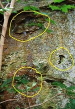
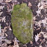
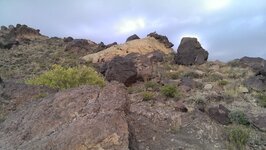
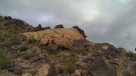
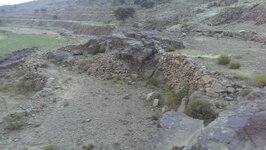
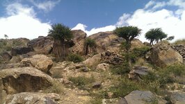
i will share your subject with below pictures , its symbols or not? IMAG0706.jpg IMAG0708.jpg
 

OP
OP
D

dsty

Bronze Member
Dec 2, 2007
1,300
736
Randal County
quarry

Right hand side looks like a bunch of boulder's and I have no idea except that they are natural. Left photo looks to be a quarry
 

Top Member Reactions

Users who are viewing this thread

Top