Pedro Navarez in Caballo Mountains or Organ Mountains????

kanabite

Hero Member
May 27, 2006
549
368
southern utah
Detector(s) used
wander aimlessly in circles with camera in hand
Primary Interest:
All Treasure Hunting
Dang , you got to love FedEx, despite all the craziness they came through! A little hand sanitizer and good to go ! Remember, a life lived in fear , is a life half lived! 20200316_171807.jpg
 

cyzak

Bronze Member
Jul 14, 2018
2,344
3,808
Mountains of Western Colorado
Detector(s) used
Garrett, General Mathematics, Geometry,Pentax,,Do the math it's there.
Primary Interest:
All Treasure Hunting
The world does not go out with a bang it goes with a whimper.
 

kanabite

Hero Member
May 27, 2006
549
368
southern utah
Detector(s) used
wander aimlessly in circles with camera in hand
Primary Interest:
All Treasure Hunting
Tomorrow Rog ,
Of course nothing is ever certain in treasure hunting and or life it seems . Maybe with a little luck I'll get to use that cute little dagger from the ancestral homeland. LOL . I HOPE YOU ARE WELL!
 

kanabite

Hero Member
May 27, 2006
549
368
southern utah
Detector(s) used
wander aimlessly in circles with camera in hand
Primary Interest:
All Treasure Hunting
Dang today was not the day .I guess the most important thing is this little distraction I'm on is not over . Unless we just get shut down from this plague of modern times, Things are just getting started.
 

avadams

Newbie
Apr 7, 2020
1
3
Primary Interest:
All Treasure Hunting
"Facts"

Recent lurker here. Glad Rog is keeping you all on your toes, and is still getting out apparently.

Here is a map link. https://www.lostadamsgold.com/?p=1078&preview=true&_thumbnail_id=1084

Other things to think about (for those who don't already know everything):

1) There are waybills in the original Spanish with authentic archaic expressiveness, spelling, and structural composition
2) There are waybills for other mountain ranges on down the Rio Bravo del Norte, with different directions, treasures
3) There are waybills that say "Organs" but have the same text as Caballos
4) There just maaaaaaybe has been more than one dude nicknamed Chato down through the years
5) The name Caballos has specific verifiable historical context, beyond just map name bingo, as does Perillo, and so on
6) I think y'all are in the wrong area of Cooke's (just my silly opinion), and definitely not a match for any waybill I have in any event. Nice scribbles to keep you snapping pics, but goodies are likely not right there
7) There is a very logical location for a proto-Chato hangout, complete with nice spring, multiple peaks, and a hot gold mine (a real purple axe-chopper) that no one has mentioned yet - got to be able to see your GF on the weekends and buy groceries, right?

Before you ask: as old Ben Sublett said, "go and find it like I did" (the research that is. wish I knew where he got those dang nuggets) The map link is all I can offer.
:blackbeard:

My take is that the potential exists for something like an El Chato situation to be around regionally, but it is far back enough in history that we have only scraps to go on. Organs is more practical, but Caballos is a better place to hang out if the heat was on. They probably spent time in both. For the Organs, Ojo de San Augustin or Soledad seems like a good center, and for the Caballos, Las Palomas (opposite side from Las Penuelas) has been around a long time, or perhaps down in Rincon area.
 

sdcfia

Silver Member
Sep 28, 2014
3,663
8,899
Primary Interest:
Other
Recent lurker here. Glad Rog is keeping you all on your toes, and is still getting out apparently.

Here is a map link. https://www.lostadamsgold.com/?p=1078&preview=true&_thumbnail_id=1084

Other things to think about (for those who don't already know everything):

1) There are waybills in the original Spanish with authentic archaic expressiveness, spelling, and structural composition
2) There are waybills for other mountain ranges on down the Rio Bravo del Norte, with different directions, treasures
3) There are waybills that say "Organs" but have the same text as Caballos
4) There just maaaaaaybe has been more than one dude nicknamed Chato down through the years
5) The name Caballos has specific verifiable historical context, beyond just map name bingo, as does Perillo, and so on
6) I think y'all are in the wrong area of Cooke's (just my silly opinion), and definitely not a match for any waybill I have in any event. Nice scribbles to keep you snapping pics, but goodies are likely not right there
7) There is a very logical location for a proto-Chato hangout, complete with nice spring, multiple peaks, and a hot gold mine (a real purple axe-chopper) that no one has mentioned yet - got to be able to see your GF on the weekends and buy groceries, right?

Before you ask: as old Ben Sublett said, "go and find it like I did" (the research that is. wish I knew where he got those dang nuggets) The map link is all I can offer.
:blackbeard:

My take is that the potential exists for something like an El Chato situation to be around regionally, but it is far back enough in history that we have only scraps to go on. Organs is more practical, but Caballos is a better place to hang out if the heat was on. They probably spent time in both. For the Organs, Ojo de San Augustin or Soledad seems like a good center, and for the Caballos, Las Palomas (opposite side from Las Penuelas) has been around a long time, or perhaps down in Rincon area.

I appreciate the title of your post - "Facts". I've known Rog' for a number of years. I like him and he's been generous to me. He's quite knowledgable but has not been known to be a reliable source of facts. Lots of good stories and blustery claims, yes. Caveat emptor.

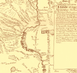
There is good advice for the curious on you webpage. Unfortunately, when we link there, we notice that the map that you reference is titled "MieraPacheco1770 snip" ("Save Image As ..." on Chrome). Apparently you have used some later map by some other cartographer and attributed it to Miera Pacheco in 1770. Of course, I could be mistaken - perhaps you can link the source of this map inset so that I can see it for myself.

Miera Pacheco was indeed active in NM in the 18th Century. That's a fact. In 1770 he was living in Santa Fe and all his work at this time was in northern NM and further northwest. There is of course his famous 1758 map of NM that does include the Caballo region. It's below and clearly does not name today's Caballo Range.
Miera Pacheco 1758.png

El Chato. I've posted historic facts about this guy numerous times. He was a bad guy from Chihuahua, Mexico. He hid stolen money on his ranch. His family verified it. If you want more facts, here's a start. There are plenty more sources if you care to look. https://www.buscadores-tesoros.com/t802-el-chato-nevarez Was there a Pedro Navarez bandit in NM in the 1600s? If so, please link to facts. Not famous treasure legends from a hundred years ago, but documents from the alleged times.

Waybills. Dime a dozen. As you point out, you can easily match those waybills to anywhere that you're fond of at the time. Organs, Caballos, Cookes. Rog' has championed all three over the years. What's next - the Franklins? May as well go after the Lost Dutchmen - at least Jacob Waltz was a real person.
 

Last edited:

cyzak

Bronze Member
Jul 14, 2018
2,344
3,808
Mountains of Western Colorado
Detector(s) used
Garrett, General Mathematics, Geometry,Pentax,,Do the math it's there.
Primary Interest:
All Treasure Hunting
I have done a lot of research on Miera Pacheco he was on the Escalante Dominguez 1776 expedition. Miera_map_1778.jpg
 

White Heart

Full Member
Sep 5, 2017
176
534
Primary Interest:
All Treasure Hunting
sdcfia, I have a vague memory of you mentioning that you found 337 or 336 degree lines or markers many times. I don't remember if it was in your book or on tnet, and of cousre I could be completely wrong about my memory.
I think you asked if anyone else had, and wondered why it kept showing up.
Do you have any new thoughts on 337 degrees?
 

sdcfia

Silver Member
Sep 28, 2014
3,663
8,899
Primary Interest:
Other
sdcfia, I have a vague memory of you mentioning that you found 337 or 336 degree lines or markers many times. I don't remember if it was in your book or on tnet, and of cousre I could be completely wrong about my memory.
I think you asked if anyone else had, and wondered why it kept showing up.
Do you have any new thoughts on 337 degrees?

I know the angle seems to be significant where I am. It repeats frequently and provides exact straight-line links directly between numerous carvings, landmarks and other geometrical elements, some separated by miles. I have no idea if this is repeated in other areas. Why 337? I don't know, I just know it's repeating hereabouts. Interestingly, 337 can also be expressed as -23. 23 is a number that has many unusual aspects.
 

White Heart

Full Member
Sep 5, 2017
176
534
Primary Interest:
All Treasure Hunting
I had the thought that 337,or 336.5 could be related to the 23.5 degree the tilt of the earth and the 26,000 cycle.
I have found a marker that puts the observer right on the 337 when standing in the "sweet spot" . I also have found attention paid to the 23.5/ 24 degree line.
 

sdcfia

Silver Member
Sep 28, 2014
3,663
8,899
Primary Interest:
Other
I had the thought that 337,or 336.5 could be related to the 23.5 degree the tilt of the earth and the 26,000 cycle.
I have found a marker that puts the observer right on the 337 when standing in the "sweet spot" . I also have found attention paid to the 23.5/ 24 degree line.

I like your earth axis tilt angle idea. Quite a coincidence, and I don't believe in coincidences.

Most handheld compasses (I use a Brunton pocket transit) can hardly be read closer to a half degree accuracy, even on a tripod. A 1/2 degree variation (say 23 vs 23.5) results in a displacement of about 42 feet over a mile. Pretty close. The point is, maybe my 337 is actually 336.5 - matching the earth's axis tilt. Something to think about.
 

Secret squirl

Sr. Member
Sep 15, 2017
278
313
Nibiru
Detector(s) used
pulsestar II pro
Primary Interest:
All Treasure Hunting
variance

This is from 1886 book "theory and practice of surveying"

DSCN4417.JPG
 

White Heart

Full Member
Sep 5, 2017
176
534
Primary Interest:
All Treasure Hunting
I believe that much of what was done on a giant scale, i.e. notches in ridges, huge stones modified and rearranged has as more to do with mapping the world than it does with hiding treasure.
Passing important knowledge onto others without informing those you wish to remain clueless requires skill. Hiding in plain siight.
Based on what I have learned about the activities of early templars, I think it is just as likely they cruised the globe looking for magnetic hot spots as treasure or gold sources.
Knowledge is power. More powerful than gold.
 

cyzak

Bronze Member
Jul 14, 2018
2,344
3,808
Mountains of Western Colorado
Detector(s) used
Garrett, General Mathematics, Geometry,Pentax,,Do the math it's there.
Primary Interest:
All Treasure Hunting
Speaking of maps have you ever looked at the one by Perry Van Arsdale, Pioneer New Mexico map it has a lot of detail to it..
 

txtea

Full Member
Nov 16, 2009
156
332
Sure looks like the rocks stacked up in the close up were done by man...apparently in an attempt to hide the caves. Does not look natural at all.
 

cyzak

Bronze Member
Jul 14, 2018
2,344
3,808
Mountains of Western Colorado
Detector(s) used
Garrett, General Mathematics, Geometry,Pentax,,Do the math it's there.
Primary Interest:
All Treasure Hunting
Sure looks like the rocks stacked up in the close up were done by man...apparently in an attempt to hide the caves. Does not look natural at all.

I would fly my drone right in there nice and safe.
 

Top Member Reactions

Users who are viewing this thread

Top