goldbugpr
Jr. Member
- Apr 9, 2006
- 47
- 30
- Detector(s) used
- minelab 3500
Forget Santa Fe, the map starts along the Gila just as shown on the map.
All the carvings are in 2 dimension only. Every clue is seen from a point on the trail and I only introduced ariel views to help you see the clues without having to put your boots on the ground.

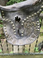
Maybe you can see the similarity in these.
All the carvings are in 2 dimension only. Every clue is seen from a point on the trail and I only introduced ariel views to help you see the clues without having to put your boots on the ground.
Maybe you can see the similarity in these.


Last edited: