The Peralta Stones

cactusjumper

Gold Member
Dec 10, 2005
7,754
5,388
Arizona
Bowman,

"as far as your question goes there is no known link between ether the maps or the stones to the LDM as far as i know dirrectly ..."

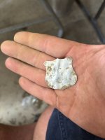
Well......Other than the fact that the Stone Map Trail follows the directions given by P.C. Bicknell in his article about the LDM. That information had to come from Julia Thomas or Rhiney, and thus Jacob Waltz, as it could not be made up out of thin air or without having been there.

It is also right where Adolph Ruth set up camp. Just above Ruth's camp is the saddle shown in the Jacob Waltz drawing......framing Weaver's Needle in the middle. It is also a short distance back from the west end of the range, which is how another newspaper article described it. That information also had to come from Julia or Rhiney.

Other than the above, and a few other things I am leaving out, there is nothing to tie the two together. ;)

Joe Ribaudo
 

the blindbowman

Bronze Member
Nov 21, 2006
1,379
30
dose that prove Waltz,stated it that way No it dose not and to think any new paper could get a story word for word with out liveing it up some for its reads is nieve at best ....i am not saying you are wrong i am just saying you have the dirrection backwards they are in fact 180% off...
 

the blindbowman

Bronze Member
Nov 21, 2006
1,379
30
you forgot one little detail . the massacre site . think about where it is and how they got there , the story goes the were running and fitting ,if it was that hot of a battle than why not them go out to the flat lands they could have pick them off a lot easy out there .. thats just my piont there is no logical reason to drive the spainish to that location unless the location was selected for a nother reason that we dont see or under stand from our piont of veiws . thus i look at it from a indain piont of veiw and than i make good sense ... drive them away from where they were as far as you can with out them getting to flat land , thats why IMHO the massacre did not happen one cayon to the right as you are head north west ... because they had to many ways to get away in that cayon that tells me the indain knew just what they were doing and why and where the would drive the spainish before it took place ...

look at tyhe facts they did not try to push them out of the MT,s . it was not a act of driveing them away .. it was a plan to massacre them away from where they had been as far away as they could with out letting them get away with what they had done to the indains in the mines ...i think the indains were far smarter than we give them respect for ...

think about another fact i found odd untell i took a good logical look at it from a indain piont of veiw ... the few bags of ore found at the massacre site ... dont you think it would be dum to run away from the rich mines with a few bags of ore .. why not take as much as you could and if you need to you could dump some to lighten the load . but we dont see that in this case ... little to no human remains were ever found and only a very few bags of ore . maybe the ore was put there by the indain them selfs and the massacre sight had nothing to do with the ore it self ...it would draw people to that location and not to where the fit started at the mine sites ...if they drove them to the massacre site on a hit and run fighting pattern they would have drove them from somewhere into west boulder cayon ... cj have you been to west boulder cayon ? let me explan why i ask .. they is only one way in or out of the south eastern end of west boulder that is from boulder at fremont saddle ...if thats is the case why leave boulder cayon to the northwest . any deer tracker can tell you the reason because they were already head northwest . there is in fact only one pass into boulder cayon in the dirrection i am talking about ... and there is only one way to get to that pass . if the indains had driven them out of the aera into boulder cayon and they had stoped them from useing boulder cayon the only place they could have gone was north west into west boulder cayon and thats just what they did do...

if this was totally just my opioion i would lable it that but it is not , and i told everyone at the site about the apache getting guns to the inslaved indains working in the mine and them massacreing the jesuits and the spainish , that story fits almost every little clue and detail of these locations and the known facts with my out line ...


put that togather with the montezuma legend and the dtuchman legend and the dr thoren legend . its over welming odds that we are talking about the same location ...

see this may have nothing to do with gold at all it may have to do with something far more valueable a holly place . maybe we see the gold as more valueable but maybe the indains could have cared less about the gold other than to use it to leed us away from their holly place .. now i am dum and i know there are apache and other tribes reading whaty i type and one has come forward and ask me question about what i am doing and why .... i hold a red spirit within me and i beleave what i am doing will help the tribes .. by hideing the site they have become hiden them selfs .... i beleave there are some of the greatest history of the tribe in the tunnle even before the aztec .....its there i know it is , but can we protect this kind of wealth and their faith after all the white man has done is there any reason for them to trust anyone now ... yes they can trust me .....i dont value money and the gold dose not seal my soul ...lol ..


but the spirits and lossorrows to a witch are like candy ......
 

cactusjumper

Gold Member
Dec 10, 2005
7,754
5,388
Arizona
Bowman,

Yes I have been in West Boulder Canyon. It was, in fact, the first place I went to
(age 13) in the Superstitions. I have been there a couple of times in the following 48 years.

Since your source for the enslaved Apache being worked in the Superstitions by the Jesuits is solely in your mind, I have no reasonable rebuttal. Your posts mirror the thought process that is taking place within you.

Not being qualified to decipher Nahuatl/Aztec pictographs, I will accept your conclusions as gospel.

"they is only one way in or out of the south eastern end of west boulder that is from boulder at fremont saddle...."

That comment fits in well with every other conclusion you have written here. It proves just how familiar you are with the Superstition Mountains. Don't know why I ever questioned you.

You are doing an excellent job. Don't let anyone dissuade you from your search for the truth.

I believe I have become a fan.

Joe Ribaudo
 

Oroblanco

Gold Member
Jan 21, 2005
7,838
9,830
DAKOTA TERRITORY
Detector(s) used
Tesoro Lobo Supertraq, (95%) Garrett Scorpion (5%)
;) Well I will probably get jumped on for this, and my apologies for posting a controversial reply in this particular thread, but I have to ask this question of Blindbowman.

Blindbowman, are you certain that the massacre victims were in fact Spanish or Mexican, and not simply Amerindians? You know that two of the three people who first found the human remains concluded that the remains were of Pimas, not Spanish or Mexicans right? Also you have hit upon one of the problems of tying in the massacre with the tales of Jesuits, Spanish etc - the very location of the massacre is NOT on any of the known major trails, in fact it is in a very odd location. I had no problem following the trail IN to the massacre site, but could not determine in what direction those victims had originally been traveling, much less what trail they might have been on.

Good luck and good hunting, hope you find the treasures that you seek, and again apologies for posting a possibly controversial message in this thread.

Oroblanco
 

OP
OP
gollum

gollum

Gold Member
Jan 2, 2006
6,729
7,596
Arizona Vagrant
Detector(s) used
Minelab SD2200D (Modded)/ Whites GMT 24k / Fisher FX-3 / Fisher Gold Bug II / Fisher Gemini / Schiebel MIMID / Falcon MD-20
Primary Interest:
All Treasure Hunting
Yes Oro,

I have to chime in here! ;D ;D ;D

As we have gone through this in the past, you know that the two people who concluded they were Amerindians, never got off their horses. The Sergeant who determined they were Mexicans, not only got down and looked them over, and found a skull with a gold tooth (you could only find reference to ONE Indian with a gold tooth, while MANY whites and Hispanics had them. MUCH MORE LIKELY), he went back later and found another skeleton under a bush dressed in western style clothes (while many Amerindians DID dress in western style clothes, they usually added their own decoration, but again, it was more likely that a white or hispanic was wearing western style clothes than an Amerindian).

We KNOW there was no report of 25-30 whites missing from the area. There are no Pima stories of a massacre of their people there,

buuuuuuuuuuuuuuuuuuuut...................................

There IS a Peralta Family History which states that many of their family were massacred by Apache in Apacheria around that time, and there IS a story passed down among the Apache about them massacreing Mexican Miners around that time.

Circumstantial evidence easily sways in favor of Mexicans being the victims of the massacre.

Best,

Mike
 

Oroblanco

Gold Member
Jan 21, 2005
7,838
9,830
DAKOTA TERRITORY
Detector(s) used
Tesoro Lobo Supertraq, (95%) Garrett Scorpion (5%)
Hi Mike!

I disagree my friend, a family story that cannot be proven to have been a family story prior to 1891, is not solid circumstantial evidence, and the finding of a single skull with a gold tooth is not enough to rule out Amerindians as the victims. If there were truly such a large party of Mexicans gone missing in that time frame, I am convinced there would be solid records to support it. If there were a party of missing Pimas, I doubt there would be any records of their having gone missing. To give an example, we know of a party of Apaches who were literally driven to leap off a cliff to their deaths (it is a matter of record) but among the Apaches there is no record of such a party having disappeared! Anyway it is possible that the massacre victims were Mexicans (or Spanish) but it is also possible that they were Pimas.

Oroblanco
 

OP
OP
gollum

gollum

Gold Member
Jan 2, 2006
6,729
7,596
Arizona Vagrant
Detector(s) used
Minelab SD2200D (Modded)/ Whites GMT 24k / Fisher FX-3 / Fisher Gold Bug II / Fisher Gemini / Schiebel MIMID / Falcon MD-20
Primary Interest:
All Treasure Hunting
You're forgetting to factor in the Apache story about them massacreing a large band of Mexican Miners. Also, the mining implements found by the sergeant when he returned to the scene later.

We are pretty close to being in agreement.

When you add up EVERYTHING IN EVIDENCE, it is only MORE LIKELY that the massacre victims were Mexican. Less likely, but still possible that they were Pimas. Could not be Apache. DEFINITELY not whites.

Best,

Mike
 

cactusjumper

Gold Member
Dec 10, 2005
7,754
5,388
Arizona
Bowman,

Did your pictographs look anything like this:
 

Attachments

  • tonaface.jpg
    tonaface.jpg
    21.3 KB · Views: 865
  • Xipe Totec.jpg
    Xipe Totec.jpg
    24.3 KB · Views: 866

the blindbowman

Bronze Member
Nov 21, 2006
1,379
30
where to start ,lol,...

"That's not true. Have you been there? You forgot the Carney Springs trail."

thats very true if you take my statment out of tects .. i said they came from fremont saddle that is north of carney springs trail and why would they duble back knowing the apache was already surounding them from the south . they would not duble back ,logic tells us that ... but yes you are right and it pionts out another peice of data subporting my theories ...why ,look at west boulder cayon .if they could have just gotten out a carney springs trail why did,nt they ... good piont made . beacuse if they were already head north on the run and they thaught they had a head start to get away, the last thing they would do is risk their head start ...

they didnt have a chance , the massacre was planed not a spear of the moment thing .......

:" It proves just how familiar you are with the Superstition Mountains. Don't know why I ever questioned you"

you question me because your very smart . you must not know the superstitions from a navagational piont of veiw or you would not be makeing fun of me , before i give you my reply cj let me say i respect you and i beleave your map is real ,.......

as many others . you got lost in traslation ...

OK, lets play the game . frist question to you . what is the main land mark on your map ?
 

cactusjumper

Gold Member
Dec 10, 2005
7,754
5,388
Arizona
Bowman,

"OK, lets play the game . frist question to you . what is the main land mark on your map ?"

Well that depends on where you are. If you are coming out of the desert from Mexico, the most important landmark on the map is the outline of the main mountain and the arrow pointing out the way in.

Once you follow that arrow and arrive at the "lofty ridge", everything in site is important.
From Superstition Peak, you can see all three X's. One of those was Harry LaFrance's cave of gold bars. The other is an old mine, which has been found and worked in modern-day times and is now sealed. It's possible that the X between Weaver's Needle and Black Top Mesa is Bob Brady's cave of gold bars.

From Superstition Peak, you can see all of the peaks that are marked on the maps as "locater dots".
You can see the hat shape on top of the ridge that separates East and West Boulder Canyons. It is above Little Boulder Canyon, which is also marked on the Stone Maps.

From Superstition Peak, you can follow the map into Little Boulder, where you must look for the heart. In time, you will find it. It is exactly where it is shown on the map, but you can only see it from the north.

You are now at the end of the Stone Map Trail.

There are a number of old trails marked on the Stone Maps, that are not on modern topographic maps. One of them is the trail that leads out of West Boulder, through a saddle and down into Little Boulder Canyon. It takes you (precisely) to the heart formation. I have forgotten more trails in that range than you will ever walk. I am confident in that remark, because your posts reveal your lack of knowledge of the Superstitions. Randy, who is fairly new to the mountains, is an "old timer" compared to you.

I understand this post is somewhat harsh, but those mountains are dangerous. I am never sure if you are just having a good time, or actually believe the stuff you are spouting. If you are serious, someone needs to attempt to bring you back to reality, before you decide to make what I assume will be your first or second trip into the mountains.

If the Spaniards were in West Boulder Canyon and fleeing the mountains, they would have headed up the Old West Boulder Trail, turned north out of the canyon on the old trail that cuts through O'Grady Canyon. Once through the small saddle they would have broke to the northwest through a fairly wide, brush filled valley and ended up at the Massacre Grounds.

If there were Indians waiting at that point, they likely would have been Wipukepas and Tonto Apache. It is just as likely that those killed at the Massacre Grounds were Spaniards camped at that place. They would have been working the arrastra and processing the gold down into bars.
There is ample physical evidence that that was exactly what was taking place there.

Good luck,

Joe
 

the blindbowman

Bronze Member
Nov 21, 2006
1,379
30
so let me make sure i am under standing what you have said . the El sombero on your map is weavers needle ... is that what your saying ?
 

the blindbowman

Bronze Member
Nov 21, 2006
1,379
30
sorry i ask i thaught you were still talking about your uncle's tracing .

the reason i asked ,is because the tracking dose not show el sombero ...
 

the blindbowman

Bronze Member
Nov 21, 2006
1,379
30
cactusjumper said:
I don't have an "El sombero" on my copy of the Stone Maps.

Weaver's Needle is the triangle slash on the Stone Maps.

that would depend on wich stone map you were talking about and who was reading it ...lol
 

cactusjumper

Gold Member
Dec 10, 2005
7,754
5,388
Arizona
Cousin Sam and I arrived a couple of days before the team, so we could go in early, set up camp and do a little extra exploring. We were camping in Little Boulder that year. The morning Duane was supposed to pack us in, it was a little too stormy for my tastes. Although Ron Was pissed at first....he later told me I was right.

Here I am waiting for the two day storm to let up:
 

Attachments

  • Waiting Out The Storm.JPG
    Waiting Out The Storm.JPG
    38 KB · Views: 788

Oroblanco

Gold Member
Jan 21, 2005
7,838
9,830
DAKOTA TERRITORY
Detector(s) used
Tesoro Lobo Supertraq, (95%) Garrett Scorpion (5%)
Mike, do you have a good photo or scan or image of the Latin Heart stone? Thank you in advance,

your friend,
Roy ~ Oroblanco
 

Peerless67

Hero Member
Jul 26, 2007
913
23
ENGLAND & CALIFORNIA
Detector(s) used
Eyes, ears and common sense
ESTA BEREDA ES PELIGROZA
YO BOY 18 LUGARES
BUSCA EL MAPA
BUSCA EL COAZON

18 GOLD BARS
LOCATE MAP BY XXXXXXX
USE BY XXXXXX XXXX AREA LA PAZ ARIZONA.


ps be sure to use an 1847 map
 

Timberwolf

Silver Member
Sep 12, 2005
2,528
37
Detector(s) used
Eagle II SL90/Eagle Spectrum/TF-900
I have never heard of these stones, but a friend emailed this message, and asked that I would post it here on TNet.
So here goes........


Hello: The unofficial unveiling of the Peralta Stone Maps at the Superstition Mountain Museum has been changed to June 25th

Timberwolf
 

Twisted Fork

Hero Member
Sep 2, 2007
723
52
UTAH
Detector(s) used
tf900 & a good old fashioned willow forked limb
The dowsing witch priest with the cross (crossing) in his hands starts near black mountain; that peak is his hat and the waving -S- at the lower back edge of the priests gown matches the massive curve in the Salt River nearby the peak. Find the old Spanish Military Trail crossing of the river near here and begin dowsing. ::)

I go to 1 of 8 places..... (the 8 richest mineral zones from Hieroglyphic Canyon Arizona, up to Kings peak Utah).

Each Peralta site uses 8 land forms leading into the triangulation grid on each location. Each grid has 8 markers going dot to dot from the windrose axle hub, past two caches and on to three mines per zone. That is 5 places per site to obtain visual gold. The triangle with the knife slash represents cache position between two markers of the infield triangle. The layout is similar to setting up Tarot cards on an old world table. A game for the King should he ever visit the New World.
 

Top Member Reactions

Users who are viewing this thread

Latest Discussions

Top