Tumacacori Mission Mines RE: Sister Micaela Molina Document

OP
OP
gollum

gollum

Gold Member
Jan 2, 2006
6,729
7,598
Arizona Vagrant
Detector(s) used
Minelab SD2200D (Modded)/ Whites GMT 24k / Fisher FX-3 / Fisher Gold Bug II / Fisher Gemini / Schiebel MIMID / Falcon MD-20
Primary Interest:
All Treasure Hunting
Hola ADtofca, What proof do they have that Fuentes made the map? Incidentally there are several ponts that have been misinterpreted in making it virtually imposible to find the goodies - I found that out when I interpreted the Map for My buoum friend gollum.

Except for the fact that we disagree on the orientation of the map! HAHAHA

Mike
 

OP
OP
gollum

gollum

Gold Member
Jan 2, 2006
6,729
7,598
Arizona Vagrant
Detector(s) used
Minelab SD2200D (Modded)/ Whites GMT 24k / Fisher FX-3 / Fisher Gold Bug II / Fisher Gemini / Schiebel MIMID / Falcon MD-20
Primary Interest:
All Treasure Hunting
Don Jose,

I doubt many people have been to the original location of Tumacacori, or know where it was.

Take care,

Joe


Joe, The original site of the Visita of Tumacacori is only about 1 1/2 miles from the current site (but on the opposite side of the Santa Cruz River). You are right though, that very few people have been to the original site. Probably a good thing though. People would have been digging up that site as well as the current Mission Site.

Mike
 

audigger53

Hero Member
Mar 27, 2004
909
3,210
Severn, Maryland
Detector(s) used
None
Primary Interest:
Cache Hunting
The author is the National Park Service. The guy who has spent all the money thinks the NPS is lying about the document to keep other TH'ers out of the area.

No problem. Check your email.

Mike

I stopped at the mission at least 30 years ago and asked the NPS person there if they knew about the 7 other Sub-Missions that were run for Tumacacori and he stated there were never any mines or other Missions . LOL The Document is a fake in my humble opinion if it came from the NPS. The Mission farmed the river bottom for crops to support the other sub missions in the mountain range. In my opinion they had to grow crops to support the miners that they used.
 

markmar

Silver Member
Oct 17, 2012
4,120
6,262
Primary Interest:
All Treasure Hunting
Let's start this thread again , just to complete some gaps which i believe exist in the Molina text/redotero .

Is clear how the text was changed/altered , because the distances between San Ramon water and Virgine de Guadalupe mine don't fit with the distances in the map . the map maker gave us a measurement clue which is 1562 varas from the San Ramon water to a point wich has a 90* angle to a straight line which ends to VdG mine.
The real distances between the San Ramon water and VdG in a straght line are :

- 1800 varas from the San Ramon water till the spiral petroglyph mark
- 1200 varas from the spiral petroglyph mark till the junction of the two lines in the map
- 800 varas from the junction of the two lines till the Virgine of Guadalupe mine

The black rock with the cross carving is 200 varas below the junction of the two lines along the canyon bed , and is not in the way between the San Ramon water and VdG mine .

Maybe many wondered why the map maker chose the San Ramon water as a key . Is simple but not for those who don't know where the VdG is .

How would be written the letter/redotero with the new clues ? I would like to read your versions .

BTW , the old Tumacacori mission is about 1250 yards at 32* NE from the actual mission , almost in the Santa Cruz river bed .
 

Oroblanco

Gold Member
Jan 21, 2005
7,838
9,830
DAKOTA TERRITORY
Detector(s) used
Tesoro Lobo Supertraq, (95%) Garrett Scorpion (5%)
Let's start this thread again , just to complete some gaps which i believe exist in the Molina text/redotero .

Is clear how the text was changed/altered , because the distances between San Ramon water and Virgine de Guadalupe mine don't fit with the distances in the map . the map maker gave us a measurement clue which is 1562 varas from the San Ramon water to a point wich has a 90* angle to a straight line which ends to VdG mine.
The real distances between the San Ramon water and VdG in a straght line are :

- 1800 varas from the San Ramon water till the spiral petroglyph mark
- 1200 varas from the spiral petroglyph mark till the junction of the two lines in the map
- 800 varas from the junction of the two lines till the Virgine of Guadalupe mine

The black rock with the cross carving is 200 varas below the junction of the two lines along the canyon bed , and is not in the way between the San Ramon water and VdG mine .

Maybe many wondered why the map maker chose the San Ramon water as a key . Is simple but not for those who don't know where the VdG is .

How would be written the letter/redotero with the new clues ? I would like to read your versions .

BTW , the old Tumacacori mission is about 1250 yards at 32* NE from the actual mission , almost in the Santa Cruz river bed .

Good post, although we have hashed this over quite a bit perhaps a bit more cannot hurt. I would advise not to consider the Molina "map" as a MAP, but more as a chart. As if you were going to plot on a sheet of paper, the locations of your house, the local school etc not intended to be accurate at all but to show relative positions of the various landmarks in relation to each other. The 'map' is a rather good candidate to be a forgery or fraud, made up by someone (anyone) working off the written descriptions given in the original Molina doc. Otherwise please do continue;

:coffee2: :coffee: :coffee2: :coffee2:
 

markmar

Silver Member
Oct 17, 2012
4,120
6,262
Primary Interest:
All Treasure Hunting
Oro

Why to make an altered copy of the Molina map ? Make not sense to me , because this map without the proper explanation , like the letter , has not any value and could be used in many locations without results .

Is a Jesuit map , and they didn't make the maps to be orientated exactly to a principal ( N,S,E,W ) compass direction . Also they had a preference for the maps orientation ( I saw that in at least three Jesuit maps ) , info which I can not reveal yet . Is a clue that helps very much in Jesuit map decrypting . They also gave in every map , a clue which is orientated to a principal compass direction .

The Molina's map maker , gave measurements in varas only for the route from the San Ramon water to VdG mine . The other measurements are in leagues ( very elastic ) and for that the map looks odd in its dimensions , showing how is longer at the 1 and 1/2 league from the mission to the VdG mine than the 3 leagues which are from the VdG mine to the Purisima mine .
But this wouldn't looks odd if we would take in consideration how the route from the mission to the VdG mine is somehow easy to walk than the route from VdG mine to Purisima mine which is almost on the backbones of the mountains .
 

Last edited:

markmar

Silver Member
Oct 17, 2012
4,120
6,262
Primary Interest:
All Treasure Hunting
Oro

To answer to your comment about the map being a fraud made by someone working off the written description from the " redotero " .

First , I believe the map would had a different shape, and second the letter doesn't says about San Pedro or Santa Isabel mines ; nor about the other clues ( words ) which fit with the landmarks from the region .
The lines in the map , help to determine the direction/orientation of the lines in regards with their angles , and to find out , all depend of the line which connects the mission with the San Ramon water and its angle .

Is a very well designed map , a challenge for a treasure hunter . Enjoy !
 

Oroblanco

Gold Member
Jan 21, 2005
7,838
9,830
DAKOTA TERRITORY
Detector(s) used
Tesoro Lobo Supertraq, (95%) Garrett Scorpion (5%)
Oro

Why to make an altered copy of the Molina map ? Make not sense to me , because this map without the proper explanation , like the letter , has not any value and could be used in many location without results .

Is a Jesuit map , and they didn't make the maps to be orientated exactly to a principal ( N,S,E,W ) compass direction . Also they had a preference for the maps orientation ( I saw that in at least three Jesuit maps ) , info which I can not reveal yet . Is a clue that helps very much in Jesuit map decrypting . They also gave in every map , a clue which is orientated to a principal compass direction .

The Molina's map maker , gave measurements in varas only for the route from the San Ramon water to VdG mine . The other measurements are in leagues ( very elastic ) and for that the map looks odd in its dimensions , showing how is longer at the 1 and 1/2 league from the mission to the VdG mine than the 3 leagues which are from the VdG mine to the Purisima mine .
But this wouldn't looks odd if we would take in consideration how the route from the mission to the VdG mine is somehow easy to walk than the route from VdG mine to Purisima mine which is almost on the backbones of the mountains .

There is nothing on that map (a chart really, not a map IMHO) that indicates it is Jesuit. Secondly, I am NOT saying that it is in any way "altered", what I said and mean is that anyone could draw up a chart like that just using the written directions. The fact that some points do not match exactly with the written description, as Marticus points out, actually helps support the contention that it is a modern fraud, made up by someone that simply drew up the chart by trying to follow the written descriptions, and apparently did not get it completely right. Another issue is that there is no additional meaningful (useful) information on the chart, which would help establish it as a separate entity as old as the Molina document itself.

So I respectfully disagree, this is no map, it is a chart, and very likely a modern fraud made up by someone that read the written directions of the Molina document. You could easily draw up the very same kind of chart on a sheet of paper in a few minutes time - would that make your chart as old as the Molina document, and as genuine?

I am fairly biased against all treasure maps, including charts and waybills, when it has been in public for many years. There is something dramatically wrong with the chart or it would have already led someone to a huge treasure.

Please do continue, we can agree to disagree;

:coffee2: :coffee: :coffee2:
 

markmar

Silver Member
Oct 17, 2012
4,120
6,262
Primary Interest:
All Treasure Hunting
There is nothing on that map (a chart really, not a map IMHO) that indicates it is Jesuit. Secondly, I am NOT saying that it is in any way "altered", what I said and mean is that anyone could draw up a chart like that just using the written directions. The fact that some points do not match exactly with the written description, as Marticus points out, actually helps support the contention that it is a modern fraud, made up by someone that simply drew up the chart by trying to follow the written descriptions, and apparently did not get it completely right. Another issue is that there is no additional meaningful (useful) information on the chart, which would help establish it as a separate entity as old as the Molina document itself.

So I respectfully disagree, this is no map, it is a chart, and very likely a modern fraud made up by someone that read the written directions of the Molina document. You could easily draw up the very same kind of chart on a sheet of paper in a few minutes time - would that make your chart as old as the Molina document, and as genuine?

I am fairly biased against all treasure maps, including charts and waybills, when it has been in public for many years. There is something dramatically wrong with the chart or it would have already led someone to a huge treasure.

Please do continue, we can agree to disagree;

:coffee2: :coffee: :coffee2:

There is nothing wrong with the chart/map IMO , but with the description in the letter .
For me is pretty clear and works good .
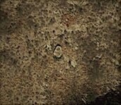
To close , I will post a GE image of the REAL VdG site , and I wish good luck to everyone who is interested .

virgine.jpg
 

Oroblanco

Gold Member
Jan 21, 2005
7,838
9,830
DAKOTA TERRITORY
Detector(s) used
Tesoro Lobo Supertraq, (95%) Garrett Scorpion (5%)
There is nothing wrong with the chart/map IMO , but with the description in the letter .
For me is pretty clear and works good .
To close , I will post a GE image of the REAL VdG site , and I wish good luck to everyone who is interested .

View attachment 1404866

What do you say is wrong in the text? Can you provide anything to support this contention, like proof that the text is wrong? Thanks in advance.

:coffee2: ;coffee: :coffee2:
 

markmar

Silver Member
Oct 17, 2012
4,120
6,262
Primary Interest:
All Treasure Hunting
What do you say is wrong in the text? Can you provide anything to support this contention, like proof that the text is wrong? Thanks in advance.

:coffee2: ;coffee: :coffee2:

The wrong in the text is , how have been left out some measurements in the route from the San Ramon water to VdG mine , and were written another which are not accurate .The accurate measurements are written in the post #751 .
The proof is the VdG site picture .
 

Last edited:

markmar

Silver Member
Oct 17, 2012
4,120
6,262
Primary Interest:
All Treasure Hunting
Hi Oro . How are you ? :coffee2:

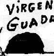
To complete the VdG mine scene , I want to show you what represents the black like cave marking beside the VdG mine in the charts/maps which are floating around .
And I am talking about these markings :

sign.jpg sign2.jpg

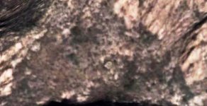
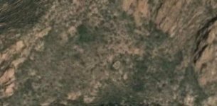
I want to say how this marking represents the shape/landmark on where the VdG mine is situated .The mine is about in the middle of this landmark . So , here are the GE images which confirm my statement :

v2.jpg v3.jpg v4.jpg

Fascinating eh ?
 

Loke

Hero Member
Mar 24, 2010
589
1,383
Republic of Texas
Primary Interest:
All Treasure Hunting
Hi Oro . How are you ? :coffee2:

To complete the VdG mine scene , I want to show you what represents the black like cave marking beside the VdG mine in the charts/maps which are floating around .
And I am talking about these markings :

View attachment 1407174 View attachment 1407175

I want to say how this marking represents the shape/landmark on where the VdG mine is situated .The mine is about in the middle of this landmark . So , here are the GE images which confirm my statement :

View attachment 1407176 View attachment 1407177 View attachment 1407178

Fascinating eh ?
not without even a li'l hint of the whereabouts ...
 

Top Member Reactions

Users who are viewing this thread

Top