Barton
Sr. Member
- Joined
- Apr 21, 2005
- Messages
- 449
- Reaction score
- 322
- Golden Thread
- 0
- Location
- Abiquiu, NM
- Detector(s) used
- What ever is needed for the project I am working on--I am a cache hunter
- Primary Interest:
- Cache Hunting
- #1
Thread Owner
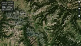
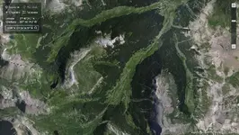
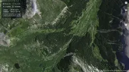
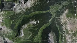
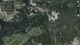
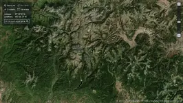
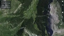
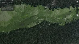
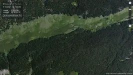
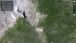
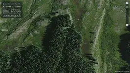
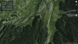
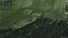
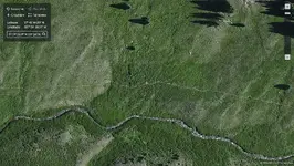
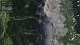
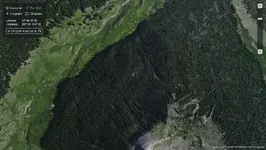
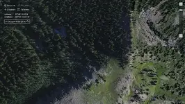
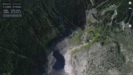
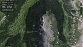
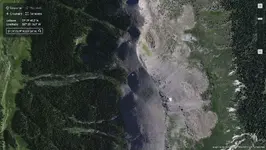
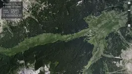
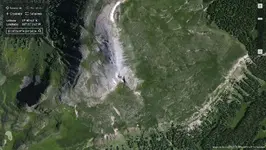
I was told that in the 1960's that Karl Von Mueller recovered
200 pounds of High Grade Gold Ore from the Middle Fork of
Ute Creek under a large flat topped stone suitable for a place
to eat your meals on . This was by a tall dead pine tree.
I lack the understanding to post a google picture here--but
the google location of the gold cache is / was:
North 37 degrees 39 minutes and 33.89 seconds
West 107 degrees 26 minutes and 34.49 seconds
1. Can some one post this aerial photo --please.
2. Do you think that there may be more caches of gold ore still
existing in this general area?
3. Do you think that there are any surface outcropping deposits
of gold ore in the Ute creek drainage that a prospector could
visually / or through assays locate? Specifically ones that
outcrop to the top of the ground / rock you can see if you go there?
4. Are there any surface outcropping placer gold deposits / or placer
gold deposits that could be located with in 24" of the surface--
by digging with a pick and shovel--and be economically worked
by hand and a gold pan?
I want to thank all the dowsers for there help on this. On a side
note--about 25 years ago my house burned down to the ground.
It burned so thoroughly that from standing outside the west side
of the house--you could look east and see the mountains to the east
of my house or you could stand on the ground and look up and looking
through the floor and the roof you could see the stars at night.
Surprisingly I had a dowsed map by Bob Ater ( now dead ) that survived
the fire which totally destroyed my house--the map has fire scorch marks
on it --yet did not burn. I had thousands of books--totally burned up--
but a simple paper map Bob did for me of Ute Creek did not burn!
Again I want to thank any dowsers who work on this.
bartonthom@yahoo.com
Sincerely, Barton