accounting for the 1715 fleet vessels by their own " offical records"

GOHO

Sr. Member
Apr 13, 2008
299
35
Re: accounting for the 1715 fleet vessels by their own " offical records"

Here is the time line i have come up with....

July 30Th -

1. "The sun never rose this day" - the storm is approaching, winds pick up fresh from the NE, "We were 28 degree lat near Cape Canaveral"
2. If the Almiranta wrecked at 2:00 am and Salmon says that " The Capitana of Ubilla wreck 4 hours earlier" then by 10:00 pm on July 30 the Capitana sunk.
3. Lima - "All ships sunk by 10:00 am" on July 31.

If the Storm was just approaching the morning of the 30Th and one ship sunk by 10:00pm all sunk within 24hrs of the first signs of a storm. To me i don't see that the storm had time to stall out.... Jeanne took almost that long but Francis took i think 36hrs.
Lima does state briefly that "The storms of great winds continued" but i take that as maybe another storm hit them later like Francis and Jeanne did. (It happened with the Atocha?)
 

OP
OP
ivan salis

ivan salis

Gold Member
Feb 5, 2007
16,794
3,810
callahan,fl
🏆 Honorable Mentions:
1
Detector(s) used
delta 4000 / ace 250 - used BH and many others too
Re: accounting for the 1715 fleet vessels by their own " offical records"

I think that the storm came in and the track did turn northward , I think it might have stalled for a bit as it changed direction --- giving the wrecked area a bit of calm as it rebuilt -- thus the "second storm" the following day , was the rear of the rebuilt storm passing by as it went northward up the coast --how long the stall was is just a guess
 

Goldminer

Full Member
Apr 28, 2006
210
107
Las Vegas, Nv
Re: accounting for the 1715 fleet vessels by their own " offical records"

Greg,
This website has tracks of T storms and hurricanes from 1851 to 2008. There are several storms per year of course, and it will take time to go through all of the years. If you pick a year, a map with that storm will pop up with information of all storms that year. Below the map there will be a list of data for all storms, click on one and only that storm will appear on the map. I found very little tracks that came from the EAST, and not a lot that actually hit Florida.
http://www.wunderground.com/hurricane/hurrarchive.asp

Attached is a map of one of the 1926 hurricanes that I believe closely fits the 1715 blow.
 

Attachments

  • 1926.gif
    1926.gif
    33.7 KB · Views: 2,696
OP
OP
ivan salis

ivan salis

Gold Member
Feb 5, 2007
16,794
3,810
callahan,fl
🏆 Honorable Mentions:
1
Detector(s) used
delta 4000 / ace 250 - used BH and many others too
Re: accounting for the 1715 fleet vessels by their own " offical records"

that 1926 hurricane track would be a great deal like what I think the 1715 fleets hurricane track to be . thanks for the input

ran over santo domingo -- goes up the slot --over the southern bahamas and runs toward the coast turning northward as it gets close to the coast ---hitting st augutine --

but I think it at that point ---- it ran up the coast farther rather than going inland like the 1926 storm
 

Darren in NC

Silver Member
Apr 1, 2004
2,780
1,574
Detector(s) used
Tesoro Sand Shark, Homebuilt pulse loop
Primary Interest:
Shipwrecks
Re: accounting for the 1715 fleet vessels by their own " offical records"

Actually, going inland would explain why the Griffon made it back safely. Nice track comparison.
 

vulcan007

Full Member
Dec 4, 2007
103
0
Re: accounting for the 1715 fleet vessels by their own " offical records"

It is unlikely that there is a 1715 galleon by amelia island. I believe that all lost 1715 naos are in area off cape canaveral south. The amelia ship may be a smaller 'lancha' or other unrelated ship likely late 18th or early 19th century.

The fact is that the East coast of the US is littered with wrecks (thousands and thousands). Problem is not much is left to find easily.

V
 

rgecy

Bronze Member
Jun 14, 2004
1,910
59
Beaufort, SC
Detector(s) used
Garrett Sea Hunter Mk II
Re: accounting for the 1715 fleet vessels by their own " offical records"

I hate that its gone, but Cornelius had started a thread called "the Wind" where we had discussed this topic. I think the hurricane track posted above is very close as well, but I think it went inland, turned north and then came back off the the coast near Georgia. I forget where, but I believe there were some accounts of the storm at St. Augustine that talked about the wind directions that substantiated this.

I had drawn a similar track and posted the image, but have since deleted it off my computer.

Robert
 

OP
OP
ivan salis

ivan salis

Gold Member
Feb 5, 2007
16,794
3,810
callahan,fl
🏆 Honorable Mentions:
1
Detector(s) used
delta 4000 / ace 250 - used BH and many others too
Re: accounting for the 1715 fleet vessels by their own " offical records"

I personally think the vessel down at amelia island is a "rescue vessel" that was returning goods recovered off the fleet or maybe a looter vessel -- (that would acount for the 1715 fleet type items found thru the years there.) however I do not think at this time its one of the missing original fleet vessels -- I think that the "missing" original 1715 fleet vessels are near st augustine , and by the cape ( the Concepcion)

please note ---the capt willaim fuller map of Nov 1769 clear shows a wreck off of what is the sandy isle in nassau sound *--- the later "bird" island seen on modern maps ---is the oyster bed shown just below the wreck -- most likely the vessel was trying to go thru the channel to get shelter behind the island in foul weather -- and went over the oyster bed --ripping out her bottom --sinking in the far side ---- of course the vessel had to sink BEFORE 1769 to be on a 1769 map -- english govenor of virgina spotswoods letter of oct 24th, 1715 states that a spanish vessel sent from havana --stopped at the fleet wreck site picked up vips and treasure and later wrecked about 40 miles north of st augustine --(which is exactly where the nassau sound wreck is located)
 

itmaiden

Hero Member
Sep 28, 2005
575
7
Re: accounting for the 1715 fleet vessels by their own " offical records"

According to this website information, a hurricane apparently crossed the Bahamas in 1715.

http://www.candoo.com/genresources/hurricane.htm#1700

itmaiden


signumops said:
billinstuart said:
I remember reading an account of the hurricane passing through the lower Bahamas before proceeding up the Florida channel, following the gulf stream. This track would have allowed the storm to intensify dramatically.
 

Sorroque

Full Member
Jan 5, 2007
128
0
Canaberal de Ayzm
Detector(s) used
GMHCX3
Re: accounting for the 1715 fleet vessels by their own " offical records"

What formation were they sailing in?
"I", or "Column".
"W", or "Wedge".
"V", or "V" formation.
"Line" formation perhaps? My guess is Line. 8) Europeans Love the Line formation.
It would also explain why they sunk in a row along the coast. I guess that they sunk near Melborne, (Shelbourne up until,1898).
I am going to invite my niece, the weather expert, to this colum.
1715 Jul. 30 coincides alright with the hurricane timeline for the disaster.

Other thoughts:
After seeing the beach shore, "The small wave Capitol of the World", with 30 foot waves crashing just 40 yards from shore and pitching objects such as sandbags high into the air during a Florida hurricane. I think that these ships were just pounded to splinters and bits!
If it was as big as the Cat.5 that hit Miami, then it is possible that some of the ships may have been carried up and over the dune and into the river.
I remember a picture from the Miami hurricane that showed a ship perched high in a tree!
:hello:
"I emailed my friend who is a big hurricane expert. Hopefully he can give me some info on that storm because I don't know much pre-1930's when it comes to significant hurricanes. Minus 1900 Galveston of course. ", Rebbecca Lee Bagget.
 

Attachments

  • andrew.jpg
    andrew.jpg
    5.1 KB · Views: 1,800
OP
OP
ivan salis

ivan salis

Gold Member
Feb 5, 2007
16,794
3,810
callahan,fl
🏆 Honorable Mentions:
1
Detector(s) used
delta 4000 / ace 250 - used BH and many others too
Re: accounting for the 1715 fleet vessels by their own " offical records"

the 1715 huuricane by historical records -- flatted the palm trees on santo domingo --- the record also states it ran over the southern bahamas -- it wrecked the fleet on the fla coast --and hit st augustune as well ---so its basic track had to be very similar to the 1926 at the very least till it hit st augustine to hit all those same places
 

GOHO

Sr. Member
Apr 13, 2008
299
35
Re: accounting for the 1715 fleet vessels by their own " offical records"

I also mapped the Capitana site (Corrigans site) even better than the Cabin Site... I found that the Capitana came down almost on a due north to south line. Remember the Capitana sank 4 hours earlier than Almiranta (Cabin site) so the winds 4 hours before the Almiranta sank were from due North... If the Storm came from a SE direction i am not sure we would get due north winds... I can see a slight SE direction but if it was to far south then it doesn't match the scatter....
 

OP
OP
ivan salis

ivan salis

Gold Member
Feb 5, 2007
16,794
3,810
callahan,fl
🏆 Honorable Mentions:
1
Detector(s) used
delta 4000 / ace 250 - used BH and many others too
Re: accounting for the 1715 fleet vessels by their own " offical records"

the 1926 hurricane ( which i think the 1715 one matched up with quite well track wize --at least till it hit st augustine at the very least -- see its track mapped out above in post # 85 bygoldminer* --comong out of the "slot" it would be coming in toward the 1715 fleet roughly from E (90 degrees) to ESE (135 degrees)---say 110 to 115 degrees (average ) sinking the fleet as it approached --- as it approached land -- near the fleet wreck site ---it then turned running northerly along the coastline just offshore until it hit st augustine as it passed -- I personally think it then broke pattern with the 1926 hurricane and stayed running northward along the coast -- the storm turning and the running northward is what allowed the griffon to escape --- as the hurricane was approaching the over loaded slow moving treasure fleet --the griffon and 3 other more lightly loaded vessels of Echeverz fleet ( the Concepcion, the El Ciervo, and the tabbaco hauling Nao San Miguel ) broke away from the fleet fleeing northward -- the 3 Echeverz vessels were most likely headed to st augustine trying to seek "safe" shelter --the griffon went north as the storm closed in -- but unlike the others she then went westward as the storm turned hugging the coast line -- getting free of the storm as it went up the coast (she was on the far side of the hurricane to the west of it) and she went back to brest, france --the other 3 vessels did not turn westward, but stayed on a northerly course which doomed them, as the storm turned and came north up the coastline it came upon them sinking them.
 

vulcan007

Full Member
Dec 4, 2007
103
0
Re: accounting for the 1715 fleet vessels by their own " offical records"

The spaniards knew exactly the locations of all the lost 1715 naos. The information is buried in the archives. Is anybody looking at this?

V
 

sretaw

Newbie
Jan 10, 2010
3
2
Austin, Texas
Detector(s) used
Tyndall Nautilus DMC
Re: accounting for the 1715 fleet vessels by their own " offical records"

I have been away from Central Florida for over 25 years. I am ecstatic to find this website and this forum, especially. I have always wondered where the other ships were. Especially since in January 1984 I found this silver plate on the beach in the Melbourne Beach area. It measure 9.5" and weighs 530g.
plate 004a.jpg
It looks exactly like plates shown in Burgess and Clausen's book Florida's Golden Galleons, p134, copyright 1982. Anyone know of any other finds in that area such as this one?
 

mad4wrecks

Bronze Member
Dec 20, 2004
2,263
107
Detector(s) used
Aquapulse, DetectorPro Headhunter, Fisher F75
Primary Interest:
Shipwrecks
Re: accounting for the 1715 fleet vessels by their own " offical records"

This was a news story about the wreck at Melbourne Beach:

A flintlock pistol, a sword and a cannon possibly used by ancient mariners are making history teacher Tom Funk and his fellow ocean explorers eager for next year's diving season to arrive.

They found the weapons in late August from a shipwreck about a half-mile off Melbourne Beach, north of the Sebastian Inlet, and plan to search the wreck more when diving conditions are at their best, usually about late May to October.

Funk and his partners hope the wreck is from the famed 1715 Spanish Silver Plate Fleet. The fleet of 11 galleons set sail from Havana in 1715 laden with jewels, gold and silver, but ran into a hurricane along Florida's east coast.

"Ten of the 11 ships were destroyed," said Funk, an archaeologist who teaches history at Satellite High School, in Satellite Beach. "Seven have more or less been found."

The shipwreck sites include spots near Fort Pierce and Sebastian, and the ships' high-value cargo gave the Treasure Coast its name. For the past decade, Funk and his partners have been surveying, exploring and researching what might be another of the treasure ships, in 43 feet of water off Melbourne Beach.

While exploring the wreck in late August, they found several artifacts that boosted their hopes.

"Our artifact collection is pretty interesting," Funk said. "We have enough artifacts, I think, to show what period they belong to."

There's the intact, silver-handled pistol and what appears to be a boarding sword, which has a curved blade and was known to be used by fighting mariners. The collection also includes some cannon balls, pewter plates and a stack of silver platters, which Funk said are beautifully embossed.

"They look like a big turkey platter," he said. "We're sending (the collection) to a conservation lab for more study."

In the meantime, Funk and his partners will work on renewing the salvaging permits they need from various state agencies, such as the state Division of Historical Resources. Permitted salvagers can end up owning items they find, but 20 percent of the value of found treasure goes to the state.

The dive site worked by Funk's team stretches diagonally for perhaps a mile. The team includes members of Heartland Treasure Quest, from Georgia and Florida; Amelia Research Co., of Amelia Island; and Florida Research and Recovery, a group of investors primarily from Georgia.

A principle of Heartland Treasure Quest is Sebastian resident Rex Stocker, who was a member of the Real Eight Co. The Real Eight Co. worked with the famed Mel Fisher's Treasure Salvors Inc. in the 1960s to recover millions of dollars worth of treasure from the 1715 Fleet shipwrecks.

Taffi Fisher Abt, Fisher's daughter and the director of Mel Fisher's Treasure Museum in Sebastian, said she's interested to hear more about the items found by Funk and his partners.

"It's quite possible this wreck is one of the 1715 Fleet," she said. "I have not seen any of these artifacts, and I haven't seen their log sheets, so I don't know for sure."


However, the Florida Bureau of Archaeological Research, in their Sept. 2009 newsletter, had this to say:

Heartland Treasure Quest, which has an exploration contract off Melbourne Beach (E-155), has reported finding a colonial shipwreck but the evidence does not present a strong case. A meeting with the Bureau in October and a revised report may help clarify any evidence for a potential site.

Then there was this article:

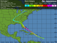
Hurricane unburies beach treasure, yields precious coins
The Orlando Sentinel, on Mon, Oct. 25, 2004
by RICH MCKAY

INDIALANTIC, Fla. - (KRT) - It is the stuff of pirate legends, but do not waste your breath asking Joel Ruth on what stretch of Florida's Treasure Coast he found his hoard of Spanish pieces of eight - waiting to be scratched out of the sand with bare fingers and toes.

Treasure hunters guard their secrets. (it was Melbourne Beach)

Especially, if like Ruth, they have just found about 180 near-mint silver coins worth more than $40,000.

To most Floridians, hurricane season is the time to board up windows and dread the worst. But to professional and amateur treasure seekers, it is the time to hit the beaches and hunt lost riches.

"It's why we're called the Treasure Coast," said Ruth, a bookish 52-year-old marine archaeologist (sic) with an African parrot named Euclid who has learned to squawk "Pieces o' eight."

It takes the big storms like Jeanne and Frances to rake several feet of sand off the beaches and dunes and expose gold, silver and gems sunk and scattered centuries ago.


Cheers, Tom
 

FISHEYE

Bronze Member
Feb 27, 2004
2,333
401
lake mary florida
Detector(s) used
Chasing Dory ROV,Swellpro Splash 2 pro waterproof drone,Swellpro Spry+ wa,Wesmar SHD700SS Side Scan Sonar,U/W Mac 1 Turbo Aquasound by American Electronics,Fisher 1280x,Aquasound UW md,Aqua pulse AQ1B
Primary Interest:
All Treasure Hunting
Re: accounting for the 1715 fleet vessels by their own " offical records"

If there was a timeline on which ships sank first.How did any people come up with this timeline in 1715 when all they had for a clock was a sun dial.A sun dial only works when the sun is out,not when you are in the middle of a hurricane.Has any sun dials been recovered from any of the wrecks?
 

mad4wrecks

Bronze Member
Dec 20, 2004
2,263
107
Detector(s) used
Aquapulse, DetectorPro Headhunter, Fisher F75
Primary Interest:
Shipwrecks
Re: accounting for the 1715 fleet vessels by their own " offical records"

Hourglass :clock:
 

FISHEYE

Bronze Member
Feb 27, 2004
2,333
401
lake mary florida
Detector(s) used
Chasing Dory ROV,Swellpro Splash 2 pro waterproof drone,Swellpro Spry+ wa,Wesmar SHD700SS Side Scan Sonar,U/W Mac 1 Turbo Aquasound by American Electronics,Fisher 1280x,Aquasound UW md,Aqua pulse AQ1B
Primary Interest:
All Treasure Hunting
Re: accounting for the 1715 fleet vessels by their own " offical records"

Tom,

Hourglasses dont work very well on a rocking ship in a hurricane.Besides who has time to turn it over when the sand runs out thats on a ship about to be destroyed?It is also a delicate instrument that can be broken very easy.
 

OP
OP
ivan salis

ivan salis

Gold Member
Feb 5, 2007
16,794
3,810
callahan,fl
🏆 Honorable Mentions:
1
Detector(s) used
delta 4000 / ace 250 - used BH and many others too
Re: accounting for the 1715 fleet vessels by their own " offical records"

hour glasses in the old days where how they figgered out how many knots they were doing distance wize for navagation -- they had a small one they used for this say 10 or 15 min -- they played out a line witha chunk of wood on it (to drag the line out )--on the line were tied knots every so many feet on it once the "time" ran out --they gripped where it was at and counted how many "knots" paid out then multiplied it by the correct amount to equal 1 hour of time. --that was their knots per hour
 

Top Member Reactions

Users who are viewing this thread

Top