What's new

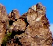
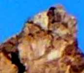
An Anomaly,

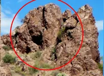
IN reply to Red Desert---No it is not quartz on the surface--it is a white rock--possibly granite

Now in this area I believe there is quartz, placer gold, gold ore and caches of gold and silver and gold and silver ores---all of which I believe is concealed.

I have not move a single stone--nor place any stones in any positions--just taken photos.

I believe that there are caches --through out this area--basically in a 360 degree circle.
I think that there are caches here--( not necessarily in this exact photo--but with in hundreds or yards of this photo ) for example of Sylvanite gold ore.
Several hundred yards to the NE I think placer gold and gold ore has been mined for centuries----
--but to have such a crazy Idea or theory would mean I think mining was carried on here by the
Spanish centuries ago----as well as long before the Spanish came to the new world.

And since they taught me in school that Columbus discovered America in 1492--
to say that there was serious mining in North America prior to 1492---would mean my
beliefs just do not fit in with accepted history.

The trouble I have is when I am in the mountains--and run into statures similar to what is found at Angkor Watt in Cambodia--like Buddha , in the Carson National Forest--that are centuries old.

Or when I am in the Black Canyon of the Gunnison and I run across a 300 foot tall
gorilla and the gorilla is wearing a belt with a purse on his waist

And when I am in the Valley of the Dragons and there are these Dragons hundreds of feet tall

Then history just does not match up with what I was taught.

Barton
 
Last edited:
Post # 20

Thank you Red Desert,

I will check out those three locations when I
get up there this summer.

Right now the site is under heavy snow.

Barton
 
And since they taught me in school that Columbus discovered America in 1492--
to say that there was serious mining in North America prior to 1492---would mean my
beliefs just do not fit in with accepted history.

The trouble I have is when I am in the mountains--and run into statures similar to what is found at Angkor Watt in Cambodia--like Buddha , in the Carson National Forest--that are centuries old.
I am with you. I also have saw some strange objects in the woods. Mines where very few people have ever been. Strange looking cliffs that in my opinion are not natural...Art
 
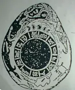
Barton, yes I've done some digging into history myself, you might be interested in this sketch (think it was done in the 1800s) of a stone the Mayans brought up here to what is now the USA. It was a gift to the Native Americans north of the border. If you read everything the Indians have to say about it, the stories all point to the Mayans being here at one time.

Read this article.

DID ANCIENT STAR PEOPLE COME TO MANATAKA AND DEPOSIT WISDOM OF THE COSMOS IN A SECRET CRYSTAL CAVE?​
by Lee Standing Bear Moore

http://www.manataka.org/page352.html
 

Attachments

  • ManatakaStonePhoto2.webp
    ManatakaStonePhoto2.webp
    52 KB · Views: 128
Last edited:
Read more on another page, gives information of the Mayans attending the Manataka Indian gatherings.

The STORY OF MANATAKA
By Lee Standing Bear Moore
THE PLACE OF PEACE
The Sacred Mountain
and Valley of the Vapors


Story of Mantaka
 
Last edited:
Hello RedDesert,

Thank you for posting the stories of the "StarPeople"
I also enjoyed reading about Manataka--and the seven caves--to me the basic jist of the stories is correct.
I had never heard--about the TULA--before reading the two articles

On the other hand--I have seen the images of the TULA in the Rocky Mountains in the United States
They are --well my hunch is--they were one race ? / group ? of our Star Neighbors. There are several
Star People / Star Neighbors that are illustrate in carvings in the rocks that I have seen.

Since they have come here once--the possibility is open for them to return again.
 
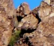
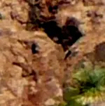
Ancient people we know that much about them. I did some map dowsing for someone once in the Superstition Mts, take a look at this.
 

Attachments

  • SuperstionMts1A.webp
    SuperstionMts1A.webp
    32 KB · Views: 118
  • SuperstionMts1B3.webp
    SuperstionMts1B3.webp
    34.8 KB · Views: 127
  • SuperstionMts1B2.webp
    SuperstionMts1B2.webp
    46.6 KB · Views: 123
  • SuperstionMts1B.webp
    SuperstionMts1B.webp
    110 KB · Views: 114
  • SuperstionMts1.webp
    SuperstionMts1.webp
    251.7 KB · Views: 129
Ancient people we know that much about them. I did some map dowsing for someone once in the Superstition Mts, take a look at this.

Looks like a mineshaft and a king's storage.
 
Looks like a mineshaft and a king's storage.
It's actually, right on the edge of the only known alteration zone, that mineral satellite can pick up in the Superstion Mts. The best place to search for gold bearing quartz veins is on the edge of an alteration zone. There is a series of weeps from Y-Canyon leading to this location, the last one should be close to here.
 
But it appears you only got the lower portion of the head in your square. He is wearing a larger crown behind that small shadow one.
 
But it appears you only got the lower portion of the head in your square. He is wearing a larger crown behind that small shadow one.
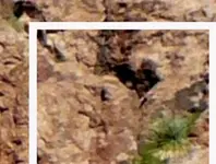
I don't think I'd mentioned the head, if you're referring to the Superstition Mt pics. I'm wondering if it could be honeycombed with tunnels?
 

Attachments

  • Rock_facecropA.webp
    Rock_facecropA.webp
    160.1 KB · Views: 114
  • Rock_facecropA1.webp
    Rock_facecropA1.webp
    35.7 KB · Views: 102
Last edited:
Think I might see what you were talking about.
 

Attachments

  • SuperstionMts1head.webp
    SuperstionMts1head.webp
    50.6 KB · Views: 114
  • SuperstionMts1head2.webp
    SuperstionMts1head2.webp
    28.6 KB · Views: 121
Might mention that zooming in close with GE you can't see this cliff, but not too far away is one (or possibly 2) of those black circular spots people once said look like UFO pads. I'm not saying they are, the one spot can be quite visible using certain historic maps on GE (with satellite images enlarged/cropped enough).
 
Last edited:
If I didn't know any better, I'd say it looks like a "Star of David" (or a star) in the upper right.
 

Attachments

  • SuperstionMts1head3.webp
    SuperstionMts1head3.webp
    18 KB · Views: 104
  • SuperstionMts1head3crop.webp
    SuperstionMts1head3crop.webp
    14.4 KB · Views: 122
Last edited:
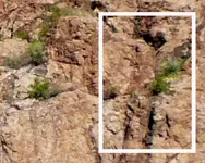
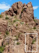
Looks like a V on a large bird head. A few other shadow symbols. But the head I was talking about was in your white box on the top of the shaft shape.
 
I never noticed this before, right above my white line, there are numbers (almost covered them up). Across the gulch is another site with another shaft and below it on the ground are plenty of shadow carving stones.

In this pic here, looks to me like some smaller symbols carved in the area left of the shaft. I'm sure this site is probably within 3 miles from where some people believe a huge Jesuit treasure might be located.
 

Attachments

  • SuperstionMts1B4d.webp
    SuperstionMts1B4d.webp
    44.7 KB · Views: 118
  • SuperstionMts1B4c.webp
    SuperstionMts1B4c.webp
    83.2 KB · Views: 121
  • SuperstionMts1B4b.webp
    SuperstionMts1B4b.webp
    89.3 KB · Views: 114
  • SuperstionMts1B4a.webp
    SuperstionMts1B4a.webp
    127.7 KB · Views: 121
  • SuperstionMts1B4.webp
    SuperstionMts1B4.webp
    223.8 KB · Views: 110
Last edited:
I never noticed this before, right above my white line, there are numbers (almost covered them up). Across the gulch is another site with another shaft and below it on the ground are plenty of shadow carving stones.

In this pic here, looks to me like some smaller symbols carved in the area left of the shaft. I'm sure this site is probably within 3 miles from where some people believe a huge Jesuit treasure might be located.

Could be something good closeby and deep, but there could be things leading you across the canyon to the other spot from this monument..
 
Last edited:
I don't think a person could go to this site alone and survive. You need leather gloves just to climb up the wash because of all the scorpions.
 
Thanks for showing these pictures, that particular type bird head image is pretty important, and it gave me another look at how it is being used.
 
Thanks for showing these pictures, that particular type bird head image is pretty important, and it gave me another look at how it is being used.
You know, the guy who took the photos, he had me dowse mineral satellite maps, then GE maps hoping to find the LDM. I tried pointing out some of the carvings and he apparently didn't notice or care (even asked me what it was I saw, so didn't mention my observations to him). There are 3 sites we pinned in GE as a possible LDM. The photos above at the pin area for the site here, were marked as 3 red circles in a row.

Across the wash is closer to this GE pin and probably where the gold hit had been marked. There is a sharp bend in the canyon with the other 2 pins across on the other side.

Below the white line (posted photos) around the shaft, between the bottom of line and the ground, I had cropped off a strange formation of the rock. Another pin site across the canyon in one photo I noticed the exact same formation. Over there it looked like a couple shaft openings around the low rock outcrops which were isolated rising up from the ground. The 3rd pin location is close but E of that pin (other side of canyon).

The alteration zone in this area is strange, on mineral satellite images it is nealy a perfect diamond shape with each point the same as the 4 cardinal point. If you go past the W pin across the canyon, you pass the W point of the mineralized zone. The W pin is also slightly S of the point of the diamond. So, thick gold bearing quartz veins will be along the edge of the mineralized zone.

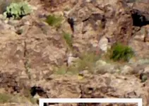
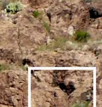
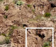
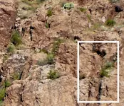
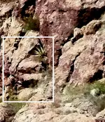
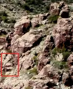
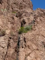
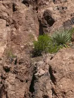
I might as well post a couple photos from across the wash area (from cliff carvings in thread). We expected the rock house of the LDM to be here during the final map dowsing. At first, I'm thinking it was the W pin across the canyon, but later changed it to this location. Notice the steps in the line boxes. Looks like a shaft or cave above the step higher up. A person can't get up to check it out, unless they have a ladder or rock climbing equipment.
 

Attachments

  • RH-area South(crop)-C.webp
    RH-area South(crop)-C.webp
    198.2 KB · Views: 168
  • RH-area South(crop)-B.webp
    RH-area South(crop)-B.webp
    442.1 KB · Views: 176
  • RH-area Cliff Wall 2.webp
    RH-area Cliff Wall 2.webp
    745.6 KB · Views: 107
  • RH-area Cliff Wall 2crop.webp
    RH-area Cliff Wall 2crop.webp
    657.5 KB · Views: 120
Last edited:

Users who are viewing this thread

Back
Top Bottom