KANACKI
Bronze Member
- Joined
- Mar 1, 2015
- Messages
- 1,445
- Reaction score
- 5,940
- Golden Thread
- 0
- Primary Interest:
- All Treasure Hunting
Hola amigos from what I can gather from the excellent info posted here. A real lesson for me in plowing and tilling.the plowing most likely had no effect depth wise to can 2 feet buried below the surface.
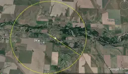
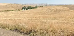
But even if you narrow down the location to 40 acre block it is still a large area to search?


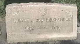
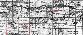
It would be interesting to see if there was some descendants of Kirkpatrick. On the 1914 map there was several areas leased by Kirkpatrick.
Kanacki
But even if you narrow down the location to 40 acre block it is still a large area to search?
It would be interesting to see if there was some descendants of Kirkpatrick. On the 1914 map there was several areas leased by Kirkpatrick.
Kanacki


 ??
??