Any ideas of the meaning of these ?

ekgoldmining

Tenderfoot
Sep 27, 2015
5
0
Ecuador
Primary Interest:
All Treasure Hunting
Georgetown Mining District in Australia: yes, there is good gold there from 1993.
In your photos, yes, Egyptians have been up in Australia, and yes, they have done mining.
There are pyryamids deep in the Jungel in the Kuranda range going up north.
The photo of the sun is interesting because the Spanish used it and proved it here in Ecuador on a few rocks with the sun symbol. It can show you the distance to the mine site and what type of mining it is placer or hardrock.
From my personal experience, if the sun is in the lower part of the river, it contains good gold; in the middle section, the sun symbol is a bit higher up on the banks; if on top, it's up on the mountains, most likely, you stay in front of the symbol, the mountain in the background; if you have square patterns next to or below it, it's a marker for distance and direction.
good luck
 

OP
OP
S

Steely

Jr. Member
May 14, 2021
33
12
Sacramento CA
Detector(s) used
Garrett
Primary Interest:
All Treasure Hunting
Georgetown Mining District in Australia: yes, there is good gold there from 1993.
In your photos, yes, Egyptians have been up in Australia, and yes, they have done mining.
There are pyryamids deep in the Jungel in the Kuranda range going up north.
The photo of the sun is interesting because the Spanish used it and proved it here in Ecuador on a few rocks with the sun symbol. It can show you the distance to the mine site and what type of mining it is placer or hardrock.
From my personal experience, if the sun is in the lower part of the river, it contains good gold; in the middle section, the sun symbol is a bit higher up on the banks; if on top, it's up on the mountains, most likely, you stay in front of the symbol, the mountain in the background; if you have square patterns next to or below it, it's a marker for distance and direction.
good luck
Thank you The location is in a town called Georgetown California know for its immensely rich gold mining area.
Yes we also think it is Spanish. The sun may have a horseshoe inside ? I don't know what to think the Roman numerals, or the thing that looks like a flying saucer. Someone said it may be an old arrastra?
 

OP
OP
S

Steely

Jr. Member
May 14, 2021
33
12
Sacramento CA
Detector(s) used
Garrett
Primary Interest:
All Treasure Hunting
Thank you The location is in a town called Georgetown California know for its immensely rich gold mining area.
Yes we also think it is Spanish. The sun may have a horseshoe inside ? I don't know what to think the Roman numerals, or the thing that looks like a flying saucer. Someone said it may be an old arrastra?
The sun is on top of this rock. If you look closely you can see some of the rays. My husband is looking at the the symbol that resembles a skull or ankh and net to it the one with zigzags and the triangle. The other symbols are on smaller boulders that form a circle.
 

Attachments

  • IMG_0353.jpeg
    IMG_0353.jpeg
    1.9 MB · Views: 40

ekgoldmining

Tenderfoot
Sep 27, 2015
5
0
Ecuador
Primary Interest:
All Treasure Hunting
Thank you The location is in a town called Georgetown California know for its immensely rich gold mining area.
Yes we also think it is Spanish. The sun may have a horseshoe inside ? I don't know what to think the Roman numerals, or the thing that looks like a flying saucer. Someone said it may be an old arrastra?
For sure, they did see the flying sourcer.
What you can try is, if there are squares or triangles, use them with the old Spanish measurement for the distance.
Like it was written before, stay in front, look at the symbol, use the background hills, mountains, etc., and go to this direction and look there a good laser pointer and a drone will be handy and saves a lot of time . The clues are the lines and shapes close to the sun symbol. If it's a square, your close-by square has lines below or around it that are the markers for distance, so one line is, in modern measurement, around 3 miles. I will later download your photos and try different filters on them.
 

ekgoldmining

Tenderfoot
Sep 27, 2015
5
0
Ecuador
Primary Interest:
All Treasure Hunting
Now what I can see is the spearhead mark from the sun's crown—one different, the big one left at the top—and that should be the directions.

On the right-hand side, it appears to be a map. There is a trail going up the mountain or hill.

The bottom line from my point of view is a distance line, so in this case, around 2 miles. You need this if you hike up that trail around 60 or 70 percent before the summit. There must be another, smaller trail going to the right; this one maybe is covered up or, in the beginning, destroyed. From there, use the bottom mark, so in about 2 miles it should lead to a mine entrance. There are two small, narrow lines that are maybe a ladder. It looks to me like they worked on or followed an outcrop.

If you have high-definition photos, send them.

Good luck if you use a drone or Google Earth; it will save you hours of walking.

will later look deeper into the writings
Dobel circle in the sun meaning rich mine or minerals below
in case its a spanish marker
 

Last edited:

ekgoldmining

Tenderfoot
Sep 27, 2015
5
0
Ecuador
Primary Interest:
All Treasure Hunting
Roman Numerals into single letters
CLVIII = C + L + V + I + I + I
numerical value of each letter and add/subtract them
CLVIII = 100 + 50 + 5 + 1 + 1 + 1 = 158
so there you have a year
first two maybe name
 

OP
OP
S

Steely

Jr. Member
May 14, 2021
33
12
Sacramento CA
Detector(s) used
Garrett
Primary Interest:
All Treasure Hunting
I should stat from the beginning. The picture of of husband was taken in 1976. We took these pictures, thought that they were done by some hippies or? and put hem away in the closet for about 10 years. My husband
met someone who had a treasure symbol book and that is when we got interested. Our family (now grown son and daughter have visited this canyon many many many times. We have books by Kentworthy and Mary Carson. Also and old map of the area. The walk to this last picture is about 1 mile ( fairly steep) well traversed, and with houses not too far away. Now the symbols are wore away. There are seven symbols total. I forgot this one. The one that looks like saucer, the one that looks like Chinese writing and this one are on one smaller group of boulders shaped like a circle. They are smaller in size. All of the carvings are right there within a few feet of each other and all along the stream
This last one is on a flat spot on the floor of the circle.! This canyon is EXTREMELY rough
and and steep!!! The picture of the the rock with moss and smaller rocks wedged with under we found interesting. It is located about 1.5 miles away . My son said he saw a small heart carved there. It is directly across from
the hand arrastra which we think is the flying saucer?? ( Just our ideas on this) There is another stream near by. The hand arrastra. being a flat that had a fall of water source coming into that could be diverted to make a swirling motion. The motion would move the rock across a hole cut out of the rock in the center , when the crushed rock
filled the hole , they would divert the water back to stream and bucket out he pool and clean the hole and center out and pan hat for gold. We really don't know much more than this after all these years. Would love to solve this mystery though!!!!
 

Attachments

  • 12BD0261804411DD.jpg
    12BD0261804411DD.jpg
    731.2 KB · Views: 37
OP
OP
S

Steely

Jr. Member
May 14, 2021
33
12
Sacramento CA
Detector(s) used
Garrett
Primary Interest:
All Treasure Hunting
I should stat from the beginning. The picture of of husband was taken in 1976. We took these pictures, thought that they were done by some hippies or? and put hem away in the closet for about 10 years. My husband
met someone who had a treasure symbol book and that is when we got interested. Our family (now grown son and daughter have visited this canyon many many many times. We have books by Kentworthy and Mary Carson. Also and old map of the area. The walk to this last picture is about 1 mile ( fairly steep) well traversed, and with houses not too far away. Now the symbols are wore away. There are seven symbols total. I forgot this one. The one that looks like saucer, the one that looks like Chinese writing and this one are on one smaller group of boulders shaped like a circle. They are smaller in size. All of the carvings are right there within a few feet of each other and all along the stream
This last one is on a flat spot on the floor of the circle.! This canyon is EXTREMELY rough
and and steep!!! The picture of the the rock with moss and smaller rocks wedged with under we found interesting. It is located about 1.5 miles away . My son said he saw a small heart carved there. It is directly across from
the hand arrastra which we think is the flying saucer?? ( Just our ideas on this) There is another stream near by. The hand arrastra. being a flat that had a fall of water source coming into that could be diverted to make a swirling motion. The motion would move the rock across a hole cut out of the rock in the center , when the crushed rock
filled the hole , they would divert the water back to stream and bucket out he pool and clean the hole and center out and pan hat for gold. We really don't know much more than this after all these years. Would love to solve this mystery though!!!!
 

OP
OP
S

Steely

Jr. Member
May 14, 2021
33
12
Sacramento CA
Detector(s) used
Garrett
Primary Interest:
All Treasure Hunting
Oh , the last I on the numerals has a horseshoe sitting sideways ( we think ?)
Oh my gosh, your interpretations seem to be right on. The carvings were done deeply, and the rocks, on the stream well wore with age (rounded etc. ) We just don't know why the miners of the 1800's would do this.
We think this was done well well before that. Have you heard of the the King's trail
We may try to go down there again this summer. It's been awhile. One time when we were there we we staked by a cougar.
 

OP
OP
S

Steely

Jr. Member
May 14, 2021
33
12
Sacramento CA
Detector(s) used
Garrett
Primary Interest:
All Treasure Hunting
hope this is better
 

Attachments

  • IMG_0348.jpeg
    IMG_0348.jpeg
    1.7 MB · Views: 47
OP
OP
S

Steely

Jr. Member
May 14, 2021
33
12
Sacramento CA
Detector(s) used
Garrett
Primary Interest:
All Treasure Hunting
Just wondering if anyone thinks these symbols are Spanish ?
 

OP
OP
S

Steely

Jr. Member
May 14, 2021
33
12
Sacramento CA
Detector(s) used
Garrett
Primary Interest:
All Treasure Hunting
What are your thoughts of the triangle? Yes there once was a mine going up a hill from the creek. although it is well known, and was in existence the the 1800's.
Have not been there yet this spring. Lion? That is not Spanish?
 

YECAK0808

Newbie
Jun 12, 2015
2
0
Primary Interest:
All Treasure Hunting
Steely, it looks like someone spent some time on your precision-carved symbols. Are they anywhere close to an old mining district, old railroad tracks, or both? The New Mexico panel shown below is, plus like yours, is very well done and contains Egyptian symbols. Map everything unusual that you find in the area, including natural landmarks, and see if any geometrical patterns are formed.
View attachment 2072141
Yes, they are in an old mining area. It's very odd. Someone obviously put a lot of effort into the symbols.
 

YECAK0808

Newbie
Jun 12, 2015
2
0
Primary Interest:
All Treasure Hunting
For sure, they did see the flying sourcer.
What you can try is, if there are squares or triangles, use them with the old Spanish measurement for the distance.
Like it was written before, stay in front, look at the symbol, use the background hills, mountains, etc., and go to this direction and look there a good laser pointer and a drone will be handy and saves a lot of time . The clues are the lines and shapes close to the sun symbol. If it's a square, your close-by square has lines below or around it that are the markers for distance, so one line is, in modern measurement, around 3 miles. I will later download your photos and try different filters on them.
What filters are you using?
 

OP
OP
S

Steely

Jr. Member
May 14, 2021
33
12
Sacramento CA
Detector(s) used
Garrett
Primary Interest:
All Treasure Hunting
Yes, they are in an old mining area. It's very odd. Someone obviously put a lot of effort into the symbols.
What filters are you using?
Thank you for the information. It looks like they used verras. Two line a pace and one line.?
I don't see squares.
Sorry didn't reply we have been out of state visiting our daughter. Just haven't looked at the forum. Have not used filters yet what do you suggest?
What filters are you using?
 

OP
OP
S

Steely

Jr. Member
May 14, 2021
33
12
Sacramento CA
Detector(s) used
Garrett
Primary Interest:
All Treasure Hunting
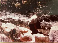
Re: previous post There are man yold productive gold mines near this area. The town of Volcanoville is just 4 miles away. An interesting article.

Main menu​

Skip to content
COMMUNITY PROFILES

Community Profiles – Small Towns East of Georgetown​

by Doug Noble • September 13, 2013 • 0 Comments
Georgetown Junction at Highway 50
Not many people realize that there was an immigration route from what is now Highway 50, through the back country to Georgetown. It left the main road at Georgetown Junction, near Strawberry, and went through Union (Onion) Valley before heading towards Georgetown. Along it a number of waystations and mining camps evolved over the years.
Many of these small towns and mining communities played a large part in the settlement of the area. Most are gone and some, such as Cement Hill, Gravel Hill, Mt. Gregory and Wolverine Hill, left little if any history of their existence. However, we do know quite a bit about others.
Twelve miles to the east of Georgetown, on Wentworth Springs Road, is the community of Quintette. John J. Quinn, received a the original land grant for this piece of forest land in 1889.
Almost immediately he sold the land to the Barklage brothers who were timbermen. It is they that started the community of Quintette, which was supported by a logging camp and the Blue Bird Mine.
In 1917 the descendants of the Barklage brothers sold the town to the Douglas family. They acquired more land in the area and turned the first building in the town, the Twelve Mile House, into the Quintette Inn – a popular summer stop for ranchers with cattle summering in the forest. In 1941 the Douglas family sold Quintette, which by consisted of the Quintette Inn, a shed and large barn, to Claude “Bob” Robbins.
The Inn burned in 1945 and was replaced by a cabin. It too burned ten years later and was replaced by another cabin – still known as the Twelve Mile House – that stands today. In 1977, when Bob Robbins was 86 years old, he mysteriously vanished, never to be seen again.
On August 7, 1903 a post office was opened in Quintette, Frederick H. Douglas serving as its first postmaster. It was closed on June 31, 1912, and moved four miles northwest to the town of Virner.
Near, if not at Quintette in the early 1850s was the first inhabited structure that early miners came across once leaving the Placerville Road at Georgetown Junction. This place was known as Works Station, Works Ranch and even Twelve Mile House. It existed as late as 1883, but not much more is known about it.
Between Quintette and Georgetown, on the north side of the road, was Kentucky Flat, a mining camp between two forks of Otter Creek. In 1854 or 1855, a toll bridge was built over Otter Creek by McCoy and Company, which made travel to and from Georgetown and these communities to the east, much more convenient.
A few miles to the north of Kentucky Flat, on a point overlooking the Middle Fork of the American River was the town of Volcanoville, which acquired the name because a nearby mountain seemed to be an extinct volcano and the miners had to work through lava cement (a hardened ash/mud deposit) to get to the gold.
In 1852 a rich deposit was discovered at this location and only three years later, a twelve stamp steam-driven mill was in operation, noisily separating the gold from the cement. In 1856 a 42.8 ounce nugget was discovered by a lucky miner and the mining activity increased.
When an 1879 forest fire destroyed most of the buildings in town, a majority of the mines closed. Two years later the Dore (Maurice Dore) Mine was reopened as the Josephine Mine, taking its name from its new owner, Joseph Nouges. By the 1890s the mine was so successful that the town itself was actually renamed Josephine.
The town continued to grow and the Josephine post office was established on August 12, 1895 with store owner Jerome C. Akley as postmaster. The post office would be discontinued on October 20, 1915 and reestablished on July 11 of the next year. It would be closed for good on October 31, 1917.
After the name of the town was changed back to Volcanoville a new post office was opened July 8, 1930 with Mrs. Clara P. Fraser as the first postmaster. It was discontinued on January 31, 1953 and moved to Georgetown.
By the 1960s most everything had shut down an a sign at the entrance to the town read: “Volcanoville. Pop. 4. Elev. 3036.” At that time, Vera Frazier and her son Jim owned the town and operated a museum in a building that has once been a dance hall, general store and saloon. The museum burned in 1969, leaving only a few residences and a beer parlor.
Virner, or Camp Virner, which was along the road from Quintette to Georgetown was a resort community and, earlier, a mining community. A post office was established there on September 11, 1897 with Janny L. Tuttle as postmaster. On March 31, 1913, the post office was discontinued.
Three miles north of Georgetown was Bottle Hill, another early mining camp. There are three stories behind why this place was so named.
The first contends that some miners paused here in 1849 while searching for gold and saw a bottle under a bush. Picking it up, they found it was full of whiskey, which they soon consumed. Believing it was an omen, they started mining on the hill, starting the community. The second story mentions some miners coming across a pile of bottles at this location. The third says that the town was named after a nearby bottle shaped hill in the Hornblende Mountains.
No matter how it got its name, Bottle Hill, or Bottle Hill Diggings, was a thriving mining community by 1855, with a book store and express office, run by William T. Gibbs and Sol M. Jinerson, two grocery stores, a boarding house, a post office and the requisite number of saloons. Soon thereafter there were established a division of the Sons of Temperance, with 50 charter members, and a lodge of Know Nothings.
The first and only postmaster for the Bottle Hill Post Office, which opened on May 28, 1855 and closed on August 17, 1859, was Samuel M. Jamison.
Mining continued at Bottle Hill at least until the 1950s.
 

OP
OP
S

Steely

Jr. Member
May 14, 2021
33
12
Sacramento CA
Detector(s) used
Garrett
Primary Interest:
All Treasure Hunting
Georgetown Mining District in Australia: yes, there is good gold there from 1993.
In your photos, yes, Egyptians have been up in Australia, and yes, they have done mining.
There are pyryamids deep in the Jungel in the Kuranda range going up north.
The photo of the sun is interesting because the Spanish used it and proved it here in Ecuador on a few rocks with the sun symbol. It can show you the distance to the mine site and what type of mining it is placer or hardrock.
From my personal experience, if the sun is in the lower part of the river, it contains good gold; in the middle section, the sun symbol is a bit higher up on the banks; if on top, it's up on the mountains, most likely, you stay in front of the symbol, the mountain in the background; if you have square patterns next to or below it, it's a marker for distance and direction.
good luck
Do you have a picture of one of the sun symbols used in Ecuador. Thank you what you say is super interesting.
 

Crosse De Sign

Gold Member
Jun 19, 2013
5,490
5,757
~: Ancient Sacred Spirit Lands Of Our Fathers' :~
Detector(s) used
White's MXT ~ TM800 ~
Primary Interest:
Other

You might read this guide, which includes markers used along Spanish Treasure Trails,
& Treasure areas, & Vault markers.
Study about using a Pentax Optio W10, W20, W30, camera. Get one, set it up as specified,
try to capture an aura.
It's not very costly, & well worth the effort to give it a try. Never know, you might get one (Aura).
 

pokergodrules

Greenie
Apr 21, 2023
17
9
Thank you The location is in a town called Georgetown California know for its immensely rich gold mining area.
Yes we also think it is Spanish. The sun may have a horseshoe inside ? I don't know what to think the Roman numerals, or the thing that looks like a flying saucer. Someone said it may be an old arrastra?
The Spanish did use Roman Numerals.
 

Top Member Reactions

Users who are viewing this thread

Top