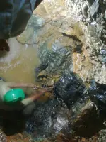
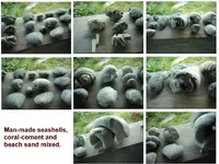
There is one site, related to dowsing in the Philippines. This is interesting because, the owner of the property dug about a 22 ft deep hole. From GE maps, it was obviously out away from the populated areas, with woods and fields clearly visible. I never got an answer or maybe forgot the details, whether the site was 2 kilometers from the cave (little sword photo) or that distance from the beach bunker. Anyway, at about 20 ft down, the owner hit this layer of seashell sculptures, made from beach sand and cement. He was hoping to hit a tunnel which had been believed to be on his property.
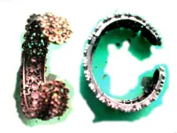
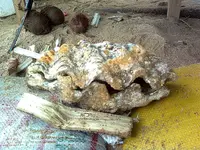
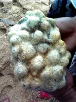
Many photos of normal sized seashell dculptures, were all put together for one pic. The Japanese probably made them in the beach bunker. Why? Good question, perhaps to mark the location of a tunnel that got filled in, after all the gold bars were removed. I realize from the photo, these appear to be real seashells. But the dowser insisted all of them were made of cement containing beach sand.