Are you sure about your location for El Penon Vulcan ?
El Penon = The Rock, or a Pinnacle. The Spanish names a number of places El Penon in which there was a lone tall standing rock, usually on top of a mountain.
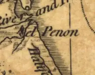
Now considering that, and the old maps and the relation to the small stream to the lake on the west of this area, this is possibly El Penon:
http://www.flashearth.com/?lat=29.695336&lon=-81.222894&z=19.1&r=0&src=msa
You will not see it on this map, but if you go to Summer Haven on Mapquest and do a zoom and head south you will find a part of a south fork of Matanza River as it meets the smaller stream coming up and on the east of their meeting a sandy area that appeared to be an old inlet.
Further substantiating that this could be the old El Penon is a very high sand mound on the south side of this sand which I have placed the cross hair at to get the above coordinates.
You can see the Pinnacle of sand really well on mapquest.
itmaiden
vulcan007 said:
Nah...the true coquina quarry you are talking about is located south by washington oaks state park. This was the location of el penon just north. V