Chadeaux
Gold Member
- Joined
- Sep 13, 2011
- Messages
- 5,512
- Reaction score
- 6,409
- Golden Thread
- 0
- Location
- Southeast Arkansas
- Detector(s) used
- Ace 250
- Primary Interest:
- Cache Hunting
- #1
Thread Owner
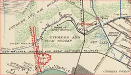
I recently saw some maps from the Civil War which I'll try to post here. If they don't show up, you may want to go to the facebook https://www.facebook.com/groups/371484532958470/

Metairie Road in the map from 1863 is the same today. Notice the Army Depot Stores which are south of where Bonnabel Blvd meets Metairie Road. Also visible is the location of Fort Redoubt
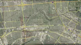
You can overlay the map in Google Earth for more accurate placement of the items.
I loved finding out that the Cemetery west of I-610 used to be a horse racing track ... which accounts for the odd layout of the roads there.


