EE THr
Silver Member
Re: LDM why you can't get it !
Travis---
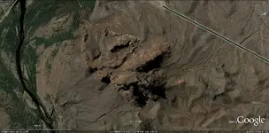
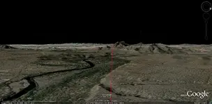
I was going from recollection, but I went to The Lost Dutchman Gold Mine site's map page, and here is what I was talking about. This will take more than one post.
First, here are some maps which show cactus markers, certain trees, corrals, and other landmarks which they appear to have in common. As a hunch, I group these together, because there is something about them that just doesn't seem right.
Maybe I'm imagining things, but here is what I have noticed---
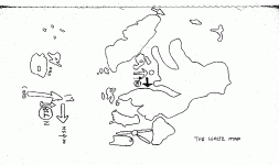
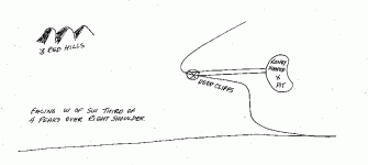
The following three all mention the LDM specifically.


The following two are for Spanish mines. While they are not for the LDM specifically, they have interesting similarities. I'm wondering if there is some reason for this?


This group is notably different than another, larger, group which all have similarities, which I'll post.
Going through all these, and resizing the ones which most fit this point, takes a little time.

Travis---
Dirty Dutchman said:EE,
Which "two sets" of stories are you referring to?Thanks,
Travis
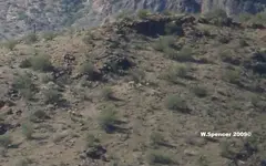
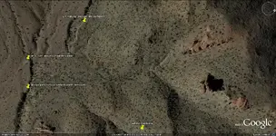
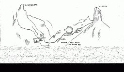
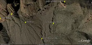
I was going from recollection, but I went to The Lost Dutchman Gold Mine site's map page, and here is what I was talking about. This will take more than one post.
First, here are some maps which show cactus markers, certain trees, corrals, and other landmarks which they appear to have in common. As a hunch, I group these together, because there is something about them that just doesn't seem right.
Maybe I'm imagining things, but here is what I have noticed---
The following three all mention the LDM specifically.
The following two are for Spanish mines. While they are not for the LDM specifically, they have interesting similarities. I'm wondering if there is some reason for this?
This group is notably different than another, larger, group which all have similarities, which I'll post.
Going through all these, and resizing the ones which most fit this point, takes a little time.