Hunter, here are the two posts that I authored. They should help. But.... the
best way to learn the LR2000 is PM Tim and get his phone number. Really. These posts don't say it all but will give you a great jump-start. TTC
[h=2]One way to use the LR2000 and county sites for research[/h]
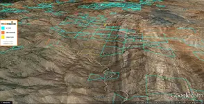
Here is a real quick way to use the LR2000 page AND Yavapai county AZ webpage for researching a claim. Say, you are cruising around and see one of those yellow claim markers. On the placard is the owner's name, Jack Tucker. The claim name is Devil's Hideout. You want to contact the owner and see if you can get permission to look for gold on his claim. You also want to check out the claim to see if the claim is active or closed. If closed, it is possible that you may claim it as your own! Let's try it. Jack and Lisa Tucker are the caretakers at the Stanton, AZ LDMA camp. They were the owners of the Miner's Creek prospecting shop in Wickenberg, AZ. It is now under new management. We will now use the name Jack Tucker to search the PUBLIC RECORDS of Yavapai county and then the BLM LR2000 page to learn the names and locations of Mr.Tucker's claims. He has MANY. First, this yellow claim marker is in section 36, just north of the Stanton camp. That will also be in Township 10N and Range 5W. Go to Google. Put "Yavapai" in the search box and you will get choices that include Yavapai county recorder. It will say "disclaimer" somewhere in the discription. Click on that site. Bookmark it, you will probably use it again. On the disclaimer site, click "I acknowledge" at the bottom. You will be directed to the "search document" site. On the right side of the page "UNCLICK" search all types box. Choices will show up. Scroll down and click on "notice of location". Now, find the date range on the page and change the "1876" to something like 1960 or so. Then go to GRANTOR (not grantee) box and enter "TUCKER,JACK". No spaces. Hit search. You will get MANY results listed for Jack. Scroll down the list until you find the claim named "Devil's hideout". You will know you are at the right claim because in that space you will see it is in section 36, and township 10N and Range 5W. At the very right top of that space are the words "view image". Click on that. You will be sent to the actual photostat copies of the two pages Jack filed with the county (plus other info). On page two will be the diagram that he drew up showing the exact location of the claim in the section (36). You will have to click on that little "minus" sign to get the pages to fit on the screen. You can now use the Section, Town, and Range (and claim name) to see if Jack is up-to-date on his maintainance fees. In other words, is he current or "delinquent". If delinquent, you MAY be able to OWN this claim. Digest and try this info so far and I'll get to the LR2000 page next. These websites are PUBLIC INFO. Use them to your delight! TimC can do MANY things on these webpages! The above suggested research info is only one of many tools you can try out. (NOTE: This write-up is NOT permission to prospect on Jack's claim, just instruction on how to research a claim name.) TTC
Navigating the LR2000 page... instructions
A long post... save it to your desktop for later reading:
Here's how I use the LR2000 page for research. Like I've said before, TimC is the EXPERT. I've learned this process from him.
GOOGLE up LR2000 (bookmark it) You will be directed to the BLM LR2000 home page.
Click RUN REPORTS. You will get a page that gives several choices.
Scroll down to PUB MC GEO REPORT (my caps).
Click on that choice (Pub MC Geo Report) . You will be directed to more choices.
Check Meridian Township Range Section.
Click Select Criteria box (at bottom of page). You have the page... Mandatory Criteria.
Click Set (Admin State). You now have a list of states. I will highlight AZ for instructional purposes.
Click Set (case disposition). Now I will select ACTIVE and CLOSED (only) on this page. You may select Active and closed if you like by dragging the cursor over both or hold down the CTRL key and click on both.
Click on Set Meridian Township Range Section. First click on Meridian. I will click in 14 - Gila-salt River Mer(for instruction).
Click on Township box and insert "10" for now.
Move right to find "direction" (any). Click here and select NORTH.
Move to Range box and enter "5". Move to direction and add WEST.
In the Section box add "23".
Move to "Add to MTR" (Meridian Township Range) box. It is highlighted in Forest green. When you click it, the info you added above will show up in the larger box below. Mine shows up as "14 0100N 0050W 023".
Click Run Report at the bottom of the page.
Your choices will show up and a box will show up with the choices you made.
Click "OK".
Now, your screen will seem to go blank for awhile (look on the URL line above)... the site is "crunching" your choices.
Several seconds later (be patient) a box will show up saying something like "Query in progress.Please wait...".
Several seconds later VIOLA! You get a list of the ACTIVE and CLOSED claims in section 23 above Stanton, AZ! There are more than 1 page of listings (see the 1 of ? top right?).
Click on the PAGE DOWN function AT THE TOP OF THE PAGE (not your PGDN/PAUSE key).
Now you will see that there are 5 pages to look at and play with. The CASE TYPE number(s) mean 384101=lode and 384201=placer. The reason section 23 has MANY more lode claims than placer is because it is a VERY rugged piece of land. Placers are more prevelent south of Stanton. Now, swap out the section numbers for other areas around Stanton to see what you get. Plug the claim name and/or owner name into the Yavapai County, AZ website I listed in another post to see exactley where they are located. A long post, to be sure! Save it to your desktop till you are comfortable with the searches. MANY more types of searches are possible using these two tools. I hope I did these instructions right. ENJOY! TTC


")

