Maps

If you stumble across a camp up there that smells irresistibly delicious, that me.
How well can you eat in the wilderness? That's one of my challenges.
Turns out better than you would think.


Jack Rabbit Stew! My FAVORITE meal!

Seriously, I found about three mines from where I was at up there an old campsite from long ago and stashes of food / water for spying on the canyon below.
Also found a lot of spent casings from a rifle looks like the crows nest of a Ruth Killer!

I found ole sledge hammers, pick, shovels, chisels, clothing, shoes, shirts, supplies and that hidden nest in a natural cluster of huge boulders over looking the canyon.

One prospect had leaded tin cans around it now that's old!

I never found an arrowhead but I did find a rock they made arrowheads from. It wasn't as pristine as the one from the Legends show but you could just make out Geronimo's Hand Print on it!

Yes, lots of history in them there parts.
A word of caution. You can starve to death eating too many rabbits. Mountain man disease I think it's called.
Rizzoto, green peas & mushrooms, rehydrated pork with sage, followed by green tea and sweets.
A chocolate on your improvised pillow.

The clothing that you found is something that interest me. Hint, hint.
Seriously, if you have a shot of the clothing I would like to see it.

I know, why would anyone photograph old clothing?

Victor,

Never took a photograph of the old clothing, couldn't get the skeleton out of the pants.

At the time I hadn't thought about it. It never crossed my mind. Probably from shopping with my wife all those years!
It looks like whomever had those cloths on had mountain man disease and a few worms.
Thought about using those trousers though, for an improvised pillow. I can post up the other photo's of the journey it may be in one of them somewhere next to the camp site stew.
 

That would be brilliant.

I have to say that Silas Haywood has turned out to be one of the more difficult names to authenticate and to research. I think that I have found him but thinking and knowing are not the same things.

Hal,

Received a reply from Tom yesterday:

"Are you talking about the trail up Squaw Box to Peter's Mesa. If so, I doubt you could put a horse up that canyon today. The old trail down La Barge Canyon should be passable. I have
(not)been in the area since 2010, so I am not a good person to ask. Since all the cattle have been taken out of the wilderness the brush is really bad in the canyon bottoms."

I would say, from my reading of his message, that it was once possible. Not many places that the old timers could not take a horse. There's "almost" always a way. Tom is always my go to guy for this kind of information. Next would be Jack Carlson or Greg Davis.

Hope that helps you.

Take care,

Joe
 

How about to modernize the old maps ?

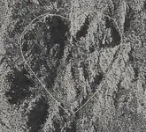
1) The Latin heart stone map

LH.jpg

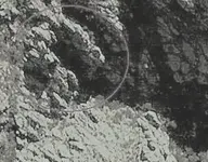
and a different picture of the " FORNIX "

fornix.jpg

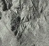
2) The stone trail heart

StH.jpg

and the stone Latin and Trail hearts together

St&L.jpg

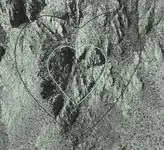
and the three hearts with the priest in the middle

Hearts.jpg
 

Hal,

Received a reply from Tom yesterday:

"Are you talking about the trail up Squaw Box to Peter's Mesa. If so, I doubt you could put a horse up that canyon today. The old trail down La Barge Canyon should be passable. I have
(not)been in the area since 2010, so I am not a good person to ask. Since all the cattle have been taken out of the wilderness the brush is really bad in the canyon bottoms."

I would say, from my reading of his message, that it was once possible. Not many places that the old timers could not take a horse. There's "almost" always a way. Tom is always my go to guy for this kind of information. Next would be Jack Carlson or Greg Davis.

Hope that helps you.

Take care,

Joe

Thanks cactusjumper

I found the email from Mr. K. with a similar response.
 

I believe the Apache (Western) word for gold is oodo. Can't think of any Apache words that begin with "P".

Good luck,

Joe Ribaudo

This may be the source for the tunnel story. In 1903, an unnamed prospector came to Mesa telling the story of his dog chasing a rabbit into a small hole somewhere in the Superstitions. A tunnel was reportedly found and rich gold ore produced.

The report claims that the prospector was backed or supported by W.C. Creene, however, this may actually be W.C. Greene. "Col." Greene made his fortune in copper, railroads, land and lumber, and then lost it all.
 

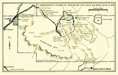
A very interesting map from James Kearny's article A Death In The Superstitions.

Arizona Historical Society
Illustration by Don Bufkin
 

Here is a link to the Superstition Search And Rescue website. They have some nice topo maps with hiking trails throughout the Superstitions. Good reference material for those who have not had the opportunity to go into the mountains themselves.

Please post maps that you are willing to share related to the LDM and Superstition Mountains.

Would be interesting to see some topo maps overlaid or in addition to some GE imagery. Especially older maps.

Superstition Search And Rescue - Area Maps

I have been working with the 1909 Florence topo, trying to superimpose it (align it) to the same SS&R map. It's about as frustrating as it gets due to the inaccuracy or distortions. Once it is close to perfect I will post the composite map.

I am wondering when Peter's Canyon was first named because it doesn't appear on the 1909 topo.

View attachment 1164942
 

Last edited:
I am wondering when Peter's Canyon was first named because it doesn't appear on the 1909 topo.

Hal,

Peter's Canyon and Peter's Mesa were named after Old Pete - Gottfried Petrasch, father of Hermann and Rhiney Petrasch.

We know Pete worked for Bark in the 1890's, so I would say the name was given between 1895 and 1920, and later gained enough traction to start appearing on maps.
 

Hal,

Peter's Canyon and Peter's Mesa were named after Old Pete - Gottfried Petrasch, father of Hermann and Rhiney Petrasch.

We know Pete worked for Bark in the 1890's, so I would say the name was given between 1895 and 1920, and later gained enough traction to start appearing on maps.

Yes, thats the story I have been told as well. But do you know why? I mean, how did that association form? Before he tried killing himself (almost jumping off the sanitarium balcony), when he was still relatively sane, was Gottfried known to have explored what eventually became Peter's Canyon?

Is there any reference that you can share that has him described as "Pete"?
Thank you for the help deducer!
 

I agree cactus, where there is a will there is a way. This was proven on my search for Tayopa.

Real de Tayopa Topical Tramp.

Can you help with the word ESCAROADIA OR ESCARDADIA? I am looking at the Peralta map given to Ruth's son by Gonzales.
Also, why would one use S. CIMA and the other (reversed) use S CLIMA?
Two very different words.

Thank you!
 

A very interesting map from James Kearny's article A Death In The Superstitions.

Arizona Historical Society
Illustration by Don Bufkin

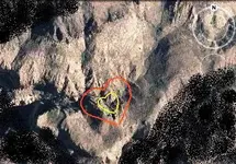
I believe the two possible routes that followed Ruth are these with red colour . He tried to follow the route which Waltz had said and to match the Perfil map or Waltz drawing in the field .

image.jpg
 

Yes, thats the story I have been told as well. But do you know why? I mean, how did that association form? Before he tried killing himself (almost jumping off the sanitarium balcony), when he was still relatively sane, was Gottfried known to have explored what eventually became Peter's Canyon?

Is there any reference that you can share that has him described as "Pete"?
Thank you for the help deducer!

Hal - Gottfried Petrasch spent at least some part of his life on Tortilla Mountain exploring and prospecting in that area, in fact I've been told that his campsite and areas of interest were the same or very close to the areas Jim Hatt had his base of operations up on Tortilla. To have an area named for him, he must have spent more than just a "little" time on the Mesa and in what became known as Peter's Canyon, but I don't know any specifics about that.

As to why he was called "old Pete" - all I can think of is it's just a nickname based on his age and the first 3 letters of his last name. Interestingly enough, I've seen both Herman and Rhiney referred to as "old Pete" in some other stories and things I've read too, so who knows :dontknow:
 

Hal. it depends upon it's usage and correct spelling. weed, weeding, hoe, or reaming.

S. cima refers to the south peak while the other refers to weather. The first sounds more correct in reference to a map.


Can you post a portion of the map with the wording ?
 

Last edited:
Yes, lots of history in them there parts.
A word of caution. You can starve to death eating too many rabbits. Mountain man disease I think it's called.
Rizzoto, green peas & mushrooms, rehydrated pork with sage, followed by green tea and sweets.
A chocolate on your improvised pillow.

The clothing that you found is something that interest me. Hint, hint.
Seriously, if you have a shot of the clothing I would like to see it.

I know, why would anyone photograph old clothing?

Hal,

I don't believe the disease is caused by a diet high in Rabbits. Rather it's just from long term living in high altitudes.

Take care,

Joe
 

<Heading off-topic into the weeds>

Not to pick a fight over it, but people have died from eating rabbits as their main diet. Including recently (a few years ago) when a young man went to Alaska, and was able to keep himself fed but only on rabbits and died of malnutrition. Living in the outdoors you actually need FAT in your diet, as your body burns it just by being outdoors, and there is very little fat in rabbit meat. Not to mention the vitamins, carbs which help provide the long term energy, etc. A diet of lean meat <like rabbit> might be great for people who spend most of their life at a desk, but living outdoors your body requires the type of diet that would make a city-boy fat as a hippo.

Sorry for getting off-track there, please do continue, and to Joe's question no I sure don't know about that dashed line from Willow Spring. Anyone?
 

Anyone know what the dash-line going northeast from Willow Spring is?:dontknow:

Thanks,

Joe

If it's the red one you're talking about, Markmar added that himself from the one Hal first posted - it's not on Hal's
 

Top Member Reactions

Users who are viewing this thread

Back
Top