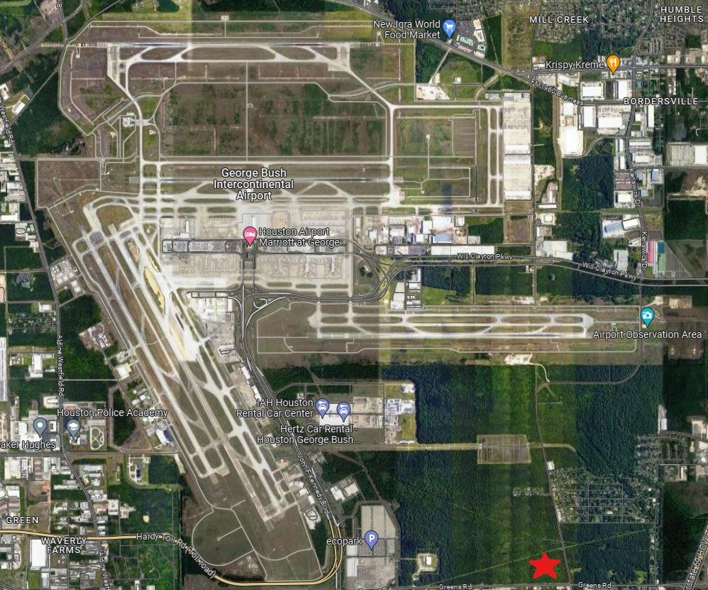
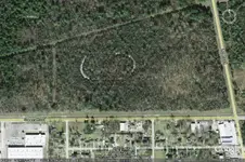
15 years later and a newcomer to this treasure hunt. I've been looking at aerial imagery from Historic Aerials to see how that property looked over the years. To clarify, this is the location of the property where remnants of an old racetrack can be seen.
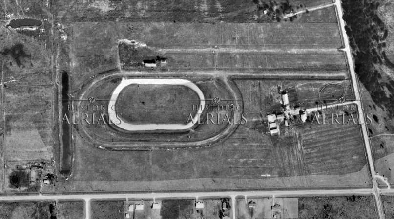
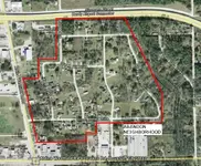
I can tell you almost certainly that the track probably did not exist until some time after 1946. Here's why: On this map from 1954, the racetrack can be seen.
But in a similar map from 1946, the racetrack is not present.
Here's the earliest aerial shot I found, from 1953.
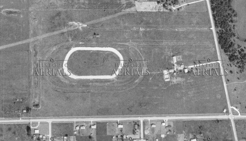
By 1957, a smaller, wider track had been built, as well as what appears to be larger spectator bleachers.
Sadly, by 1962, the racetrack seems to have fallen out of much use. The large spectator stand is already gone, and the roads leading back to the track seems to be growing over -- evidence that they're not being driven on.
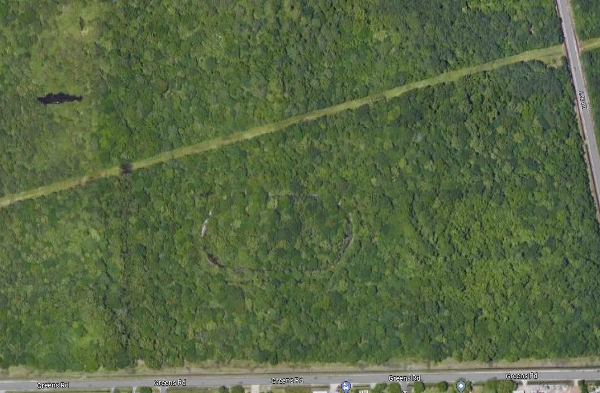
Two years later the racetrack is clearly out of use. The stands are gone, the roads overgrown. There's nothing remaining but the ovular gash carved into the ground.
But if we take a wider look, we see what may be the cause of this closure: the construction of IAH.
And of course, below what we see in satellite imagery today. I have as of yet been unable to find out for certain (1) what was the name of this racetrack venue or (2) how long it operated. I hope someone happens upon this thread who might be able to shed more light on this mystery. Hopefully it won't be another 15 years from now!
P.S. I have reached out to the director of the Houston Airport System requesting permission to enter the property and take photos. If that works out, I will post an update here for sure. Take care everyone!


")
 I can't seem to find a Jensen Road. Jensen Dr and Hwy 59 is right smack in the middle of major hwys. 59, Jensen and I-10 all come together right in that area. Does the track still exist or is it completely gone? I couldn't find anything that resembled a track on google earth. It would be a great place to hunt if you could find the actual location. Thanks for the info on it, very interesting.
 )
)