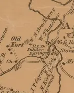
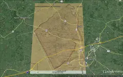
One must remember that roads do change over the course of time ... but the lines such as vector boundaries (from a set point at a certain bearing to a second point) do not change unless they are made to change by reapportioning counties.
County/State/Country vector boundaries are the first source to look to for accuracy as these are legally described boundaries that are unaffected by flooding (look at the Mississippi River before 1927 and now) or other natural changes. They remain CONSTANT unless they are legally changed as noted above. Many of your boundaries in that map ... are either completely wrong on the map or the map is not sized and aligned to match the unchanged vector boundaries.
If your map is so inaccurate that those boundaries are wrong, perhaps it is totally useless for any purpose.
For those maps that I work on for myself, I always get at least three definite points to match up. Three items I can put my hand to, literally.
In ground truthing, you get to see where roads have changed their paths, things you might miss if you didn't know about them. Since many old roads began as animal trails or Indian trails, over time they evolve to adapt to changes in land ownership and other changes - like the relocation of a bridge or a washout. Even convenience will play a part.
Use Google Earth to plot the path of the old roads, upload it to your GPS and you'll find those changes are MANY!
Boots on the ground is the only way to know.
Be well.


