What's new

Need Help From GPS Users - From Your Experience Which is Best at $200 + or -

JohnnyFlake

Full Member
Joined
Sep 26, 2013
Messages
234
Reaction score
55
Golden Thread
0
Location
Henderson, Nevada
Detector(s) used
Fisher CZ21 - 8" Coil - Tesoro Outlaw - 5", 8" & 10" Coils - Bounty Hunter Tracker IV with 8" Coil, Garrett Pro Pointer & Garmin Oregon 450 GPS.
Primary Interest:
All Treasure Hunting
I am looking to pick up a GPS Unit for marking locations where I pick up material to be panned at other locations. I also want to use it when out Metal Detecting.

For those of you with experience using GPS Units, which is the best out there in the $200 range or less.

If you have only used the one you have now, do you like it? What are the features?
 
Upvote 0
I follow a simple rule of them when going off the paved path with a gps. Take a compass with as backup. Gps units do fail and even moderate tree canopy will block out most satellite signals.

Always, Always, Always, a compass, a lighter, a knife, a loud whistle & a CD disc (mirror w/ hole) in my pack! Those are absolute essentials! For me, I also carry a handgun!
 
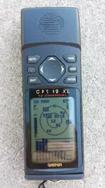
I hate to say what I have with all the modern GPS but here I go. I have an Garmin XL12 that I find very useful in its accuracy. I once went to an intersection (late Night) knowing the latitude and longitude of the center of the intersection and the XL was nearly dead on. But I too would like to step up to a new GPS.

XL12.webp
 
That xl is new, is till have a working gps 12 and a gps III
I would hook it up to my old laptop via serial cable and use it for mapping on the road and that was pre 93 at the latest.
 
My wife wants to buy me a new GPS for my upcoming birthday. Torn between the Garmin eTrex 20 or the Garmin 450 as either of them can be had for under $200.00. Looking for some input from others. I know the eTrex 20 has a better battery life but with a smaller screen. The 450 has a larger screen but shorter battery life. Both will allow input from the computer and I assume both have mini SD card slots.

Whats everyone opinion on either GPS?
 
Last edited:
Whats everyone opinion on either GPS?

I will start by saying what you didn't ask for. Of all the handheld GPSs, I would buy the GPSMAP62s if my current (GPSMAP60csx) ever dies. I feel it's the best of combination of ruggedness, satellite locking, and customized mapping.

Now, to the topic of the etrex-200 or the Oregon 450, that would be an easy one. The 450 handsdown.

Edit- if you haven't been here: GPS Tracklog - GPS reviews, news, tips, tricks and deals It has a ton of info and links to free maps!
 
Last edited:
Keith, I like my Etrex 20 for it's small size and battery life. Fits in my shirt pocket and does all that I need for prospecting. I am having an issue with it communicating with my Base Camp program on the laptop. Not sure what the problem is but have not taken time to research it. Sometimes waypoints set in the field will not upload to the Base Camp program on my laptop. Downloads are working OK though. I have no experience with the 450.
 
The Garmin Oregon 450 can be had for around $170/$180 on eBay, if you take your time looking for one. There hasn't been anything mentioned, in this thread, that can match it's capabilities!
 
Thinking I had made a wise decision in purchasing the Garmin Oregon 450 I called to cancel the order this morning. Garmin has discontinued the 450, 450T, 550, 550T. I would rather have a GPS that Garmin is going to support in years to come with software updates.

I hadn't seen that. I guess that's why it was on sale so cheap.
 
Someone dropped the ball on my cancellation order of the Garmin Oregon 450 and its being shipped, I am going to keep it. I have read more about it and Garmin will continue to support it for a while. The price was right and its new. No explanation as to why Garmin has discontinued the 450, 450T, 550, and 550T, but in reading it appears the 450 out shined the 550 and there are still issues with the 600 series of which further updates will correct these issues.
 
Downloaded the manual. In reading the manual it does not state the max. size MicroSD (8, 16, 32, 64 gigabit etc.) card that can be used nor does it state if I can use the fastest cards available. Anybody have a clue?
 
I've an "out of curiousity" question. When I'm outside with my smartphone on a sunny day, I have to cover the screen or find a shaded area to read it.

Do the handheld GPSs have the same issue? If so, how do you solve this issue?
 
I've an "out of curiousity" question. When I'm outside with my smartphone on a sunny day, I have to cover the screen or find a shaded area to read it.

Do the handheld GPSs have the same issue? If so, how do you solve this issue?

You can't. It has to do with how bright your screen display is, and many modern electronics sacrifice brightness for battery life. Other than buying a different model, you will have to keep shading your screen.
 
Amazing Amazon, ordered the Oregon 450 at 4PM yesterday and it arrived at 5PM today. Granted Amazon is in Phx.

After unboxing the the 450 my first impression was, WOW the screen is small. Then I slipped in a fresh set of batteries and turned on the GPA. Second impression WOW technology in screen resolution has not kept up in the GPS world. Granted the 450 as of today is 4 years old technology but what a disappointment. I can see the pixels within the screen and when comparing to a Galaxy S4 in screen resolution the 450 is a 2 plus. I am reminded of my Garmin 12XL of which not being in color but the resolution is nearly the same.

Now I will have to give the 450 a run through and see how well it holds on to my position while in the field. I hope I can look pass the resolution quality and move forward but I am spoiled by HD quality of the Galaxy S4.
 
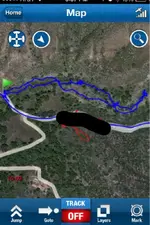
AzViper, I too am spoiled by a smartphone, although I only get a signal in about half the places I dig. I have a cool map app from Trindle Outdoors, that has good satellite image,old topos and will track your travels, given you have reception.
 

Attachments

  • image-226049983.webp
    image-226049983.webp
    55.4 KB · Views: 97
Anybody have a clue?

I am trying to import Google Earth. I followed this YouTube video to a T. Converted the .KML file in GPS Visualizer and have a GDB file, but when I go to import file in Base Camp the import button is not highlighted. I have the Oregon 450 plugged into my computer and showing up in Base Camp. I do not have a MiniSD card installed but I would think I could import to the internal memory but maybe I can't.

​
 
I've an "out of curiousity" question. When I'm outside with my smartphone on a sunny day, I have to cover the screen or find a shaded area to read it.

Do the handheld GPSs have the same issue? If so, how do you solve this issue?

Smartphones use backlighting to show the pixels on the screen. They are designed for lower light conditions. The backlight eats batteries and can't ever get bright enough to overcome bright sunlight.

GPS units use transflective screens. Transflective screens are a lot more expensive but they only use backlighting when the light is dim. They use the non-powered reflective quality of the screen to show the image clearly in bright sunlight without the need for additional lighting. Transflective screens are used in better quality devices that are primarily intended for daylight use.

The combination of screen size, number of pixels and backlight or transflective screens determine how much battery energy is used. Batteries last longer with transflective screens of smaller size and fewer pixels.

That's why the Garmin Oregon and other larger touch screen GPS units have less battery life than smaller non-touchscreens. The determining factor for battery life is the type and size of screen. Another battery factor is the type and size of onboard memory.

On transflective touch screens there need to be two more layers of material over the top of the image forming pixels to allow the touch sensitivity. This requires an even brighter backlight in low light conditions which shortens battery life even more. GPS users will seldom see this effect since most GPS use is during daylight. In overcast conditions or when tree cover is extreme the extra backlighting will shorten battery life even more on a touchscreen than a non touchscreen unit.

The GPS manufacturers try to keep battery use as low as possible for each unit. They do this by balancing the desire of consumers for bigger and more detailed screens with the least pixels possible and the smallest acceptable onboard memory. Adding memory or screen size or pixels costs big in battery life. The touchscreen GPS units get about half the battery life and are shipped with about half the memory of the slightly smaller non-touchscreen units.

I prefer the non-touchscreen Garmin units for another reason entirely. A touchscreen requires two hands to operate. The Garmin non-touchscreen units require only one hand to operate. Since I mostly use my GPS unit while hiking or 4 wheeling having a free hand to steady myself on a slope or while jostling in rough terrain is important. The extra battery life and increased memory is just a bonus.
 
Anybody have a clue?

I am trying to import Google Earth. I followed this YouTube video to a T. Converted the .KML file in GPS Visualizer and have a GDB file, but when I go to import file in Base Camp the import button is not highlighted. I have the Oregon 450 plugged into my computer and showing up in Base Camp. I do not have a MiniSD card installed but I would think I could import to the internal memory but maybe I can't.

I'd try converting the kml file to GPX format instead of GDB. GPX is open format and can be edited with a text editor if needed (look for munging of the headers). Any Garmin can read GPX without going through any flip flops with third party applications.

As an alternative you could check out this thread on a Garmin Forum.
https://forums.garmin.com/showthread.php?35112-importing-and-working-with-gdb-files
 
I'd try converting the kml file to GPX format instead of GDB. GPX is open format and can be edited with a text editor if needed (look for munging of the headers). Any Garmin can read GPX without going through any flip flops with third party applications.

As an alternative you could check out this thread on a Garmin Forum.
https://forums.garmin.com/showthread.php?35112-importing-and-working-with-gdb-files

Thanks Barry. I will follow up with you on the Footprints work around. Did not want to bother you while out prospecting in Quartzsite. Trying to get home to work on my trommel but taking care of some recalls on my Tundra.
 
I'd try converting the kml file to GPX format instead of GDB. GPX is open format and can be edited with a text editor if needed (look for munging of the headers). Any Garmin can read GPX without going through any flip flops with third party applications.

As an alternative you could check out this thread on a Garmin Forum.
https://forums.garmin.com/showthread.php?35112-importing-and-working-with-gdb-files

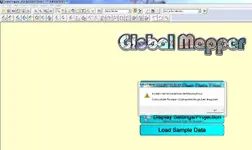
Barry I tried to open the .kml file in Gobal Mapper and this is the error I get.

A1.webp A2.webp
 
That's a 16 year old program Keith. ???

Time to move on to something more modern. Try GPSBabel it's free and very effective.

Best part is you already have it. It's built into your FootPrint!

Go to the GPS button at the top of your mapping window and select the "GPSbabel" button from the popup.

For Input choose the "File" button and for Format choose "Google Earth (Keyhole) Markup Language" from the dropdown menu. Point to your KML file with the "File Name(s)" button.

For Output choose the "File" button and for "Format" choose GPX XML from the dropdown menu. Give the new file a name and a place to be saved under the "File Name" button and click the "Apply" button on the lower right of your window.

Bob's yer Uncle!
 

Users who are viewing this thread

Back
Top Bottom