Need help with a picture.

BennyV

Bronze Member
Joined
Feb 22, 2021
Messages
1,232
Reaction score
2,056
Golden Thread
0
Primary Interest:
All Treasure Hunting
Hello All,

If you could offer any advice on buried valuables (silver most likely) please let me know. Also, looking for the original home site.

Thanks in advance!
-Ben
C5177A62-992A-4A18-85C8-576CF7DA6196.webp
 

Anyone else getting anything?
 

Best I can pick up is here.
 

Attachments

  • BennyV-map1.webp
    BennyV-map1.webp
    324.5 KB · Views: 55
Green is for archaeological.
 

Attachments

  • BennyV-map1B.webp
    BennyV-map1B.webp
    329.8 KB · Views: 64
Go to historicaerials.com and look at the 1951 aerial view. You can also compare todays aerial to 1951.
 

One in middle area, maybe didn't make color green enough.
 

I see it is blue. The color was green, but laptop started running slow on external mouse and got broken lines. Apparently, clicked undo, too many times, went back to blue. Just remember old stuff, perhaps relics or artifacts. While I'm at it, give you my reference file for green.

Green in general is a color indicator, I use for various other targets mostly archaeological (old ruins or foundations but especially those non-metallic objects such as Indian flints, glass, pottery, carved stone with treasure signs).
 

Ok, moved over slightly in green, hits now better centered.
 

Attachments

  • BennyV-map1C.webp
    BennyV-map1C.webp
    332.4 KB · Views: 61
Try this online mapper, select US Topo. You might have zoom out slightly, when switching from satellite image. For screenshots, put down gps box lower right, by clicking globe on center top of box. Use your gps coords and mapper will make a pin. Use Google Chrome browser if mapper doesn't seem to work.


Bumping this again. Haven’t gotten out there yet but wanted to confirm the spots mentioned. I’m looking for silver/gold.
 

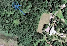
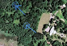
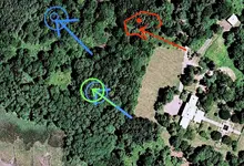
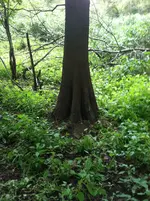
Im no dowser benny, but I do have experience and use common sense. First I check foundation corners, next run the fence line and property boundries....I focus on property corners, and fence posts. Next imagine your self looking out a kitchen window....caches are often buried in spots where the depositor could glance out the window, and see the spot and keep an eye on it. Often times ill search out the cloths line area....usally this is within view of a window as mentioned before. This is a spot where the loose pocket change ends up on the ground, and a post for a cloths line is a great cache marker. Next of course is the old growth trees...I always check these trees for caches, and I often bury my own caches in the roots and shade of an old marker tree....look for marks or hardware on and in the tree. Large stumps should be checked also. Barns, sheds,and out houses have always been go to hiding spots, and should be checked....same approach under stairs, and all four corners of the structures, or foundations....of course basements and root cellars are hot spots also.....caches are often times buried at depths that are frustratingly deep, and patience and determination are a virtue when cache hunting. I my self bury my caches at depths that are detectable and tested with my detector. I think most caches are buried within view of the main house, and its reassuring to the depositor to be able to glance out a window and make sure no one is obviously digging the spot.
20190908_183251.jpg

Here is my shallow crystal skull cache going in the ground !!
20200411_155136.jpg
20200411_155218.jpg
20200411_155225.jpg

I use jars with metal lids....they are sealed in blue tape, and then dipped in hot paraffin wax !! Last pic is what that spot looks like now....I call this dime cache of 30 bucks the pissy cache....I often pee on it !!:laughing7::laughing7::laughing7:
20200411_155318.jpg


So that my advice for searching out caches....hope it helps !!
I have found several over the years, and am searching for one now...I have found 2 that were already recovered at my latest spot....there were no banks in the islands for many years....the islanders buried there money !!
Cheers Benny !!
 

Also I agree with reds areas....to me it looks to be a definite old square area of cleared trees....this indicates old home area. Obviously it has grown up and is hard to decern....there appears to be larger old growth canopies there....this indicates that select trees were left standing there after initial clearing....I believe that's your original area of settlement.....check for evidence of foundations, and home remains there, and those big trees I would check well !! Good luck...very interesting!!
 

Hey Ben where is the nearest water supply or Spring?? I would find the water supply ..A small drone with simple Infrared will show ground disturbances for 100 years, add ultraviolet cross strobe and see Gold N Silver/Nickle up to 15ft underground.. This is Old info to me but still very Viable, I have thought seriously of setting up such a drone that fits into a lunch pail.
 

You might want to take a good look around this area also.
 

Attachments

  • BennyV-map1D.webp
    BennyV-map1D.webp
    334 KB · Views: 65
Hey Ben where is the nearest water supply or Spring?? I would find the water supply ..A small drone with simple Infrared will show ground disturbances for 100 years, add ultraviolet cross strobe and see Gold N Silver/Nickle up to 15ft underground.. This is Old info to me but still very Viable, I have thought seriously of setting up such a drone that fits into a lunch pail.
There’s a spring a ways off, but there might be one closer by. I only covered half of the property so far with not much to show.
 

As mentioned by others in posts above, pay attention to trees. Especially, if they seem out of place. This photo is a cyprus (cypress?) tree out of place. The Ohio French Historical Site Museum archaeologist send the pic to me.
 

Attachments

  • cyprustree.webp
    cyprustree.webp
    345 KB · Views: 51
Last edited:

Top Member Reactions

Users who are viewing this thread

Back
Top Bottom