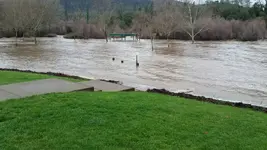
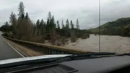
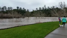
Nice CA Storm

SchoolOfHardRocks

Sr. Member
Joined
Apr 30, 2014
Messages
380
Reaction score
912
Golden Thread
0
Location
Gone, With the Wind
Primary Interest:
Other
Upvote 0
When you folks in CA can safely get out and recover some gold, please take some pictures of both the creeks AND the gold for those of us back East wishing we could be out there!
And if anyone can put together a before-after image of a river, I'm sure it'd be interesting to see. I typically take a few pictures of where I'm prospecting each time I go out; I did that up in Massachusetts and by comparing year 1 to year 2 I could see that some tree debris had been washed away by a storm, opening up an area for prospecting that wasn't accessible the year before.

Show us some pics please!
- Brian
 

Hi AU Solitude,
My point of reference for the water data I posted is the water station at the Lake Clementine Dam, this is upriver from the confluence of the North & Middle Forks of the American. Any water reading station below the junction of these two rivers could have easily shown a higher reading as the Middle Fork is the larger of the two rivers.

The junction of these two rivers is a powerful meeting point as in the 60's when the Hell Hole Dam, up river on the Middle fork, broke the surge took out the new bridge just down stream from the junction, that would have been something to witness!

I've been on the NFAR after some heavy winter/spring water, the changes in the topography can be dramatic though a lot depends on just how and when a prominent boulder or section of land gives way allowing a wall of water access to a less obstructed path. Nothing in or along a river is safe! Picture "very large" pine trees and a few oaks moving swiftly down a milk chocolate brown river with boulders bouncing along the river bedrock with the thud and whacks of the boulders easily heard while standing on a high bank some 30' above the river. It is amazing to see/hear this while it is happening. Then a few months later that same river is crystal clear water very safe to swim in, timing!!................63bkpkr
 

Glad I don't have a dredge in the water as adios at these near record setting flows. John
 

Now is the time to get pictures showing turbitity in the creeks and rivers. 10,000 dredges couldn't produce this much
 

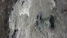
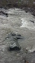
But all that brown silt your dredges produce destroys the habitats! Anyone help me with portrait pictures posting as landscape? Anyways... Not nearly as pounded as you guys up north, but the EFSG was up from calf height at my usual crossing spot to over my knees. Needless to say I was afraid to cross at that location and had to find a safer spot to cross at. River was muddy brown yesterday from the storm the night before, and probably still getting sprinkles at the top. Had my eye on a rock that was nearly submerged as my indicator rock to warn me that the river was rising and to get my stuff and get to the other side before I was unable to cross.

Bazooka was ripping though. Didn't have to clean the grizzly at all and the sniper was eating buckets. Wish we had this flow all the time.
 

Attachments

  • 20170110_104917.webp
    20170110_104917.webp
    1.4 MB · Views: 179
Last edited:
Goldfleks make sure you don't get caught on the wrong side of the river. You won't be the first one to get marooned there !
 

Haha, yah I know. I got out well before the rain kicked up. Would have had to hike out the long way around shoemaker lol.
 

Ha . There have been a few times that Search and Rescue had to come in with helocopters
 

But all that brown silt your dredges produce destroys the habitats! Anyone help me with portrait pictures posting as landscape? Anyways... Not nearly as pounded as you guys up north, but the EFSG was up from calf height at my usual crossing spot to over my knees. Needless to say I was afraid to cross at that location and had to find a safer spot to cross at. River was muddy brown yesterday from the storm the night before, and probably still getting sprinkles at the top. Had my eye on a rock that was nearly submerged as my indicator rock to warn me that the river was rising and to get my stuff and get to the other side before I was unable to cross.

Bazooka was ripping though. Didn't have to clean the grizzly at all and the sniper was eating buckets. Wish we had this flow all the time.

rock.webp
 

rodoconnor - I agree with you that now is indeed the time to take pictures of the Natural Runoff color of the rivers with, if possible, an official Sign in the picture that states what river/creek the picture is taken of.

If I were in the area of Auburn I would try to get down either the Green Valley Trail or the Euchre Bar trail as for the EB the bridge over the river is a clear landmark of where the picture was taken. Be Safe All!..................63bkpkr
 

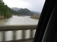
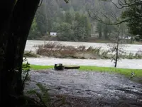
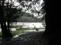
Ugh. After spending two plus days living inside a waterfall, I had to get out. And do what? That was easy. ANYTHING! So here's some pics of the Smith between rain bands today. Much lower than 12 hrs ago tho.

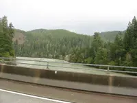
Riding solo, North bound on 101 crossing Dr Fine bridge...out the passenger window...on the fly. Not recommended :nono:
001.webp

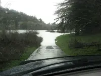
Nope, not a boat ramp. It's the road to the day time camp grounds at Jedidiah.
003.webp

You can see where the water was at the bottom of the frame.

004.webp

005.webp


Another daredevil crossing pic...Northbound 199 just before 197 out the drivers window.
008.webp

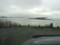
And now for something completely different, the mouth of the Smith @ the Pacific Ocean.

013.webp
 

Those pictures are great Jeff!
When I'm in a valley at normal water levels, I always look at how the trees are so far up from the river rocks and wonder..why? These pictures make it clear why there's that no-mans(tree's)-land, and make me realize that when the water is low we are (in geologic terms) walking and digging on the bottom of raging rivers like this.
Awesome!
- Brian
 

SF American River Lotus/Coloma
 

Attachments

  • 1484182318996.webp
    1484182318996.webp
    103.5 KB · Views: 110
  • 1484182349164.webp
    1484182349164.webp
    33.5 KB · Views: 101
  • 1484182415299.webp
    1484182415299.webp
    61.5 KB · Views: 100
That will bring the steelhead into the Smith. They'll be close to the bank getting out of the way of the rolling cobbles. Nice pics Jeff.
 

One pic I didn't take was the three pickups on a sand bar big enough for 2.5, all fishing for steelies. No luck yet.
 

Last edited:
And as the world turns , so does the weather for the mid - west! The west coasts rain / snow has made it to the mid - west in the form of rain , freezing rain , and snow for tomorrow! BRING IT ON YOU BAD GIRL!
 

russau,
Remember it is not nice to tease mother nature!...............63bkpkr
 

I have always wanted to secure a large sluice box into the bottom of a flooding creek and let mother nature fill it up with gold.

So far we do not have the flows here yet. Anybody doing this?
 

While dredging a Nor Kal creek I uncovered on bedrock some old railroad ties staked down perpindicular to the stream. They were filled with hardpack between them--and plenty of Au
 

While dredging a Nor Kal creek I uncovered on bedrock some old railroad ties staked down perpindicular to the stream. They were filled with hardpack between them--and plenty of Au

Cool, where abouts in Northern California?

I have struggled with how to best secure something in a flooding creek, but my idea was to select a portion of creek that has bedrock normally exposed and drill/grout some large eyelets in and place the box last minute before flooding was forecasted. It would probably have to have some slope to it otherwise it might get buried.

I guess a culvert crossing might work better.
 

Top Member Reactions

Users who are viewing this thread

Latest Discussions

Back
Top Bottom