I'm a Bit Lost on your Last request.
Are you talking on Top of the Rock Wall
by the Sign ?
or am I at the wrong place ?


.jpg")
the roads there have changed allot since 1938 as you can see.
and that the original Richard Street was lower & now part of a Rt 61 Widening. (see Richard Connected to Tumbling Run Road in 1938.
a Physical impossibility today if it was up by the Sign)


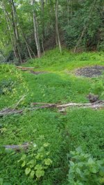
this looks interesting


however
but even that looks different on the ground

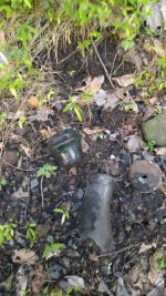
so sorry I have no Info on that or even any idea what that little Village was called.
If it had a Name.
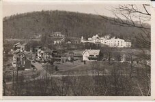
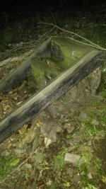
Looks like the End of Richard street was very crowded at one time.
Are you talking on Top of the Rock Wall
by the Sign ?
or am I at the wrong place ?
the roads there have changed allot since 1938 as you can see.
and that the original Richard Street was lower & now part of a Rt 61 Widening. (see Richard Connected to Tumbling Run Road in 1938.
a Physical impossibility today if it was up by the Sign)
this looks interesting
however
but even that looks different on the ground
so sorry I have no Info on that or even any idea what that little Village was called.
If it had a Name.
Looks like the End of Richard street was very crowded at one time.


Last edited by a moderator: