Stone map

Status
Not open for further replies.

cmenokla

Jr. Member
Joined
Dec 21, 2015
Messages
89
Reaction score
37
Golden Thread
0
Location
SE Oklahoma
Primary Interest:
All Treasure Hunting
20160912_160343.webp20160912_160728.webp20160912_160844 (1).webp20160912_160844 (1).webp20160912_161128.webp

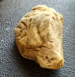
Need help with this map... to me it looks like 3 hills, a water source like a creek, then 1 hill. on my property I have 3 hills to the west, a large creek, then 1 hill on the east. Unsure if Native American or what... Thank you:hello2: 20160912_155432.webp20160912_160255.webp20160912_160555.webp20160912_160916.webp
20160914_095823.webp
20160914_104955.webp
20160914_104433.webp
20160914_103210.webp
20160914_103901.webp
20160914_104557.webp
 

Attachments

  • 20160914_095748.webp
    20160914_095748.webp
    423 KB · Views: 241
Last edited:
Upvote 6
Are you being serious? :laughing7:
 

First generation Garmin?
 

I think I see the remnants of an 'O' and a 'K' on said rock. It's kind of hard to tell without some sort of legend. I imagine one might think a map would be placed on a much larger stone. Not meaning to be rude but our eyes do play tricks with our minds and sometimes we see things that aren't really there. I do wish you luck though.
 

Last edited:
Whatya got there is a stone with some groves on it.
 

I see 2 hills and a pond I think the lines under the pond means its well stocked. I also see a water fall or rain the trail of many tears. I would get it looked at by a profeesional!!!!
 

Interesting. Looks to be worked by human hands, but I wouldn't jump to the conclusion that its a map. And I wouldn't hold my breath for a proper interpretation.
 

Petrified worms?
 

Are you missing the letter "D" in the title?
Kudos!
Carl
 

Fossils (shellfish?) in sedimentary rock? Even though I might be stoned.
 

Its simply a rock....


_________________________Tapatalk Signature_________________________

DT2016
 

Keep on Rockin!!!!
 

When it comes to map reading, I'm lost without the legend and scale.
 

OK? Old Kinderhook?
 

Could be a chunk of cornerstone from an old foundation for a house or barn or mill, etc. It was customary to put the date of building on the cornerstone, maybe that is part of the date or the builder's name. Any other debris around that might point to an old structure being nearby?
 

Most people only find a portion of these stone maps.........you have the whole map.
 

Looks like its been tossed around tho, did you find it near water? If so maybe cornerstone. But I still like the native carving idea too.
 

I cant tell if people responding to this thread are serious or not. If you think that is a map .....I've got a bridge in Brooklyn I will sell cheap:headbang:
 

I cant tell if people responding to this thread are serious or not. If you think that is a map .....I've got a bridge in Brooklyn I will sell cheap:headbang:
It's a rock and an active imagination....

I have seen thousands of rocks like that in the 20+ years I walked the fields, streams and river banks of Missouri..


_________________________Tapatalk Signature_________________________

DT2016
 

Last edited:
Status
Not open for further replies.

Top Member Reactions

Users who are viewing this thread

Back
Top Bottom