Paul, and Bob-in-SD, I have tried, as you guys are, to use google sattelite photos for random searches in areas I'm researching. Invariably though, random shapes (even if seemingly symmetric, etc...) usually always turn out to be something innocuous. Something, for example, that seems square, turns out to be nothing but a modern dirt dike, or something round turns out to just be the ring of a dried up seasonal pool, etc...
Or put another way: Take some sites you actually
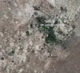
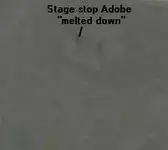
already know of (foundations in the middle of no-where, adobe melt, lone chimneys out in the country, or whatever), and google-satellite zoom in on
those: Ask yourself honestly: if you were just randomnly flying around via computer satellite (which isn't very focused or zoomed in), would you have honestly seen anything out of the ordinary there? I have tried, on many sites that I have done well at (reales, buttons, seateds, etc...) and can honestly say, the google satellite would have been of no help. Yes of course, now that I *
already* know of the site, only
THEN does the out-of-place shadows or shapes or whatever make sense.
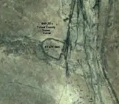
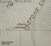
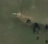
Paul, as for Soap (aka San Filepe) Lake: I gave a talk, a few years ago, to the San Jose metal detecting club about mission era finds, sites, etc.... Afterwards, a fellow came up and said he'd detected at the site of a stone corral, way back in the back country of Henry Coe Park (or perhaps he meant, beyond their boundries back in the middle of nowhere, which would put him north of Hwy 152, eh?). He got some gun parts, buttons, a spur, etc... of the mission era. He had some sort of friend who ranched back there, who had clued him in, and taken him to this site. He & I were gonna team up and make another hike back in there, but he didn't seem to aggressive, so I never pushed it, and promptly forgot about it. As for the rancho and adobe at Soap Lake, all citations I have read about it, say the site of the actual adobe is un-known. One would think it wouldn't be too far from the lake of the name, nor too far off the travel route (which roughly follows the modern highway, eh?). I have studied every likely spot coming and going along there, ad-nauseum. Seems like every good spot, that might have been used in historical times, is built on (as there are modern homes dotting along that road). But anything's possible. As you know, sometimes where they put adobe sites, was the not same rationale for choosing a site, as the rationale for choosing wooden home/western sites.
At the Fisher museum, amongst their various finds displays, is some seated coins and such, with a caption "found near Soap Lake, CA". I asked the lady at the desk about that. Ie.: "who found this?" etc... It didn't seem like she knew or cared, as perhaps it way predated her (nor would they have probably divulged anonymous donors anyhow
")
)


")
 I think the spring grasses will be beat down low enough by now, to allow the coil to be swung in those hilly grass-lands.