The Sombrero Mine

Steve Bowser

Greenie
Sep 5, 2023
14
59
Ahwatukee, AZ
Hello again LDM hunters and Thank You for the interest in my material. This is a continuation of my thread 'Is the Lost Dutchman Mine the Sombrero Mine?'.
View attachment 2065607
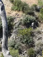
'Above the junction of a West flowing canyon/wash(Tortilla) and a North flowing canyon/wash(Peters) you will find clues to the mine'.
This is a pic of a rock pinnacle just East of this Junction of Tortilla Wash and Peters Canyon. This has been 'chipped' on top to form the shape of a Heart and would
be seen from a good distance as you enter the mining 'site' from the East. This was to advise the Mexican miners they had arrived at their destination.
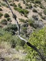
The Peralta Stone maps show a trail coming in from the West. This is a pic of this junction, the 'chipped' Heart is to the right
The red dashes are this trail coming in from the West, into Peters, across this hilltop, and then into Tortilla Wash heading South.
View attachment 2065643
This is a pic of the 'stone' trail marker.
View attachment 2065644
This is a 'current' 2023 google close up of this hilltop.
View attachment 2065697
Next is a google pic of the same hilltop, this is dated 2007.
For any 'Spanish/Mexican' treasure hunter I cannot emphasize enough the benefits Google Earth can provide. They made 'maps' out of the terrain,
and they were very good at this. Depending on the 'terrain' I would think these could be found at many of their sites around Az, Mexico, etc.-'depending on the terrain'..
The Mexican miners would have 'scouts' that would go to the 'mountain tops'. With 'eye glasses' they would scan the hill sides and hill tops for these 'symbols/signs' to show them the way. The 'sign/symbol' site would be cleared of rock, brush and at their time would have been clear to see. Over time these will disappear, however, if you 'change' your Google 'time' zones you can find them. I find 2007 is best for me. I believe the mountain to the 'South' of this junction is 'Geronimo Head, looking at the sky'. You can see this from the 'West', such as on the road to Payson. The 'knob' on the top South end of this mountain top is the 'Sombrero' hill identified in the maps to name this mine, which is across the 'gulch'(Peters) to the East. From this mountain top looking North they would see the below.
X This is the 'trail' symbol and would be placed along the trail. See this symbol and a 'trail' is there.
- ) Separated Arrow This advised to 'continue this way but pay attention to the next symbol'.
Circle with a Dot in the center This is the mine symbol. The 'line' is providing the direction.
These are almost 200 years old yet can still be seen and advise where the trail is and the direction to go to the mine.
View attachment 2065647
This is a google from the top of the 'chipped' Heart rock, looking South at the South side of Tortilla Wash. The Peralta Stone Map trail entering Tortilla is below on the right. There is a triangle shaped area 'cleared of brush' , the arrow is pointing to this. There is a 'X' trail symbol in this cleared area(next pic). This is not the trail to the Sombrero mine, this trail is in the bottom of the wash and exits past this spot.
View attachment 2065861
View attachment 2065880
This is a sketch map dated 1846, my apologies this is upside down, it will match up better for the following pic.
I have marked Tortilla Wash, Peters Canyon and the Sombrero-which is not listed on this map.
View attachment 2065984
This is a google pic of this sketch map location. Other than the Sombrero mine these tack marks are just an estimate location based on the trails/signs, but I have no doubt they are there. There is a Heart inlay stone dated 1847 reflecting 10 mines 'within the Heart'. They left in 1847 and as far as I know only came back to the Sombrero due to so rich. There is a 3? mile broken ridge that runs in a 'line', the Sombrero mine is on the right(inside the red square). There is a 'black' vein in this broken ridgeline, pics of what this same rock looks like up close I have posted previously. If you zoom down, you can see a red dirt vein(Iron) on top running parallel with this broken ridge. The Mexican miners had 'current' maps and were updating them, dug out mines would not be on these current maps, and they are about to get booted out.
View attachment 2065985

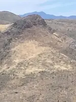
When the Mexican miners come into this site from the South, they entered from the 'East' end dropping down off
the broken ridge down close to Tortilla Wash and would 'head West'. This trail is between the 2 'left' yellow tacks. 'East' of the Sombrero mine, across the Mountain and below the 2 mine tacks, this is a pic of the 'West' slope of this mountain, Tortilla Wash is on the bottom right.
View attachment 2066051
This is a 2007 pic of this same slope. I have been advised my 'signs/symbols' I see are just 'shadows' so my apologies if unable to 'see'. It appears to me that there is a large section covering several of these 'hills' that had been cleared and symbols placed. The bottom arrow is for a symbol that was 'added' to show the way to the newly found Sombrero. I see the 'X' trail symbol, a 'half circle', and a line. I believe the half circle is the same as the half circle on the Peralta Heart stone for the Sombrero and is implying 'to go around the mountain'-trail the direction of the line. The top arrow is pointing to a 'Heart' shape. Alot of effort was put into this site.
View attachment 2066059
I believe there was a camp in here, and if I go the direction of the 'line' on the hillside symbol, this trail goes up and over the North side of this Mtn. This is a pic from the North looking at the Peters canyon side, and the yellow dashes show this trail. It goes to this mine, and possibly others. It also continues South down Peters Canyon. I believe the miners hauled the ore to the camp to be processed to haul home.
View attachment 2066190
*Be sure to use different 'time zones' on google to look at these.
The terrain in here is restricted so the miners had few places to make/go with a mule. If you can see a trail it had traffic and is important, such as above. Just past the Ledge with the Sombrero mine is a gulch, and a trail going up, coming from the North. The main trail South is in the canyon floor. I can see a trail going up this slope, and one going into the gulch. I do not know if these are prospects or mines, but when I can see a trail going into a dead-end gulch, or into a cliff face or up onto a dead-end ledge, there is a reason.
View attachment 2066194
 

Steve Bowser

Greenie
Sep 5, 2023
14
59
Ahwatukee, AZ
Ancientones,

Regarding your satellite images where you identify a route connecting Tortilla Creek with Peters Canyon and avoiding the Lower Box at the entrance to Peters Canyon. You have labeled this route with a note "Trail symbols, Trail and clues." I've added some notes in white to your images.
1 Long View Pass with labels.jpg
2 Zoom View Pass with Labels.jpg

This route has been well known for many years and was possibly used in 1873 by the U.S. Army Fifth Calvary led by Major William Brown in search of Apache rancherias. Second Lieutenant John Bourke kept a diary and drew map sketches during this expedition and based on his observations they could have used this pass. Some of us call this Military Pass.
In modern times many horse riders used and still use this pass to enter Peters Canyon from Tortilla Creek because you can't bring a horse up through the Lower Box at the entrance to Peters Canyon. Tom Kollenborn and Ron Feldman used this pass to enter Peters Canyon and then rode up the east side of Geronimo head.
3 Looking south up Peters Canyon.JPG


An old time Dutch Hunter by the name of Al Reser used this route and marked it on his personal master map of Superstition trails.

Jack Carlson also uses this route and has it marked on his map on page 324 of Superstition Wilderness Trails West.
4 Jack's map a.jpg

In the pass are new and old fire rings with lots of cans. Along the old built up trail leading from Tortilla Creek up to the pass is a modern claim monument.
5 Possible claim marker.JPG


6 Looking west from Tortilla Creek.JPG


There are several cairns, monuments and markings on this route and pass. Based on the tremendous use it has received over the years it's hard to speculate on which, if any, are related to the Spanish, the Mexicans or old mines.

The same can be said of the area you've identified as the location for the Lost Dutchman/Sombrero Mine. Although I have not been to and examined your exact location for these mines, I have been to the immediate area many times and located modern prospecting camps nearby including Two Hammer Camp which is between your mine area and Peters Canyon to the west, just a few minutes away.
7 Two Hammer Camp Junk.JPG

Consider that the cairns, monuments, markings, etc. at your mine area could be from modern day searchers and prospectors. It more likely you're seeing modern day activity as opposed to pre-1900 work.

It's on my list for this coming hiking season to visit and examine your mine area.

Steve
 

axer

Greenie
Aug 26, 2015
19
36
Detector(s) used
Fisher F2 and White's TM 808
Primary Interest:
All Treasure Hunting
I believe the Mexicans said that they could see their Sombreo mines when looked across the canyon from their rich funneled pit mine and never referred to the pit mine as their Sombreo pit mine. We are on-site and can see LA or El Sombrero (hat on a mountain)( you can see on our site) across the canyon from the pit mine. Also adjacent and under La Sombrero we can see several mines..... hence most likely their Sombreo mines. We also can see 4 peaks as 1. And yes we have found Waltz or someone mined both sides of the mountain ( 2 pit mines). You can see the Hat on a mountain on our site. At the 2015 Rendazvue on Saturday I sat and talked with Mike Gwen, and he graciously shared some thoughts with me. He was truly a nice man, so sorry to hear he passed. History is sadly leaving us, some things will never be the same, the Mike Gwens were a special breed of men.
.
Jeffhowlett, I have been reading old posts and came across your mention of someone mining on both sides of a mountain, is this the Spanish sunken valley site?
 

OP
OP
A

ancientones

Full Member
Apr 16, 2010
102
105
Jeffhowlett, I have been reading old posts and came across your mention of someone mining on both sides of a mountain, is this the Spanish sunken valley site?

Ancientones,

Regarding your satellite images where you identify a route connecting Tortilla Creek with Peters Canyon and avoiding the Lower Box at the entrance to Peters Canyon. You have labeled this route with a note "Trail symbols, Trail and clues." I've added some notes in white to your images.
View attachment 2105896 View attachment 2105897
This route has been well known for many years and was possibly used in 1873 by the U.S. Army Fifth Calvary led by Major William Brown in search of Apache rancherias. Second Lieutenant John Bourke kept a diary and drew map sketches during this expedition and based on his observations they could have used this pass. Some of us call this Military Pass.
In modern times many horse riders used and still use this pass to enter Peters Canyon from Tortilla Creek because you can't bring a horse up through the Lower Box at the entrance to Peters Canyon. Tom Kollenborn and Ron Feldman used this pass to enter Peters Canyon and then rode up the east side of Geronimo head.
View attachment 2105898

An old time Dutch Hunter by the name of Al Reser used this route and marked it on his personal master map of Superstition trails.

Jack Carlson also uses this route and has it marked on his map on page 324 of Superstition Wilderness Trails West.
View attachment 2105901
In the pass are new and old fire rings with lots of cans. Along the old built up trail leading from Tortilla Creek up to the pass is a modern claim monument.
View attachment 2105902

View attachment 2105903

There are several cairns, monuments and markings on this route and pass. Based on the tremendous use it has received over the years it's hard to speculate on which, if any, are related to the Spanish, the Mexicans or old mines.

The same can be said of the area you've identified as the location for the Lost Dutchman/Sombrero Mine. Although I have not been to and examined your exact location for these mines, I have been to the immediate area many times and located modern prospecting camps nearby including Two Hammer Camp which is between your mine area and Peters Canyon to the west, just a few minutes away.
View attachment 2105907
Consider that the cairns, monuments, markings, etc. at your mine area could be from modern day searchers and prospectors. It more likely you're seeing modern day activity as opposed to pre-1900 work.

It's on my list for this coming hiking season to visit and examine your mine area.

Steve
Hello Steve and Thank you for the post. My material is for the Mexican miners who worked here, not White man.
The Lost Dutchman mine experts all advise 'I am too far out, no minable minerals here'. The Tonto Forest Service will not issue me any type of permit to prove, their response was 'they have no records of mining history in the Sups'. I commend you on going out and 'seeing for yourself'. The trail symbols I see on the hillsides are Mexican, described
by them and placed where they can be seen. This was not a small time operation and the symbols were made for
future trips. I encourage you to look at how the ground was 'cleared' for the symbols on the hilltop between Peters and Tortilla. The Apache and Mexicans had more to do with these trails than white man. If you 'think' like a Mexican Miner in your quest out here, you will see 'why' they made symbols for future trips. The 'updated' Heart Inlay
Stone reflecting the date and number of mines found 'to date' is your Bible-nothing White man. Jacob described how he 'found' his mine, he killed Mexicans who came back to work the rich Sombrero vein after the Apache massacre-this is also documented in their history for this mine.
I will repost a photo to show the 'best' clue.
Good Luck with your explorations!
B
 

OP
OP
A

ancientones

Full Member
Apr 16, 2010
102
105
Hello Steve and Thank you for the post. My material is for the Mexican miners who worked here, not White man.
The Lost Dutchman mine experts all advise 'I am too far out, no minable minerals here'. The Tonto Forest Service will not issue me any type of permit to prove, their response was 'they have no records of mining history in the Sups'. I commend you on going out and 'seeing for yourself'. The trail symbols I see on the hillsides are Mexican, described
by them and placed where they can be seen. This was not a small time operation and the symbols were made for
future trips. I encourage you to look at how the ground was 'cleared' for the symbols on the hilltop between Peters and Tortilla. The Apache and Mexicans had more to do with these trails than white man. If you 'think' like a Mexican Miner in your quest out here, you will see 'why' they made symbols for future trips. The 'updated' Heart Inlay
Stone reflecting the date and number of mines found 'to date' is your Bible-nothing White man. Jacob described how he 'found' his mine, he killed Mexicans who came back to work the rich Sombrero vein after the Apache massacre-this is also documented in their history for this mine.
I will repost a photo to show the 'best' clue.
Good Luck with your explorations!
B
Steve,
This is a photo from 1 of my Heli trips and will show the 'best' clue. This is the ledge, and some of the 'clues'
at the site. The best clue is the 'Tailings Pile'(blue arrows), these are as good as gold :). The Left arrow is the Sombrero mine tailings on a small ledge below the mine. According to their notes they put the tailings here so those traveling the trail below would not know there was a mine above. According to Jacob, he and his partner spied Mexicans, climbed up a rocky knob vantage point above them, and killed them. He advised he found 'his' vein when they climbed this knob, the Right blue arrow points to a 'small' tailings pile. My previous advised of using the Heart Inlay as it is a boundary and inside are their just found mines and the scope of this operation. The clues for the Sombrero Mine come from the Apache and Mexicans, not White man. There were 'several' active Mexican gold mines here, documented by them, symbols/trails to get to them, tailings piles at these spots. They were then massacred by the Apache.
Again, Thank you for your post and hope this helps.

1696112507081.png
 

pokergodrules

Greenie
Apr 21, 2023
17
9
Steve,
This is a photo from 1 of my Heli trips and will show the 'best' clue. This is the ledge, and some of the 'clues'
at the site. The best clue is the 'Tailings Pile'(blue arrows), these are as good as gold :). The Left arrow is the Sombrero mine tailings on a small ledge below the mine. According to their notes they put the tailings here so those traveling the trail below would not know there was a mine above. According to Jacob, he and his partner spied Mexicans, climbed up a rocky knob vantage point above them, and killed them. He advised he found 'his' vein when they climbed this knob, the Right blue arrow points to a 'small' tailings pile. My previous advised of using the Heart Inlay as it is a boundary and inside are their just found mines and the scope of this operation. The clues for the Sombrero Mine come from the Apache and Mexicans, not White man. There were 'several' active Mexican gold mines here, documented by them, symbols/trails to get to them, tailings piles at these spots. They were then massacred by the Apache.
Again, Thank you for your post and hope this helps.

View attachment 2107605
It breaks my heart that you guys cant figure it out I guess it takes a Mexican.
 

Idahodutch

Bronze Member
Sep 25, 2019
1,850
4,785
Idaho
Detector(s) used
Whites MXT
Gold Legend
Primary Interest:
Other
Ancientones,
You look to have found a mine, and it is an awesome find. Why do you feel the need to pull Jacob Waltz into it?

If you were following the LDM clues, and the led you here that would be one thing. If that’s not what happened.
You found this site, then started seeing if any clue could possibly fit somehow 😎😂👎
Doesn’t work like that.
You have gone from awe and glory, to the guy that mixes up stories.
You say you don’t use white man clues 🧐 ok, so stick to that story.

Every time I hear you try to pull Waltz into your spot, you lose some credibility …. At least with me.

I have congratulated you from the beginning on the find. Not on anything LDM, as you yourself have stated you use different clues .. not white man, so completely understandable that they don’t align with LDM lore.

Nobody wants to be associated with a nut case. And people are thinking “what’s up” because you try to force other stuff, clues …. afore fitting them . Just leave that stuff out of it , and focus on your find …. So it’s not the LDM.
I don’t think you are a nut case, I think finding what you found, has messed with you enough that you are just trying to make sense of things.
So make sense, not chaos.
Your friend, Idahodutch
Ancientones,
My post was uncalled for. I apologize for for my rant.
It is not my place to stick my nose in your business.
Sincerely,
Idahodutch
 

OP
OP
A

ancientones

Full Member
Apr 16, 2010
102
105
Ancientones,
My post was uncalled for. I apologize for for my rant.
It is not my place to stick my nose in your business.
Sincerely,
Idahodutch
Idahodutch,
NO apologies needed sir. It is these discussions and feedback that get the thoughts/ideas out to keep up the quest.
The Forest Service was able to designate this a 'Wilderness' due to no mining history or Precious Metals so maybe
neither of us have a clue :).
 

Steve Bowser

Greenie
Sep 5, 2023
14
59
Ahwatukee, AZ
Steve,
This is a photo from 1 of my Heli trips and will show the 'best' clue. This is the ledge, and some of the 'clues'
at the site. The best clue is the 'Tailings Pile'(blue arrows), these are as good as gold :). The Left arrow is the Sombrero mine tailings on a small ledge below the mine. According to their notes they put the tailings here so those traveling the trail below would not know there was a mine above. According to Jacob, he and his partner spied Mexicans, climbed up a rocky knob vantage point above them, and killed them. He advised he found 'his' vein when they climbed this knob, the Right blue arrow points to a 'small' tailings pile. My previous advised of using the Heart Inlay as it is a boundary and inside are their just found mines and the scope of this operation. The clues for the Sombrero Mine come from the Apache and Mexicans, not White man. There were 'several' active Mexican gold mines here, documented by them, symbols/trails to get to them, tailings piles at these spots. They were then massacred by the Apache.
Again, Thank you for your post and hope this helps.

View attachment 2107605
Ancientones,

Thank you for your Heli image showing the 'best clue'. Your image will help me explore your site on my hike there next month. I look forward to locating and documenting all the clues at your mine area. My primary objective is documenting a Native American site very close to your mine area and I'll check out your site on the way back. It takes me 3 1/2 hours to reach Two Hammer Camp which is just a few minutes west of your mine site. I will start my hike at 6 am and will be back before dark, so a full day of hiking and exploring. Anything you would like me to photograph while I'm at your mine site?

You said the image was from 1 of your Heli trips - so you were in a helicopter when you took this image?

Steve
 

Arizona_John

Full Member
Aug 6, 2023
115
193
Philippines
Detector(s) used
Nokta, OKM, Fisher, Garrett, Tesoro Lobo Supertraq
Primary Interest:
All Treasure Hunting
The 1846 sketch map which you used up side down in your first post of this thread, it's a bad reproduction of the Peralta-Fish map. You could do a research after i mentioned it, but you are too vested with your theory to look at anything else. Fish ( name ) added to the map it's not for Fish Creek, but for the person who brought the map to the public.
That map is upside down then you’ll see the saddle
 

josh711

Greenie
Jan 20, 2022
11
5
I think this will s the Geronimo mountain that you are talking about
 

Attachments

  • IMG_3741.jpeg
    IMG_3741.jpeg
    47.1 KB · Views: 47

deducer

Bronze Member
Jan 7, 2014
2,281
4,360
Primary Interest:
Other
Ancientones,

Regarding your satellite images where you identify a route connecting Tortilla Creek with Peters Canyon and avoiding the Lower Box at the entrance to Peters Canyon. You have labeled this route with a note "Trail symbols, Trail and clues." I've added some notes in white to your images.
View attachment 2105896 View attachment 2105897
This route has been well known for many years and was possibly used in 1873 by the U.S. Army Fifth Calvary led by Major William Brown in search of Apache rancherias. Second Lieutenant John Bourke kept a diary and drew map sketches during this expedition and based on his observations they could have used this pass. Some of us call this Military Pass.
In modern times many horse riders used and still use this pass to enter Peters Canyon from Tortilla Creek because you can't bring a horse up through the Lower Box at the entrance to Peters Canyon. Tom Kollenborn and Ron Feldman used this pass to enter Peters Canyon and then rode up the east side of Geronimo head.
View attachment 2105898

An old time Dutch Hunter by the name of Al Reser used this route and marked it on his personal master map of Superstition trails.

Jack Carlson also uses this route and has it marked on his map on page 324 of Superstition Wilderness Trails West.
View attachment 2105901
In the pass are new and old fire rings with lots of cans. Along the old built up trail leading from Tortilla Creek up to the pass is a modern claim monument.
View attachment 2105902

View attachment 2105903

There are several cairns, monuments and markings on this route and pass. Based on the tremendous use it has received over the years it's hard to speculate on which, if any, are related to the Spanish, the Mexicans or old mines.

The same can be said of the area you've identified as the location for the Lost Dutchman/Sombrero Mine. Although I have not been to and examined your exact location for these mines, I have been to the immediate area many times and located modern prospecting camps nearby including Two Hammer Camp which is between your mine area and Peters Canyon to the west, just a few minutes away.
View attachment 2105907
Consider that the cairns, monuments, markings, etc. at your mine area could be from modern day searchers and prospectors. It more likely you're seeing modern day activity as opposed to pre-1900 work.

It's on my list for this coming hiking season to visit and examine your mine area.

Steve

Very interesting. Thank you for sharing.
 

Top Member Reactions

Users who are viewing this thread

Latest Discussions

Top